3:32pm Update THE NATIONAL WEATHER SERVICE IN JACKSON KY HAS ISSUED A * TORNADO WARNING FOR… * UNTIL 415 PM EDT * AT 328 PM EDT…NATIONAL WEATHER SERVICE DOPPLER RADAR INDICATED A * LOCATIONS IMPACTED INCLUDE… THE NATIONAL WEATHER SERVICE IN JACKSON KY HAS ISSUED A * TORNADO WARNING FOR… * UNTIL 400 PM EDT * AT 324 PM EDT…NATIONAL WEATHER SERVICE DOPPLER RADAR INDICATED A * THIS DANGEROUS STORM WILL BE NEAR… OTHER LOCATIONS IMPACTED BY THIS DANGEROUS STORM INCLUDE DILLON. THE NATIONAL WEATHER SERVICE IN JACKSON KY HAS ISSUED A * TORNADO WARNING FOR… * UNTIL 400 PM EDT * AT 320 PM EDT…NATIONAL WEATHER SERVICE DOPPLER RADAR INDICATED A * LOCATIONS IMPACTED INCLUDE…
EAST CENTRAL FLOYD COUNTY IN SOUTHEAST KENTUCKY…
CENTRAL PIKE COUNTY IN SOUTHEAST KENTUCKY…
SEVERE SQUALL LINE CAPABLE OF PRODUCING BRIEF RAIN-WRAPPED
TORNADOES IN ADDITION TO WIDESPREAD STRAIGHT LINE WIND DAMAGE. THIS
DANGEROUS STORM WAS LOCATED NEAR BLUE MOON…OR 10 MILES WEST OF
PIKEVILLE…AND MOVING EAST AT 50 MPH.
PIKEVILLE…BOLDMAN…GALVESTON…OSBORN…COAL RUN…ZEBULON…
SHELBIANA…CHLOE…META…GARDEN VILLAGE…RACCOON…MARROWBONE…
FISHTRAP LAKE…CANADA…KIMPER…PHYLLIS…HUDDY…MCANDREWS…
HARDY AND BIGGS.
3:29pm Update
NORTHEASTERN BELL COUNTY IN SOUTHEAST KENTUCKY…
HARLAN COUNTY IN SOUTHEAST KENTUCKY…
SOUTHEASTERN LESLIE COUNTY IN SOUTHEAST KENTUCKY…
SOUTHWESTERN LETCHER COUNTY IN SOUTHEAST KENTUCKY…
SOUTHEASTERN PERRY COUNTY IN SOUTHEAST KENTUCKY…
SEVERE THUNDERSTORM CAPABLE OF PRODUCING A TORNADO. THIS DANGEROUS
STORM WAS LOCATED NEAR SANDY FORK…OR 13 MILES NORTHWEST OF
HARLAN…AND MOVING EAST AT 40 MPH.
TREMONT…KERR…BLEDSOE AND LONGTON AROUND 335 PM EDT.
BAXTER…GATUN…LOYALL AND HARLAN AROUND 340 PM EDT.
REX…CLOVERTOWN…KITTS AND HARLAN GAS AROUND 345 PM EDT.
TEN SPOT…VERDA AND MARY HELEN AROUND 350 PM EDT.
SOUTHERN KNOTT COUNTY IN SOUTHEAST KENTUCKY…
EAST CENTRAL LESLIE COUNTY IN SOUTHEAST KENTUCKY…
LETCHER COUNTY IN SOUTHEAST KENTUCKY…
SOUTHEASTERN PERRY COUNTY IN SOUTHEAST KENTUCKY…
SOUTHWESTERN PIKE COUNTY IN SOUTHEAST KENTUCKY…
SEVERE THUNDERSTORM CAPABLE OF PRODUCING A TORNADO. THIS DANGEROUS
STORM WAS LOCATED NEAR DALEY…OR 8 MILES SOUTH OF HAZARD…AND
MOVING EAST AT 55 MPH.
WHITESBURG…DIABLOCK…VIPER…JEFF…CORDIA…ELIC…SLEMP…
ANCO…DAISY…WISCOAL…VICCO…CORNETTSVILLE…SASSAFRAS…
ULVAH…BLUEFIELD…ARMINTA…RED STAR…SMITHSBORO…AMBURGEY AND
HALLIE.
3:05pm Update
Here are some amazing hail pics out of Pike County…
2:40pm Update
TORNADO WATCH until 9pm for much of eastern Ky. Here is a look at the watch outline and the current warnings…
2:34pm Update


THE NATIONAL WEATHER SERVICE IN JACKSON KY HAS ISSUED A
* TORNADO WARNING FOR…
NORTHERN CLAY COUNTY IN SOUTHEAST KENTUCKY…
SOUTHEASTERN JACKSON COUNTY IN SOUTHEAST KENTUCKY…
EXTREME NORTH CENTRAL LAUREL COUNTY IN SOUTH CENTRAL KENTUCKY…
OWSLEY COUNTY IN SOUTHEAST KENTUCKY…
* UNTIL 315 PM EDT
* AT 229 PM EDT…NATIONAL WEATHER SERVICE DOPPLER RADAR INDICATED A
SEVERE THUNDERSTORM CAPABLE OF PRODUCING A TORNADO. THIS DANGEROUS
STORM WAS LOCATED NEAR DEESE…OR 5 MILES SOUTH OF MCKEE…AND
MOVING EAST AT 50 MPH.
* LOCATIONS IMPACTED INCLUDE…
BOONEVILLE…ATKINSTOWN…OLIN…ANNVILLE…GREEN HILL…GRAY
HAWK…SETTLE STORE…TURKEY FOOT…MILDRED…WELCHBURG…NEW
ZION…PRIVETT…TYNER…DATHA…EGYPT…ZEKES POINT…MUMMIE…
HERD…SHEPHERDTOWN AND MAULDEN.
2:32pm Update
THE NATIONAL WEATHER SERVICE IN JACKSON KY HAS ISSUED A
* TORNADO WARNING FOR…
WEST CENTRAL CLAY COUNTY IN SOUTHEAST KENTUCKY…
NORTHWESTERN KNOX COUNTY IN SOUTHEAST KENTUCKY…
LAUREL COUNTY IN SOUTH CENTRAL KENTUCKY…
EAST CENTRAL PULASKI COUNTY IN SOUTH CENTRAL KENTUCKY…
* UNTIL 315 PM EDT
* AT 229 PM EDT…NATIONAL WEATHER SERVICE DOPPLER RADAR INDICATED A
SEVERE THUNDERSTORM CAPABLE OF PRODUCING A TORNADO. THIS DANGEROUS
STORM WAS LOCATED NEAR BILLOWS…OR 13 MILES WEST OF LONDON…AND
MOVING EAST AT 45 MPH.
* LOCATIONS IMPACTED INCLUDE…
LONDON…MANCHESTER…BUNCH…BERNSTADT…EAST BERNSTADT…
HIGHTOP…PITTSBURG…KEAVY…SUBLIMITY CITY…LONDON-CORBIN
AIRPORT…DORTHAE…MAPLESVILLE…FARISTON…LILY…NORTH CORBIN…
LEVI JACKSON S.P….LANGNAU…CRAWFORD…LESBAS AND MCHARGUE.
2:30pm Update
THE NATIONAL WEATHER SERVICE IN JACKSON KY HAS ISSUED A
* TORNADO WARNING FOR…
EXTREME NORTH CENTRAL FLOYD COUNTY IN SOUTHEAST KENTUCKY…
JOHNSON COUNTY IN NORTHEAST KENTUCKY…
NORTHERN MAGOFFIN COUNTY IN SOUTHEAST KENTUCKY…
SOUTHEASTERN MORGAN COUNTY IN SOUTHEAST KENTUCKY…
* UNTIL 300 PM EDT
* AT 225 PM EDT…NATIONAL WEATHER SERVICE DOPPLER RADAR INDICATED A
SEVERE SQUALL LINE CAPABLE OF PRODUCING BRIEF RAIN-WRAPPED
TORNADOES IN ADDITION TO WIDESPREAD STRAIGHT LINE WIND DAMAGE. THIS
DANGEROUS STORM WAS LOCATED NEAR HOLLIDAY…OR 8 MILES SOUTH OF
WEST LIBERTY…AND MOVING EAST AT 50 MPH.
* LOCATIONS IMPACTED INCLUDE…
SALYERSVILLE…PAINTSVILLE…OVA…FLORRESS…KERNIE…STELLA…
MATTHEW…PATTON…WONNIE…BLOOMINGTON…ELSIE…GULLETT…
CISCO…GIFFORD…ORIENT…LOGVILLE…HALEBURG…MAGGARD…PLUTARCH
AND DINGUS.
THE NATIONAL WEATHER SERVICE IN JACKSON KY HAS ISSUED A
* TORNADO WARNING FOR…
SOUTHWESTERN ELLIOTT COUNTY IN EAST CENTRAL KENTUCKY…
NORTHWESTERN MAGOFFIN COUNTY IN SOUTHEAST KENTUCKY…
EASTERN MENIFEE COUNTY IN EAST CENTRAL KENTUCKY…
MORGAN COUNTY IN SOUTHEAST KENTUCKY…
NORTHERN WOLFE COUNTY IN SOUTHEAST KENTUCKY…
* UNTIL 245 PM EDT
* AT 200 PM EDT…NATIONAL WEATHER SERVICE DOPPLER RADAR INDICATED A
SEVERE THUNDERSTORM CAPABLE OF PRODUCING A TORNADO. THIS DANGEROUS
STORM WAS LOCATED NEAR MARIBA…OR NEAR FRENCHBURG…AND MOVING
EAST AT 50 MPH.
* LOCATIONS IMPACTED INCLUDE…
WEST LIBERTY…WELLINGTON…MAYTOWN…TOLIVER…KOREA…ARTVILLE…
DAN…BIG WOODS…EZEL…HAZEL GREEN…MURPHYFORK…EBON…
DAYSBORO…OMER…PEKIN…ARNETT…REXVILLE…KELLACEY…MIZE AND
HELECHAWA.
1:55pm Update
THE NATIONAL WEATHER SERVICE IN JACKSON KY HAS ISSUED A
* TORNADO WARNING FOR…
NORTHWESTERN LAUREL COUNTY IN SOUTH CENTRAL KENTUCKY…
NORTHERN PULASKI COUNTY IN SOUTH CENTRAL KENTUCKY…
SOUTHERN ROCKCASTLE COUNTY IN SOUTH CENTRAL KENTUCKY…
* UNTIL 230 PM EDT
* AT 152 PM EDT…NATIONAL WEATHER SERVICE DOPPLER RADAR INDICATED A
SEVERE THUNDERSTORM CAPABLE OF PRODUCING A TORNADO. THIS DANGEROUS
STORM WAS LOCATED 7 MILES SOUTHEAST OF LIBERTY…OR 17 MILES
NORTHWEST OF SOMERSET…AND MOVING EAST AT 55 MPH.
* LOCATIONS IMPACTED INCLUDE…
PULASKI…SCIENCE HILL…DABNEY…BOBTOWN…WOODSTOCK…BEE LICK…
BANDY…WILLAILLA…SHOPVILLE…QUAIL…VALLEY OAK…LEVEL GREEN…
BROMO…BENT…SPIRO…MARETBURG…WABP…HANSFORD…BLOSS AND
WELLHOPE.
THE NATIONAL WEATHER SERVICE IN JACKSON KY HAS ISSUED A
* TORNADO WARNING FOR…
EXTREME NORTH CENTRAL ESTILL COUNTY IN EAST CENTRAL KENTUCKY…
MENIFEE COUNTY IN EAST CENTRAL KENTUCKY…
SOUTHEASTERN MONTGOMERY COUNTY IN EAST CENTRAL KENTUCKY…
POWELL COUNTY IN EAST CENTRAL KENTUCKY…
NORTHWESTERN WOLFE COUNTY IN SOUTHEAST KENTUCKY…
* UNTIL 215 PM EDT
* AT 139 PM EDT…NATIONAL WEATHER SERVICE DOPPLER RADAR INDICATED A
SEVERE THUNDERSTORM CAPABLE OF PRODUCING A TORNADO. THIS DANGEROUS
STORM WAS LOCATED NEAR VIRDEN…OR 7 MILES NORTHWEST OF STANTON…
AND MOVING EAST AT 55 MPH.
* LOCATIONS IMPACTED INCLUDE…
STANTON…FRENCHBURG…BEAN…JEFFERSONVILLE…ROSSLYN…LUCKY
STOP…CAT CREEK…BOWEN…MEANS…CEDAR GROVES…LOMBARD…NADA…
CORNWELL…SLADE…FAGAN…ROTHWELL…HAYSTACK…TABOR…KOOMER
RIDGE CAMPGROUND AND RED RIVER GORGE.
12:45m Update
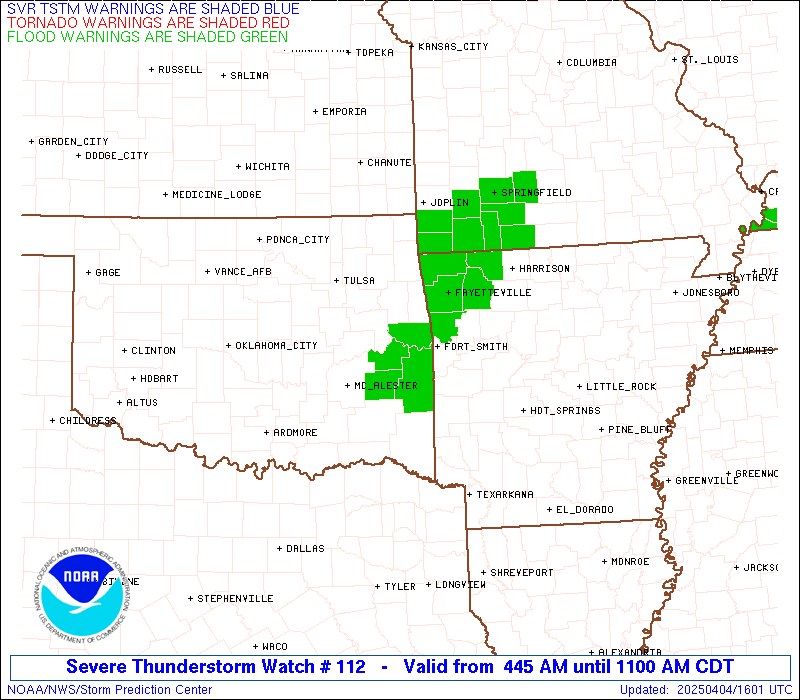
A new SEVERE THUNDERSTORM WATCH is now out for eastern Kentucky until 7pm. Here is a look at the watch and current warnings…
Damaging winds and large hail are likely with this complex of storms as it rolls eastward across the state. I will update as needed and crank out rapid updates through twitter.
Take care.
9am Update
Good morning all. A SEVERE THUNDERSTORM WATCH is in effect for most of central and western Kentucky until 2pm. Here is a look at the watch outline and the current warnings…

A line of thunderstorms will race eastward across the region with damaging winds and large hail a good possibility. This action is shaping up to provide a greater severe threat than what we had on Friday. I will have updates as needed and will send out rapid fire updates via twitter. Take care.
Previous Update
Good Saturday everyone and welcome to another day of tracking scattered storms across the region. The boomers on Friday packed a punch for some areas as large hail was the main player. We will see a similar setup across the region today and we have the blog set up for your tracking needs… again.
Before we get to the tracking toys… let’s break down the overall weather pattern.
– Scattered storms today can go severe with large hail and damaging winds possible.
– Sunday will sizzle!! Record high temps in the mid and upper 80s will be likely under mainly sunny skies. Don’t be surprised if we see a 90!
– A strong cold front will swing in from the west Monday and will contain a line of showers and thunderstorms. Some of these may be strong or severe. Either way… winds will really crank.
– The pattern over the next few weeks is one that is likely to be very active with periodic showers and storms that can put down quite a bit of rain. Check out the GFS Rainfall Forecast for the next 2 weeks…

Back to the weather of today and the threat of a few severe boomers…
Today’s Severe Storms Outlook

Current Watches

Radars for the entire state…

SPC Severe Weather Threat
Sunday

Monday

I will have updates as needed today so be sure to check back. Have a great Saturday and take care.

Thanks Chris, Looks like it is going to be another interesting day to say the least. Could we be looking at some high water issues given the projected rain fall amounts? That is a lot of rain even if it is over a two week period. Every body be safe out there and watch out for the lightning.
Discouraging. This has been the worst spring for fishing I can remember. First it was cold, then we had floods, now it is wind and storms every day. If it is warm enough, the water is muddy from all the rain or the wind from the next system coming in blows you off the water. The day or two you could actually fish happens during the week when I am at work. Oh well, at least Chris provides accurate information so you can plan your trip accordingly. Thanks for the work you do!
Severe thunderstorm watch until 2 pm for most cky and wky. I am running a live blog on my blog due to this for those interested.
Here we go folks, looks like a derecho set up to me.. Gonna be a rough one.
This one does seem different….
This doesn’t look to be anywhere close to as damaging as a Derecho… but it will at least be interesting for the Bluegrass. A lot of us got the shaft yesterday…but this one is going to make up for it!
bowing segment near Jasper IN has led to a t’storm warning for that area.
The MCS is generating its own ‘energy’ along the warm front for support of severe weather.
The numbers aren’t that impressive from the SPC, but again this system is feeding on itself. Very interesting…
I’ll be reporting to my storm spotter location soon. Looks like we’ll get something…I’ll have camara and video ready just in case.
Boy if this line of storms holds together It could be a doozie.
1″ hail reported in Dubois County, IN. .7″ hail was reported in Crawford County, IN.
Reports of trees down in Crawford County, IN.
Small hail reported in Downtown Louisville.
Power lines down in Corydon, IN from the same storm that is now hitting Louisville. .7″ hail reported at Church Hill Downs, .5″ just across the Ohio River in Floyd County, IN, .5″ hail along Dixie Highway in Lousville, and trees are down in Crawford County, IN.
marble size hail in Valley Station in SW Jeff county and lots of lightning
I’ll have video footage of storm posted on my blog…as soon as I figure out how to do it…
Power lines down in Pleasure Ridge Park (Jefferson County). Trees down along Dixie Highway, hail reported in Jeffersontown as well as Sellersburg, IN.
The cell in Spencer Co. looks to be the most damaging at the moment. All this activity is swirling around the convection-generated vort max as if it’s on a pinwheel. It’s kind of cool.
LMK is reporting that folks are seeing the green sky with this system north of here. Wow, I haven’t seen that for a long time…and usually it’s not a good sign when you do.
Hail in SE Lexington. Ranging in size from dime to quarter.
North of where?
Starting posting on yesterdays post by accident. Wild storm in Winchester. 50+ mph winds, pea to marble sized hail, and .70 in of rain in 15 minutes and still going strong.
Now the siren is going off…I guess better late then never.
Reports of trees down across Shelby County. Lots of trees down in Louisville as well.
I saw it, it was really cool
It is hailing in south Lincoln county. pea size
good stormy afternoon from the town of wayne, wva just south of huntington, wva. severe storm is passing by just to our south around the ft. gay/dunlow areas of wva. very vivid lightning along with very loud thunder. it is raining in my area as of now but radar plainly shows that the severity of the storm going by just to the south of the area. however moer potentially severe storms are lined up to the west , what appears to be a training situation lining up with the storms from west to east.
the mesocyclone seems to be centered over se indiana, north central ky and sw ohio and moving ese with the most intense storms rotating on the south side of it with a more generalized heavy soaking rain from the ohio river on north.
more updates to follow.
The storm moving through Eubank and Science Hill is showing signs of rotation. Look out in Northern Pulaski, Southern Rockcastle and Western Laurel Counties.
I need info guys, after the main line of storms come through, will any more pop up or develop to our west? Thanks in advance 🙂
TORNADO WARNING FOR…
NORTHWESTERN LAUREL COUNTY IN SOUTH CENTRAL KENTUCKY…
NORTHERN PULASKI COUNTY IN SOUTH CENTRAL KENTUCKY…
SOUTHERN ROCKCASTLE COUNTY IN SOUTH CENTRAL KENTUCKY…
* UNTIL 230 PM EDT
* AT 152 PM EDT…NATIONAL WEATHER SERVICE DOPPLER RADAR INDICATED A
SEVERE THUNDERSTORM CAPABLE OF PRODUCING A TORNADO. THIS DANGEROUS
STORM WAS LOCATED 7 MILES SOUTHEAST OF LIBERTY…OR 17 MILES
NORTHWEST OF SOMERSET…AND MOVING EAST AT 55 MPH.
* LOCATIONS IMPACTED INCLUDE…
PULASKI…SCIENCE HILL…DABNEY…BOBTOWN…WOODSTOCK…BEE LICK…
BANDY…WILLAILLA…SHOPVILLE…QUAIL…VALLEY OAK…LEVEL GREEN…
BROMO…BENT…SPIRO…MARETBURG…WABP…HANSFORD…BLOSS AND
WELLHOPE.
Man us just had another wave of severe severe weather.Walnut size hail sheets of rain heavy wind.What is causing all these storms esp with the Hail?????? I hope I dont lose a power again.
Huge hail northern pulaski
Is Louisville supposed to get more storms or are we done for the day?
What’s it looking like for floyd co guys? any chance of any weakening?
We just lol.
Shane,
I’m in between morehead & Ashland, are we looking at more storms firing behind this main line or is this gonna be it for the day?
Just got some hail here is London. Mostly marble size hail but there was some quarter size hail to. We just got clipped by the southern end of the storm. The wind wasn’t that bad.
The worst of it is over for Morehead and should be over in Ashland shortly.
Wondering the same…….anyone out there know?
absolutely nothing going on here on the farm cloudy with peeks of sunshine and happy about it
Got a good video of the hailstorm but don’t think I can load it up here.
Bowling Green is reporting 89 degrees. Looks like that ties a record.
Just went out and looked at damage in Harlan. I will definitley be surprised if this is not confirmed to be a tornado.
There’s a link on Chris’ twitter page of a pic of hail from Pike county. I guess that wasn’t from you? It was huge!!!
Hi, mate! I am totally agree with that way of assumption and everything joined.