Good evening, folks. I told you guys a case of spring fever would break out early this week! Temps hit 70 or better in several areas, but we are about to go another way. We have a lot of rain on the way over the next several days as our temps come way down. As a matter of fact, there is a growing potential for winter weather later this week into the weekend.
The first wave of rain is is increasing quickly from the southwest this evening. Here are your radars to track the action…

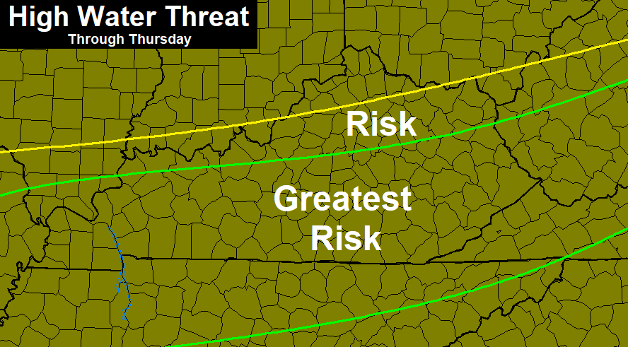
From there, rounds of heavy rain will soak the region through Thursday. Rainfall totals of 1″-3″ will be common, but some areas may top 4″. Here’s the area most at risk for potential flooding issues…
 The latest GFS shows this potential very well…
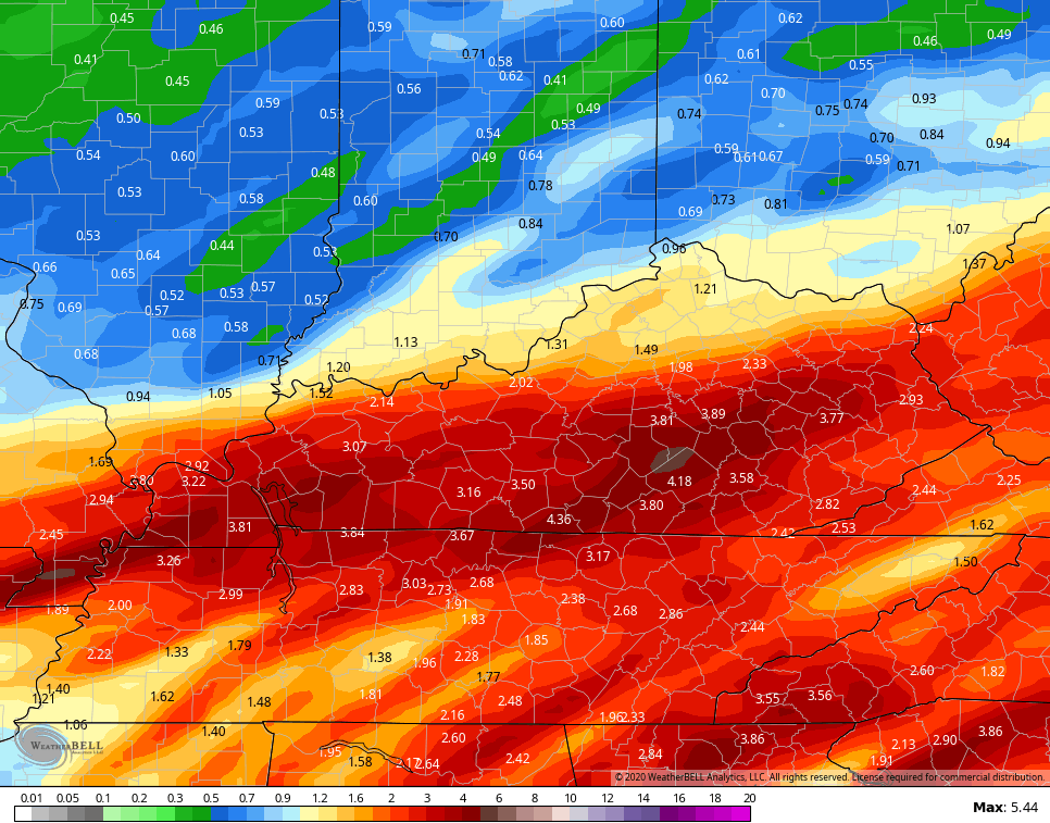 That would be enough to cause some flooding issues over the next few days, so let’s keep a close eye on water levels during this time.
There could also be a period of freezing rain across the north at some point, especially on Wednesday.
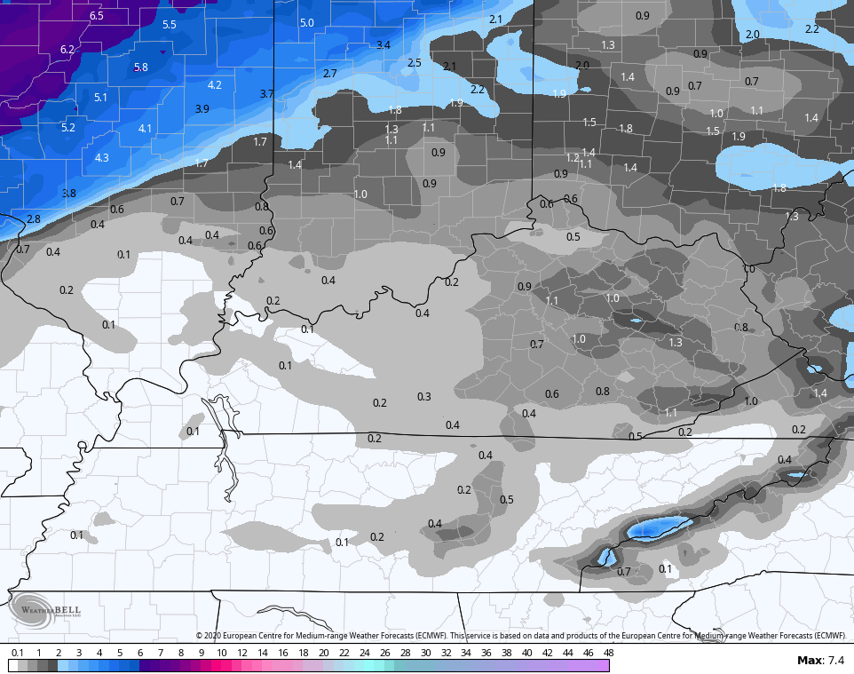
As cold air crashes in behind each low, we eventually get in on some snows by Thursday night and Friday. Light accumulations are possible. Here’s the EURO…
 Another winter weather maker comes in behind that for the weekend. That one could also put down some accumulations. That system could be interesting for parts of the state.
After that goes through, expect our region to wind up in another very wet looking pattern. The average rainfall from the 21 member GFS Ensembles is way up there for the next 2 weeks…
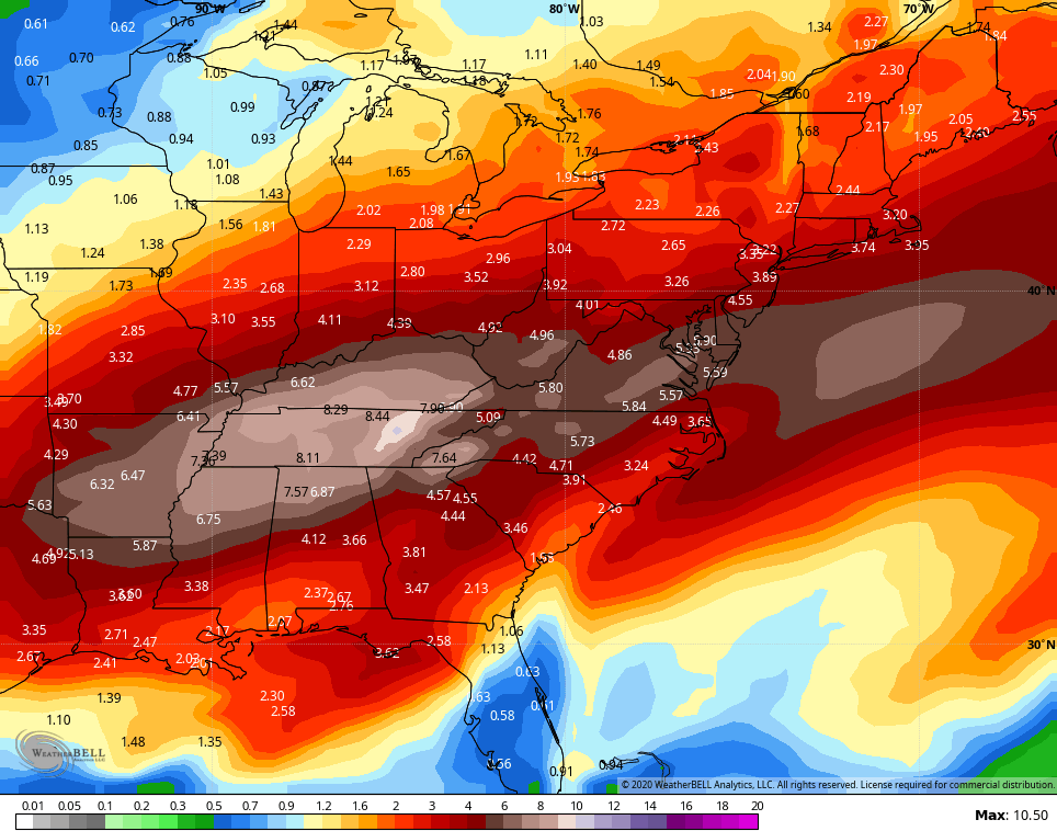 Crazy!
Enjoy your evening and take care.

There could be some very quick melting wet snow accumulations this weekend, especially on Pine and Black Mt ;however, it looks like SOS to me as even the lows are borderline freezing, let alone toasty daytime highs in 40 range.
I know what your thinking, lol, SOS stands for “sporadic only snowfalls.” What where you thinking, lol? 😛
Positive spin time:
High water table for spring growth = Check
Local government saves money on snow removal = Check
Polar ice caps refrozen = Check (You will NOT be seeing much national media talking about that- goes against the script)
I’m seeing a whole lot of winning!
Low heating bills = Check.
Extra Palm Tree growth (me) = Check.
I have been noticing quite a bit of birds chirping and singing at day break, kinda like what happens in April.
Ugh. My yard doesn’t drain well even living on a hill with a 14 ft drop of about 20 yards to my neighbors fence. Gotta wipe the dogs feet off from the mud that will be certain after the deluge.