Good Saturday, folks. Not that this comes as a shock, but we have more rain pushing across Kentucky today. This is bringing another round of locally heavy rain for many. While better weather follows this up for Sunday, the pattern continues to be full of systems set to bring more heavy rain and strong storms.
Let’s begin with today. As mentioned, rain is moving in from west to east and will be heavy at times. 1″+ rains are likely for several areas, especially along and south of Interstate 64. Local flooding issues may develop, especially in areas dealing with flooding early Friday.
A WIDE range in temps will also be noted with the far south hitting the low 50s with the middle 30s across the northern half of the state. There’s even the chance for a few snowflakes to fly in the north and that’s something for us to keep an eye on.
Here are today’s trackers…


Sunday looks much better with sunshiny skies and temps in the 50s.
Temps continue to slowly climb early in the week with just a small chance for a shower or storm. The rain and storm chances really ramp up for the middle and end of the week. Some of the storms then could be strong or severe.
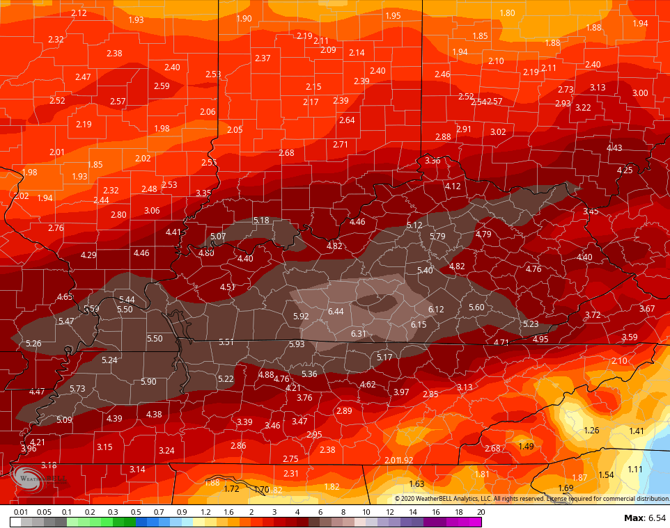
The models continue to advertise our region being in the sweet spot for the heaviest rainfall through next weekend…
GFS 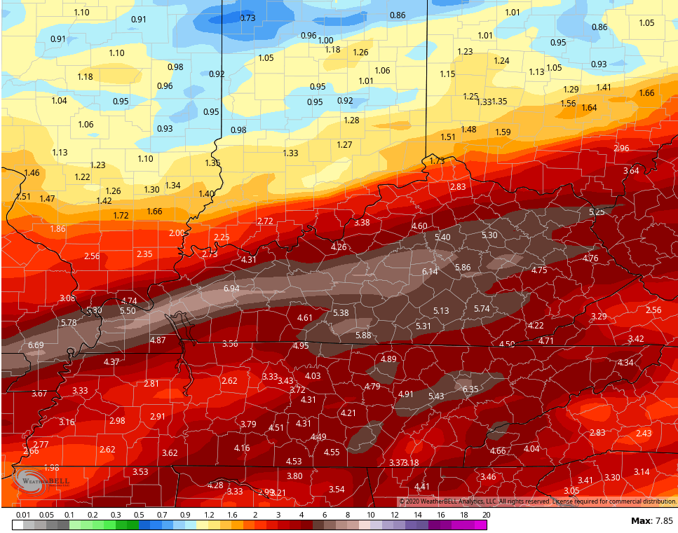 Canadian
 This stormy and wet pattern looks persistent into week two. Here’s the 2 week rainfall total from the GFS…
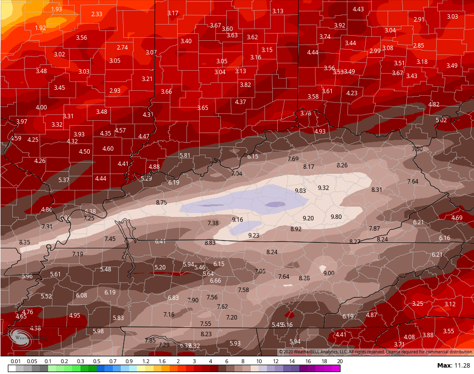 This is one nasty pattern, folks!
I will have updates later today. Have a good one and take care.

Thanks Chris, This depressing weather pattern continues ………….. on and on and on. At lease we will have a normal Spring weather day on Sunday and not looking forward to all the rain and storms next week. Nothing going on and not able to go anywhere just adds salt to the injury. My advice, just get a good book to read or work on a jigsaw puzzle or you can always watch reruns of sitcoms from the 50’s and 60’s.
With crummy weather like this, it sure would be nice to sit back and just watch nonstop NCAA basketball. Maybe I can find some good reruns.