Good evening, folks. It’s a very soggy day here in the bluegrass state as another system rolls through. To make things worse, this is a very cold rain. As we look down the road into next week, the pattern continues to look very active.
Let’s begin with the rain out there today. Some areas are already close to 1″ of rain and we have heavy downpours going through the evening. Areas of eastern Kentucky had some pretty significant flooding issues yesterday. The lack of warnings from the NWS in Jackson on that is very concerning, btw.
If you’re in those areas, please keep a close eye on water levels as this round of rain moves through…


Sunday looks much better with a mix of sun and clouds taking control. Temps will warm to around 50 with temps hitting 60 early in the week.
The next round of rain and storms should arrive by Wednesday…
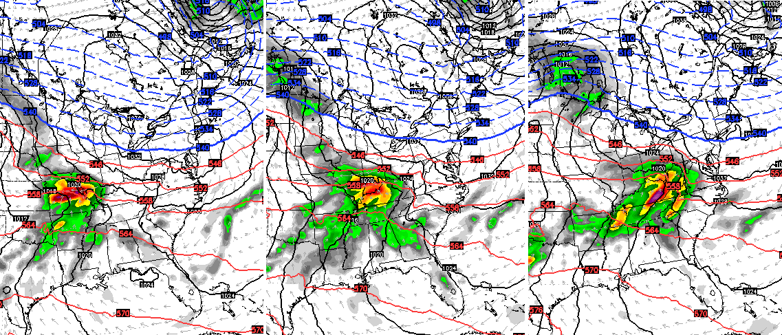 Strong storms and local high water issues will be possible.
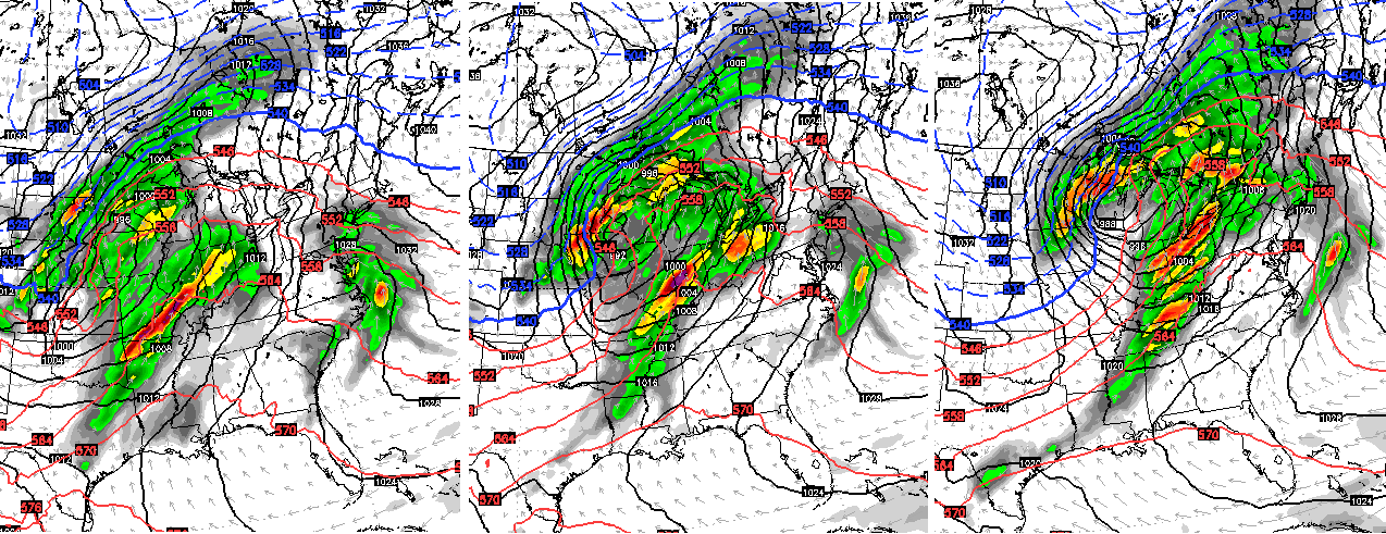
A major plains storm system then evolved behind this by the end of the week. Warm and unstable air floods in here and we could see temps hit the 70s. As that system moves into the Great Lakes, we may find ourselves dealing with more strong to severe storms…
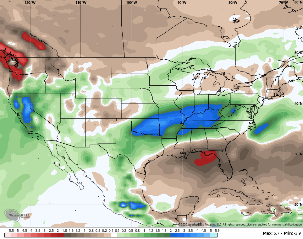
 This continues to be the overall wetter than normal trend we’ve been talking about for a while. The GFS Ensembles two week rainfall anomalies show this well…
 Buckle up for a wild spring, folks.
Enjoy the rest of your day and take care.
