Good evening, folks. I wanted to drop by for an update on the potential for severe weather threat for Easter Sunday into Sunday night. It’s a threat that looks to increase as a powerful storm rolls into the Ohio Valley.
Before we get to that, remember to cover the tender plants and vegetation tonight. Frost and freezing conditions are likely for most of the region.
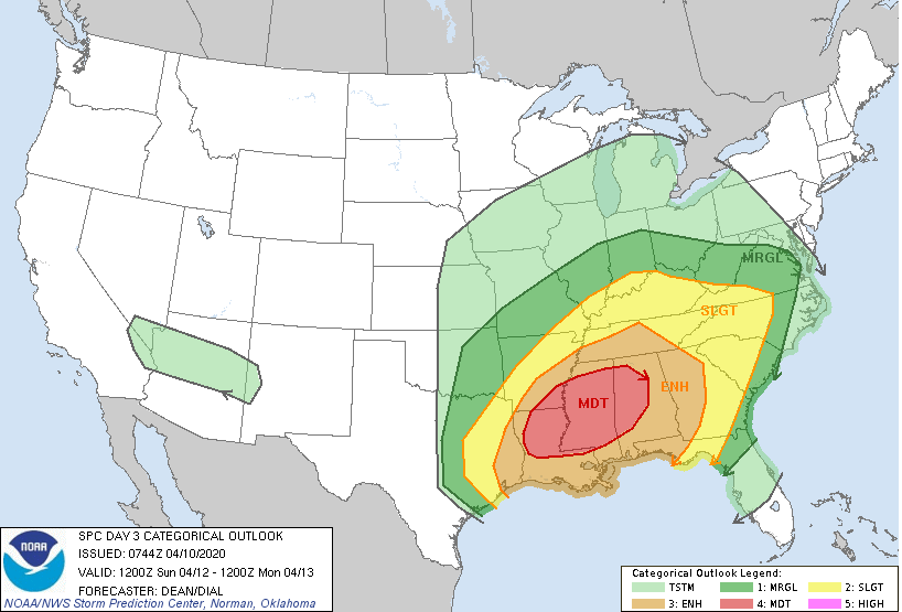
The Storm Prediction Center has the Easter Sunday Slight Risk for much of the state…

Damaging winds, large hail and a few tornadoes will be possible. The greatest threat for severe weather is late afternoon into Sunday night. In addition to the threat for severe storms, flooding rains will be possible in some areas. The exact location of the flooding risk depends on how our line of severe storms behaves and where it sets up.
This is a major storm system that will produce an Easter snowstorm behind it and a major severe weather event ahead of it. The SPC shows just how expansive the risk is…
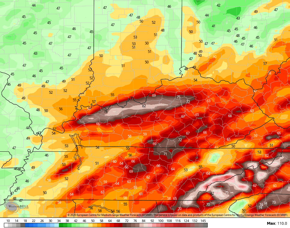
 The models are spitting out the potential for MAJOR winds across Kentucky from this setup. The EURO is off the charts…
 The NAM isn’t that high, but isn’t that far behind…
 So, our severe weather threat is something to really keep a super close eye on through the weekend. That’s exactly what I will be doing with my updates. See you guys later tonight!
Have a good one and take care.
