Good Saturday, everyone. After a frigid beginning to the day, our focus is all about the potential for severe storms and heavy rains for Easter Sunday. That’s when a strengthening low pressure rolls from the Mississippi Valley into the Ohio Valley.
Let’s begin with today and look ahead. After a below freezing morning, temps recover into the upper 50s to low 60s this afternoon. A mix of sun and clouds will be noted and I can’t rule out a few showers this evening….

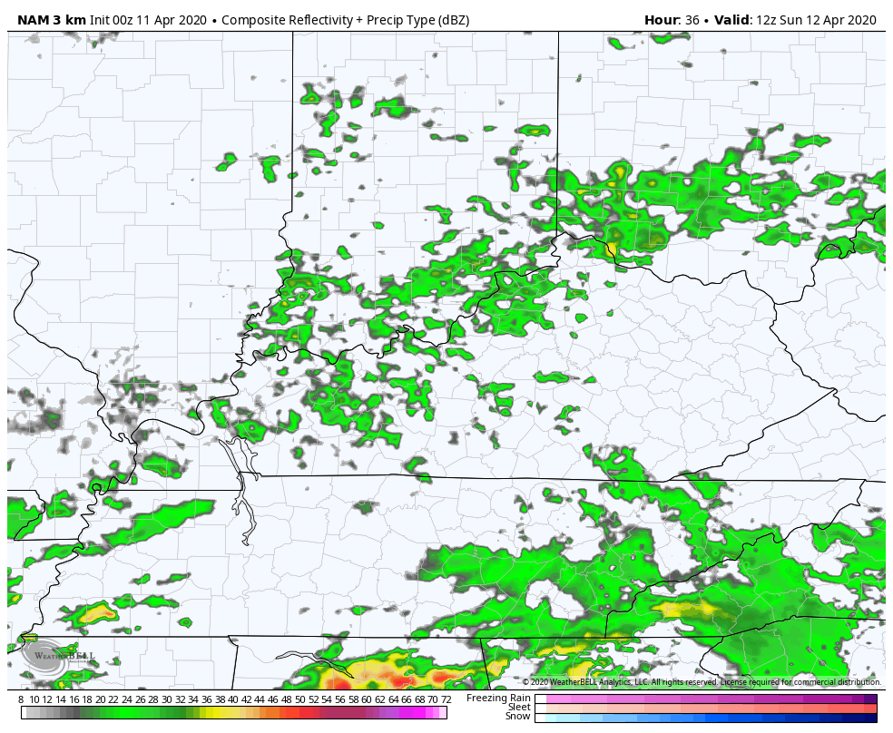
Easter Sunday will feature a major storm system working from the Mississippi Valley into the Ohio Valley and Great Lakes. This will have accumulating snow behind it and a major severe weather outbreak ahead of it. The greatest potential is just to our south, but the severe weather risk gets deep into our region. Here’s the latest Sunday Severe Weather Outlook from the Storm Prediction Center…

Damaging winds, large hail and a few tornadoes are possible. Storms may also put down enough rain for local flash flood issues to develop.
Here’s how the Hi Res NAM sees the Sunday setup…
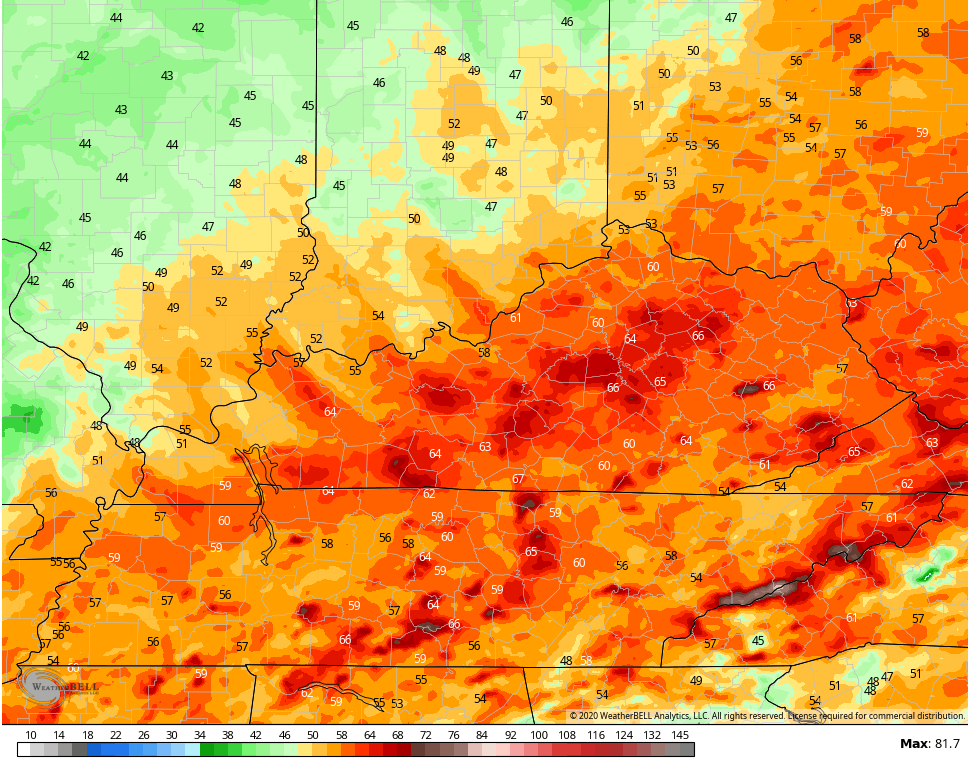
 Check out the wind gusts showing up on Sunday and Sunday night…
Hi Res NAM
 I will have another update later today, so check back. Have a great Saturday and take care.

We will pull out of this nasty pattern before long. Bring on the 90s lol.
Bring on the humidity. LOL
You need to have your mental status checked. Just kidding…
Tornadic setups in AL/MS, especially in April and May, have not been kind in the past decade.
That is ironically the good thing about being a meteorological fence. Areas around us tend to get more snow and also relatively worse storms.
I hope how soon we get out of this back and forth cold vs. warm pattern. after a few 80* days im hoping the snow and cold just goes away. hope the severe stuff loses its steam…. stay safe everyone.