Good Thursday, everyone. Our busy pattern is kicking off with a potent storm system rolling right on top of the bluegrass state today. This is the first of three such systems showing up in the next several days. Each will bring thunderstorms, gusty winds and the potential for too much rain.
Let’s start with today’s bowling ball. This works from west to east across the Commonwealth. Waves of showers and thunderstorms will be noted through tonight. Winds will be very gusty and could cause issues across southern and southeastern Kentucky. That’s the area that could also see a strong storm or two. Here’s the Severe Weather Outlook from the SPC…

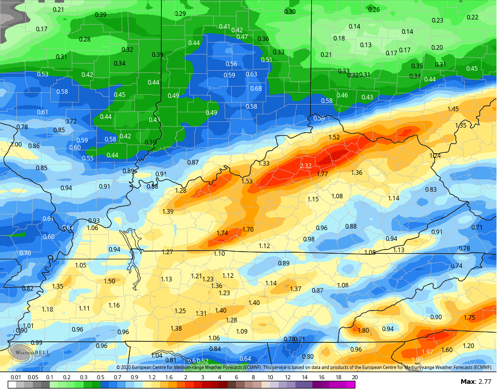
Heavy rainfall may cause local high water issues to develop. The EURO is showing some pretty good totals by Friday morning…
Showers will taper early Friday as we break out into a mix of sun and clouds. This is only a small break in the action as our next storm moves in for Saturday. This one may also bring very gusty winds, strong storms and heavy rains. Check out how much rain the EURO adds to the above total through early Sunday…
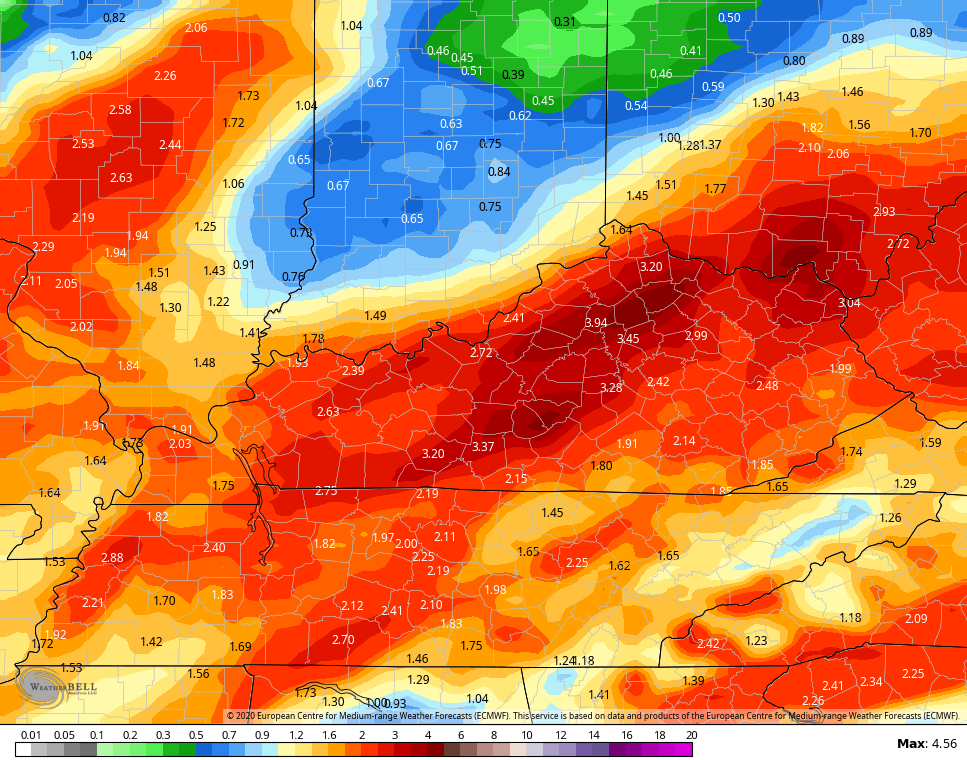
Between now and Sunday, some areas may see 2″-4″ of rain.
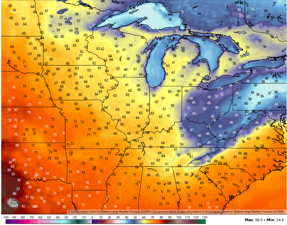
Our low is slow to depart on Sunday and that means chilly showers may linger across the east. That’s going to absolutely crush the numbers in the east. Check out the Sunday highs…
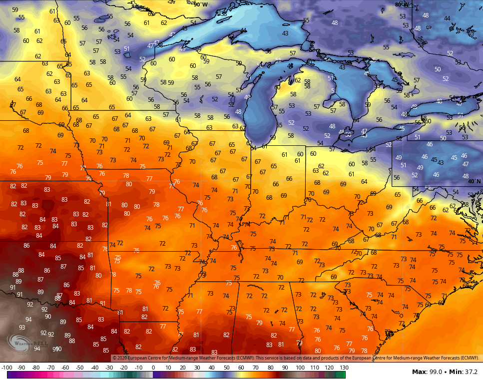
One that moves way, temps rebound quickly for Monday and Tuesday and may reach the 70s by Tuesday…
That’s ahead of another system dropping in here and taking on a similar look from late Tuesday into Wednesday. That brings another shot of storms, wind and heavy rainfall. Behind it will come a sharp drop in temps… Again.
Here are your tracking tools for the day…


Make it a good one and take care.

Is this going to be like Easter Sunday for southern and southeastern Kentucky? Maybe less significant? We had a power outage for like two days. :/
Raining here in central Kentucky at present, but no thunderstorms, maybe later this afternoon ? Yesterday’s weather was beautiful, with mild temperatures and plenty of hazy sunshine until high Cirrus Stratus clouds begin to lower late in the evening. I’m hoping we will not have a prolong Summer weather event that could delay Autumn like weather because of the cooler than normal Spring we are experiencing. Temperatures will have to balance out sooner or later and that scenario almost always happens. UGH !