Good Friday, everyone. We have a better sky taking control of the weather as the day wears on, but that isn’t going to last through the weekend. Another potent system works right on top of us this weekend, bringing more rain and thunderstorms our way.
There is a little better news in the temp department for next week and I will get to that in a bit. First, let’s start with what’s going on out there today. Things start with some clouds and a few showers across the east. That action may linger into the middle of the day…

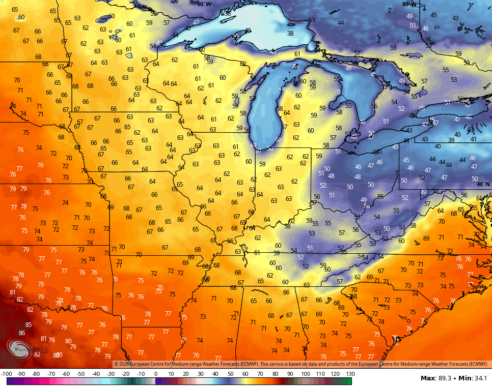
Skies become partly cloudy this afternoon with temps generally in the 60s.
Saturday looks to start out in pretty good shape, but that goes downhill quickly as rain and storms roll in from west to east. That happens as low pressure moves directly over top of us. As this system slows down to our east, it keeps a few showers going across the eastern half of the state into Sunday…

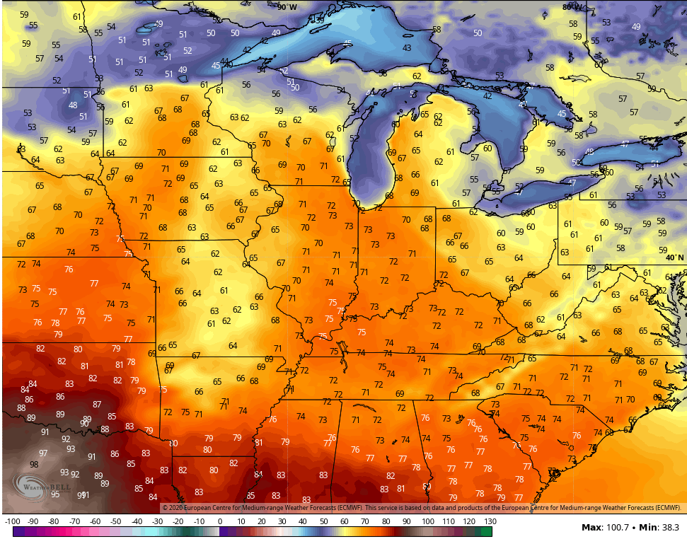
That leads to quite the temperature gradient for Sunday highs, but the numbers are a little better than before…
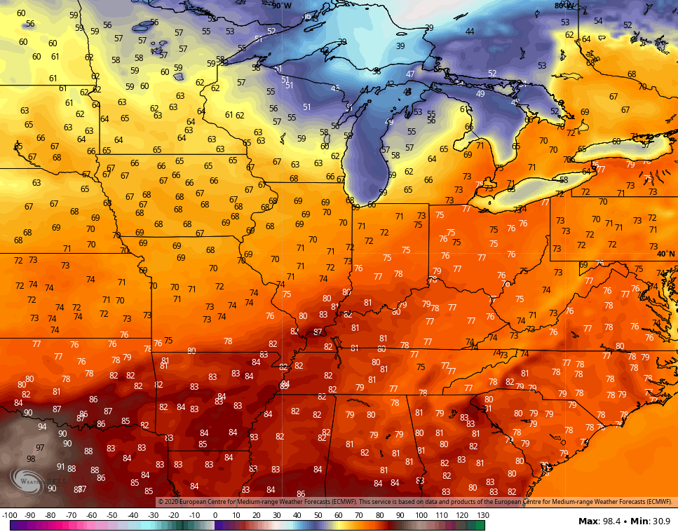
Monday sees partly sunny skies return with temps deep into the 60s. As our next system gets set to arrive by Tuesday night and Wednesday, temps really spike ahead of this. Highs on Tuesday should be deep into the 70s for some…
As that system blows in, showers and thunderstorms show back up…

There’s some ugly with that for a day or two, but the Euro is quickly warming things up by the final day of April. Check out the numbers…
YES, PLEASE!!!!!!!!!!
Have a great day and take care.

Besides the weekend rain it is not a bad forecast.
Yesterday’s “April Showers” amounted to 0.56 inches in my backyard. “May Flowers” this Spring should be the size of “dinner plates” with all the rain we have had this month.
I need 7-10 days of 75 or higher with plenty of sunshine to get me out of this wx slump im in. my dear dear mother nature, is that too much to ask? if I didn’t know any better id think I was in the pacific northwest instead of Kentucky.