Good Saturday, folks. It’s another warm and windy day across the Commonwealth and this continues through the weekend. Once into early next week, we will be fighting an upper low set to spin across the eastern half of the country. That could bring a few ugly days
Any storm out there today is rather scattered in nature, but a few will be on the move. Gusty southwest winds will boost thermometers into the upper 70s and low 80s.
A cold front makes a run at us late Sunday into Sunday night. Temps ahead of this will spike into the low and middle 80s as winds continue to crank from the southwest. A few scattered storms will also go up, with the potential for a line of strong storms from northwest to southeast.
Here’s the Sunday Severe Weather Outlook from the Storm Prediction Center…

The system dropping in here from the northwest is going to cut off from the main flow. There’s a big disagreement from the forecast models on where this thing slows down and how long it sticks around. Areas who get under this would have cool and damp weather.
The GFS Ensembles are pretty far east with this, giving us just a little bit of ugly before temps rebound in a big way by the end of the week…
The Euro Ensembles are a little slower and closer to us with this system, but clear it our for the second half of the week…
The EURO is the ugliest run and keeps this right on top of us through the end of the week…
The EURO sometimes doesn’t handle cut off systems very well, so let’s hope that’s the case with this one.
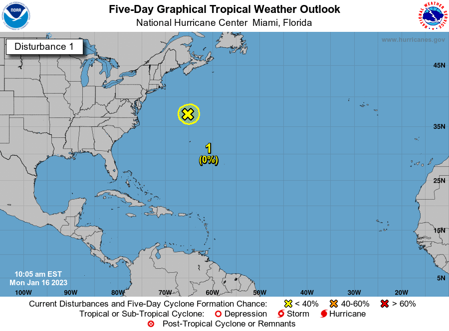
I suspect much of how this plays out depends on how a potential tropical system off the southeastern coast…

The faster that can move away, perhaps the better chance this upper low heads east faster!
I lave you with your Saturday scattered storm tracking tools…


…
Make it a great day and take care.

Rain off & on is a sure bet over the next 5 days.
Thanks Chris, Interesting to see that upper level low pressure system this time of the year. Usually those systems form in the later part of Winter.
I can’t recall any tropical storms forming this early. It looks very likely this (80%) chance will become Arthur. This would open the Atlantic Hurricane Season 2020, which would start on June 1st anyway.
If the upper level low phases with the tropical storm over the Appalachian It could be a flood disaster and may even be pushed west into central Kentucky. Anyway lets get past today’s predicted storms for this afternoon.
After all this mess is out to sea, a real nice Summer time ridge may develop over our area. Hopefully, it will be around for a couple of weeks.
Thanks Chris, Interesting to see that upper level low pressure system this time of the year. Usually those systems form in the later part of Winter.
Looks to be a nice warm and humid Saturday. Hope to gets some outdoor work done, but may have to dodge some showers this afternoon.
Outdoor work is a must today, may have to work between the showers. Looking forward to more Summer Time weather late next week, but that depends on what happens in the tropics and the upper level low pressure system ?
Must of had a computer glitch. As this morning I couldn’t get any post through. Now here they are. I did not mean to post so much. The first one is my original post. The others following are attempts to reconnect. Sorry Chris
PS I have DSL connections and that is probably where the problem is ?