Good afternoon, everyone. We have rounds of showers and thunderstorms rolling into the region and this may cause high water issues. These rounds of storms will be spinning around an area of low pressure rolling through the region.
Let’s begin with the potential for strong to severe storms this evening across the west. This is the area the SPC is highlighting this region for the severe storms risk…

As the low moves east, a low end severe storms risk across central and eastern Kentucky…

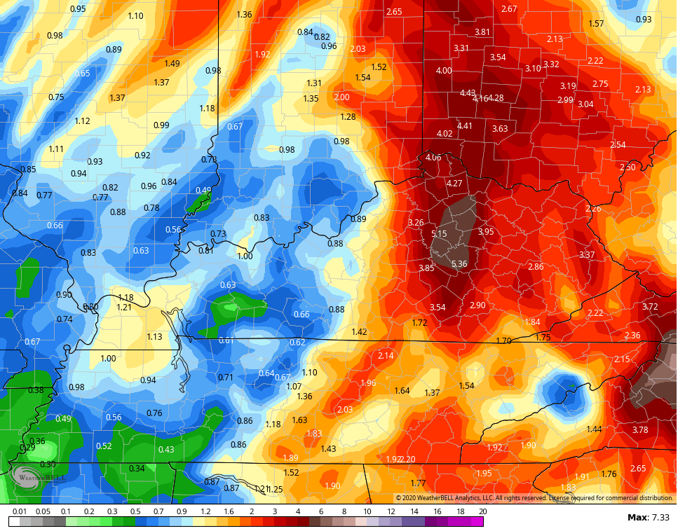
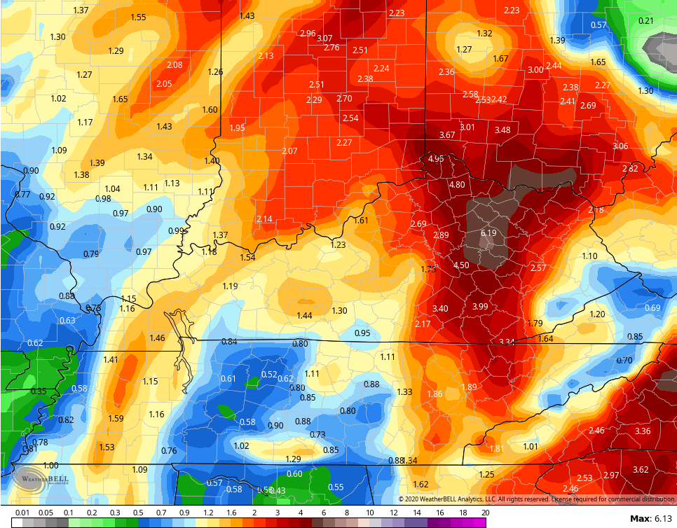
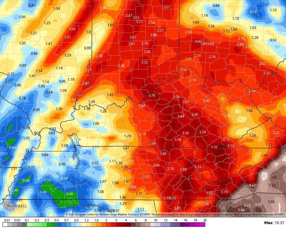
The greatest risk is from torrential rainfall over the next few days. Repeat shower and thunderstorm action will move across the same areas of central and eastern Kentucky. The numbers from the forecast models are alarming…
NAM
 GFS
GFS
 CANADIAN
 EURO
EURO
 Flooding and flash flooding issues could become an issue over the next few days.
Here are your tracking tools for the rest of the day…


Current watches

Possible Watch Areas

Enjoy the rest of the day and take care.

Thanks Chris. Well I’ve sure enjoyed the pAst few days of sunshine and warm temps. Looking at the week ahead at least it doesn’t look to be a total washout, even with the scary numbers of projected rainfall. Thh G at, I hope, is wrong! Looking forward to sunshine and more warmth in a few days. Have a great Sunday afternoon all and keep an eye and ear on the weather.
Memorial Day Weekend to be warm…. That warms my heart
Flash Flood Warnings are now in effect for virtually the entire Chicago Metro area until 10:30 PM local time, as a large area of heavy rain is moving in from the south and southwest.
From midnight through 4 PM, almost an inch of rain has fallen at Chicago’s O’Hare Airport, while 1.33 inches has fallen at the NWS forecast office in Romeoville in the SW suburbs. Those totals could easily be doubled, or even tripled, in the next several hours. Add those numbers to the 2 to 4 inches of rain received on Thursday… wow!
At least the severe weather threat is very low, it’s just the heavy rain that’s concerning everyone here, as area rivers are going to undergo major flooding.