Good Tuesday, folks. As our late May run of early summer temps continues, the threat for booming thunderstorms rolls on. These storms are still bringing a flash flood threat to the region and a few storms could briefly go severe. Once into the weekend, cooler changes settle in as we get set to flip the calendar to June.
Let’s begin with today and roll ahead. We are dealing with another very warm and humid day, leading to additional rounds of storms. Just like the past several days, any storm that goes up can be briefly severe and put down enough rain to cause flash flooding.
This is a trend that continues through the end of the week. That’s when a cold front marches in by late Friday and Saturday. This could touch off greater coverage of strong storms and torrential rains.
Here’s the setup between now and the front arriving…

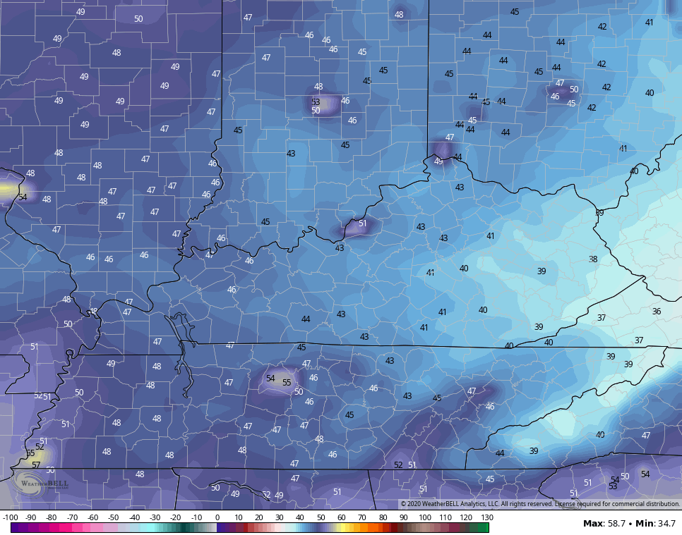
The air behind this turns amazing as we close May and say hello to June. Highs from Sunday through, at least Monday, will likely be in the low and middle 70s. Lows may flirt with records…
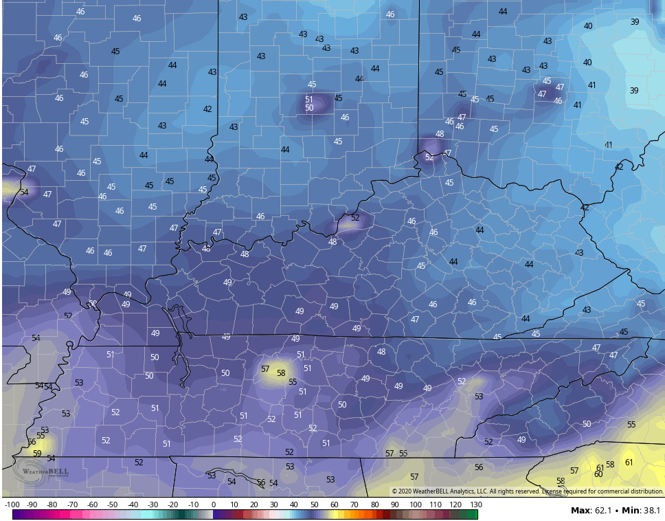
Sunday Morning
Monday Morning
That will be a below normal temp pattern that likely flips back to warm by the middle of next week. Maybe this is the trend we are seeing for early summer… Back and forth temps.
I leave you with your Tuesday storm trackers…


Have a great Tuesday and take care.

You will not have me complaining about temps in the seventies.