Good Saturday, folks. We have more of the same on the way this weekend into early next week as steam and storms continue to work hand in hand. This is a setup rolling with us into next week, but a cold front does try to help us out later in the week.
As usual, we start with where we are right now. Temps today will once again show a wide range because of scattered showers and storms. Temps range from the middle 80s to low 90s across the state, with a few hot spots showing up. With the tropical humidity, temps will feel much hotter than they actually are.
Remember me talking about how pathetic the EURO is with temps around here? Check this out…
More than a week ago, this EURO Model high temp forecast was flooding social media. It was showing widespread 100+ temps this week and it wasn’t even close. The EURO has serious issues with temps around here. #kywx pic.twitter.com/pUdBLlVvQV
— Chris Bailey (@Kentuckyweather) July 17, 2020
Hopefully weather folks are waking up to how bad that model has become. It is simply spitting out numbers that are so out of touch, you cannot base any kind of temperature forecast off it.
Those same showers and storms may be slow-movers and put down a lot of rain in local areas. Once again, that could lead to some high water issues. Here are your Saturday trackers…


This pattern is going to keep spitting out similar conditions from Sunday through early next week. Highs range from the middle 80s to 90-95, depending on the amount of storms on any given day. Humidity levels will make it feel much hotter, but that’s because the tropical air is really off the charts.
Now, we are heading into a pattern that becomes more conducive for rounds of stronger storms and heavy rains. This setup can deliver some big wind makers and flash flooding. Here’s the GFS…

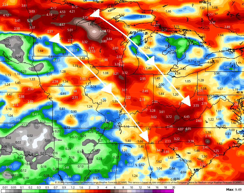
Even the Euro is seeing the storms…

The control run of the EURO sees the potential over the next 1-2 weeks…
Make it a great Saturday and take care.

Thanks Chris, I think eventually the European Weather Model along with the American Weather Model will be corrected, hopefully before Autumn and Winter arrive. We shall see.
Rainfall from yesterday was around 0.60 inches in my county of Taylor, which was most welcome for the crops.
Tropics so far remain quiet, but it is a sleeping lion about to wake up.
Have a great Saturday Folks !
More cloud cover than expected has prevented the heat index from reaching the predicted 105 degrees here in the Chicago area. Though, dew points are very high, making it feel very tropical outside.
At 4 PM at Chicago’s O’Hare Airport, it was 89 degrees with a heat index of 101, and a dew point of 77. Near the NWS Forecast Office in Romeoville in the SW suburbs, it was 86 degrees with a heat index of 99, and a dew point of 78.