Good afternoon, folks. I wanted to drop by for a quick update on the storms blowing up and the big changes on the way for the rest of the week. This is a pattern likely to feature a lot of wet weather that will also lead to much cooler than normal temps to end July and begin August.
Let me start by saying, you can now leave comments once again. You have to register in the comments section to start the process. Once you do that and get approved, you can leave comments only under that approved account. The message board registration is separate, but it’s also open now for registration. You can start your own weather discussions on the message board and even upload your own maps.
Storms continue to go up as a cold front drops in here from the northwest. A few of these storms may be strong or locally severe. The Storm Prediction Center continues with a low-end risk for severe weather in the north…

Any storm that’s out there can also produce local high water issues, so keep that in mind.
I have no changes to the pattern ahead. Our front stalls across the region with a couple of storm systems rolling in here. I may have to adjust this a bit farther north…
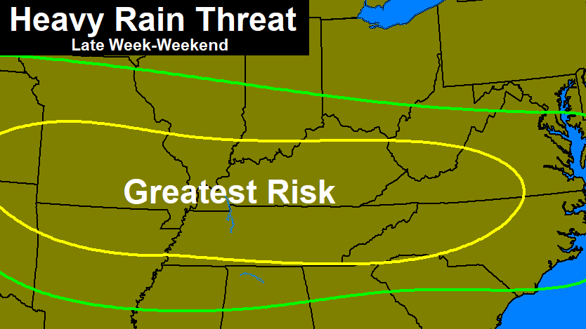
You can see how the midday model runs are more aggressive on this being a little more to the north…
GFS
 CANADIAN

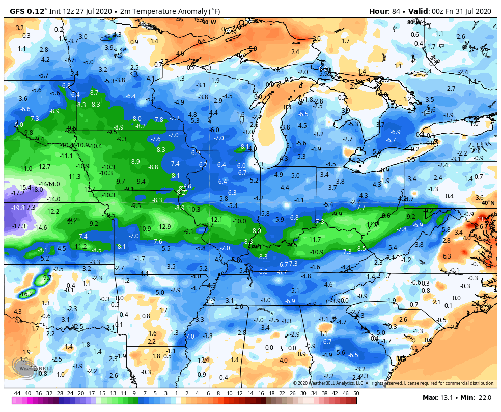
That leads to a much cooler than normal setup. Look at the departure from normal…
 I will have your normal full blown update later tonight, so check back. Until then, here are your tracking tools…


Current watches

Possible Watch Areas

Have a great rest of your day and take care.

Looks like we will have to go through a lot of “wet days” before the cooler drier air gets here. I just hope there isn’t any severe weather anywhere. At the present, central Indiana is getting a line of storms. Could move into the northern part of Kentucky before Sunset if they hold together. In central Kentucky scattered showers are developing. Isn’t this a little late in the Summer for this weather type ?
Glad to be approved/accepted…love the new layout…