Good afternoon, everyone. Another low pressure is working into the western part of the Tennessee Valley and will lift north into the Ohio Valley through Saturday. That brings an increase in storms and heavy rain, with the potential for a few severe storms.
The Flash Flood Watch has been extended into Saturday…

Northern and northeastern Kentucky should also be included in this Watch. That seems like a no-brainer considering the amount of rain these areas have seen.
As storms increase from the southwest, the potential is there for a few severe storms developing into the evening. Here’s the current Severe Weather Outlook from the Storm Prediction Center…

That threat then expands to include much more of the region into Saturday…

Damaging winds and a brief tornado spin up can’t be ruled out across central and eastern Kentucky.
A leftover shower or storm will be with us Sunday before another system drops in here and brings a few more storms for Monday and Tuesday. Temps average below normal during this time and through next week.
Hurricane Isaias is rolling through the Bahamas and will impact the east coast of Florida on Saturday. From there, the storm turns north toward the Carolinas then rides the coast to New England. Here’s the official forecast from the National Hurricane Center…

The Hurricane Models show the fine line the east coast of Florida is walking with a direct hit or a skim storm…
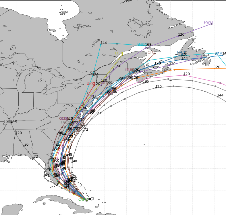
The EURO is more of a Florida hit…

The GFS is more of a skim job up the coast…

I leave you with your tracking tools for the rest of the day…


Current watches

Possible Watch Areas

Enjoy the rest of closing hours of July and take care.
