Good afternoon, everyone. We have a cold front working across the state and it’s bringing a broken band of showers and storms. The next front arrives later Monday and brings unsettled weather with it for a few days, but the temps are the big storm or the week ahead.
First off, let’s track today’s action across central and eastern Kentucky…

The next system drops in here from the northwest late Monday and slowly sinks toward the south into Tuesday and Wednesday. As it does so, low pressure develops along the boundary. This means scattered showers and storms will be noted during this time. The best chance is across the south and southeast as we get toward the middle of the week…
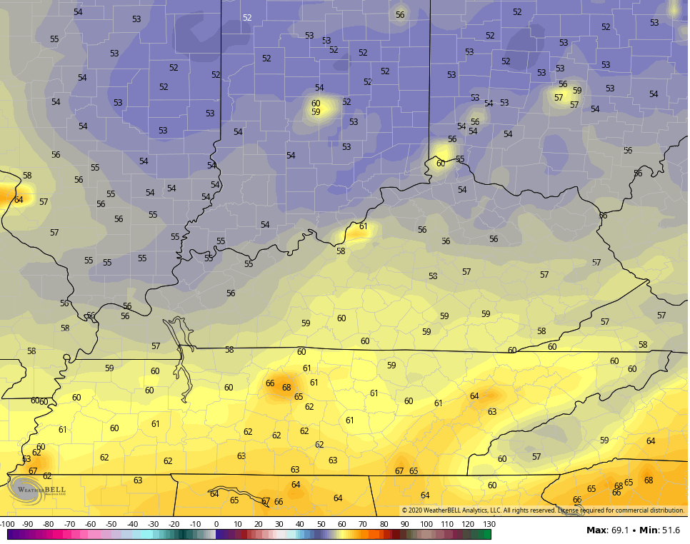
 Very nice air is behind this front as another blast of September air takes control. Check out some of the forecast low temps…
WEDNESDAY
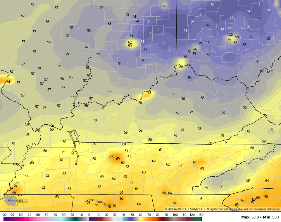
 THURSDAY
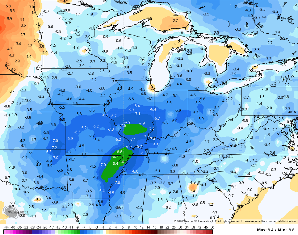
Temps for the 7 day period starting today average well below normal for the entire area…
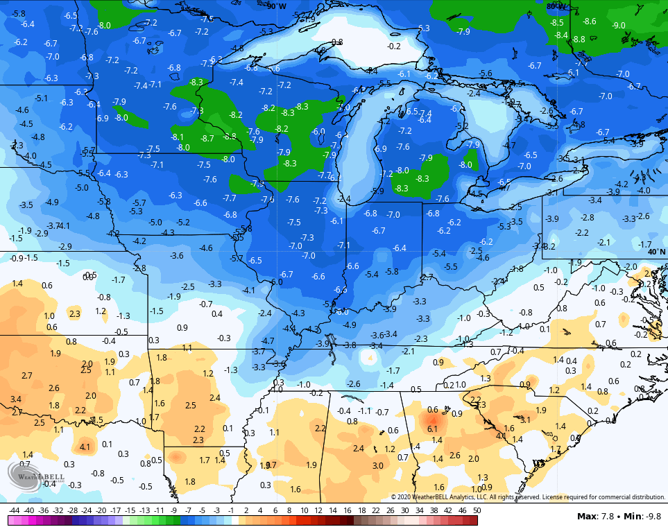
That’s from the GFS and it’s also showing another cool blast arriving the following week. If we look at the model forecast for the final 7 days of August, it shows below normal temps continuing…
Enjoy the rest of your Sunday and take care.

We had a hefty rain shower come through about an hour ago. I’m hoping the frontal line develops as it moves into our more southern counties where the farmers need the rain.
Liking the temperatures next week, but I wonder if the dew points will drop where we will have some comfortable Sunny days.
Tropics not too exciting yet. Some shear going on at the present. If that shear continues maybe we will have more tropical storms “fizzle” than ones developing into destructive hurricanes.