Good afternoon, everyone. We have another spectacular day taking shape across the region as our September feel rolls on. This calm pattern is about to turn a little stormy around here as the tropics continue to flex some serious muscle. That flexing has a chance to impact our weather next week.
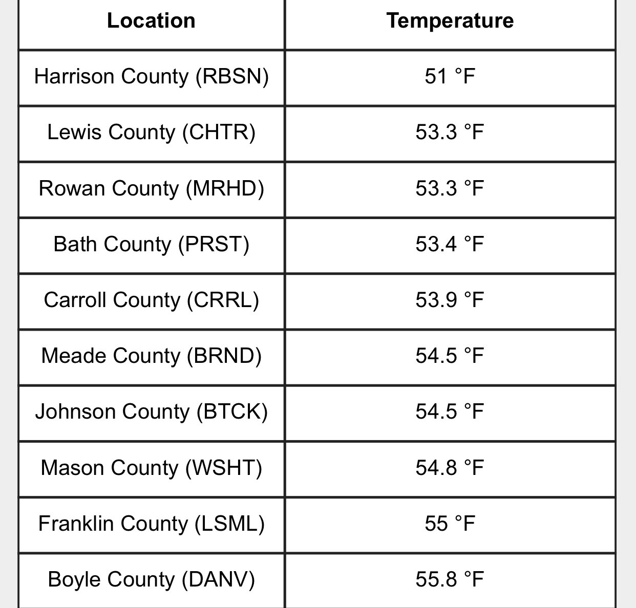
Let’s begin with today. Temps out there this morning were deeeeeep into the 50s for lows. I mentioned last week that a few spots could approach the 50 degree mark. This morning’s lows from the Kentucky Mesonet show just how close we got…
Scattered showers and storms will flare up this afternoon across the east and southeast as moisture slowly creeps back into the picture. Here are your radars to follow along…

Showers and thunderstorms will then increase across the rest of the region Friday and continue into the weekend. It’s not going to rain all the time, but this is going to be on and off through Sunday…
I’ve been highlighting the likelihood of the tropics getting super active once again and they are doing just that. It’s looking increasingly likely we will be dealing with double trouble getting into the Gulf of Mexico this weekend into early next week.
Two storms are developing and will take aim at the US during this times.
Tropical Depression 13 should be named at any moment. The National Hurricane Center forecast takes this into the Bahamas as a hurricane then impacting Florida before getting into the Gulf…

Tropical Depression 14 is also forecast to get into the Gulf of Mexico around the same time…

This could be a wild looking setup with two systems in the Gulf at the same exact time. This is something the Canadian Model has been showing for a long time, so it may end up being the top dog with this setup.
Enjoy the rest of your day and take care.
