Good afternoon, everyone. We are following two weather stories of the day. The first is on the potential for severe storms in the north and east through the evening, but this is the lower end of the spectrum. The main show is down in the Gulf of Mexico as Laura continues to strengthen into a hurricane. What’s left of Laura will then move toward Kentucky by the time we hit Friday and Saturday and could have a big impact on our weather.
Let’s start with the severe threat. There is a low-end risk for severe storms in the north and east. Here’s the area to watch from the Storm Prediction Center…

Scattered storms will be with us over the next few days, with an increase on Thursday. That’s when some tropical rains show up well ahead of Laura.
As mentioned, Laura is now a hurricane and is forecast to become a major hurricane before coming ashore near the Texas/Louisiana shore Wednesday night. From there, this storm works northward into the Mississippi River Valley before taking a hard right into our region Friday and Saturday. This is likely to be a tropical depression when it arrives. Here’s the latest from the National Hurricane Center…

The consensus among the hurricane models is for what’s left of this storm to move west to east right on top of Kentucky…

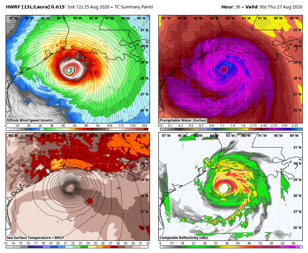
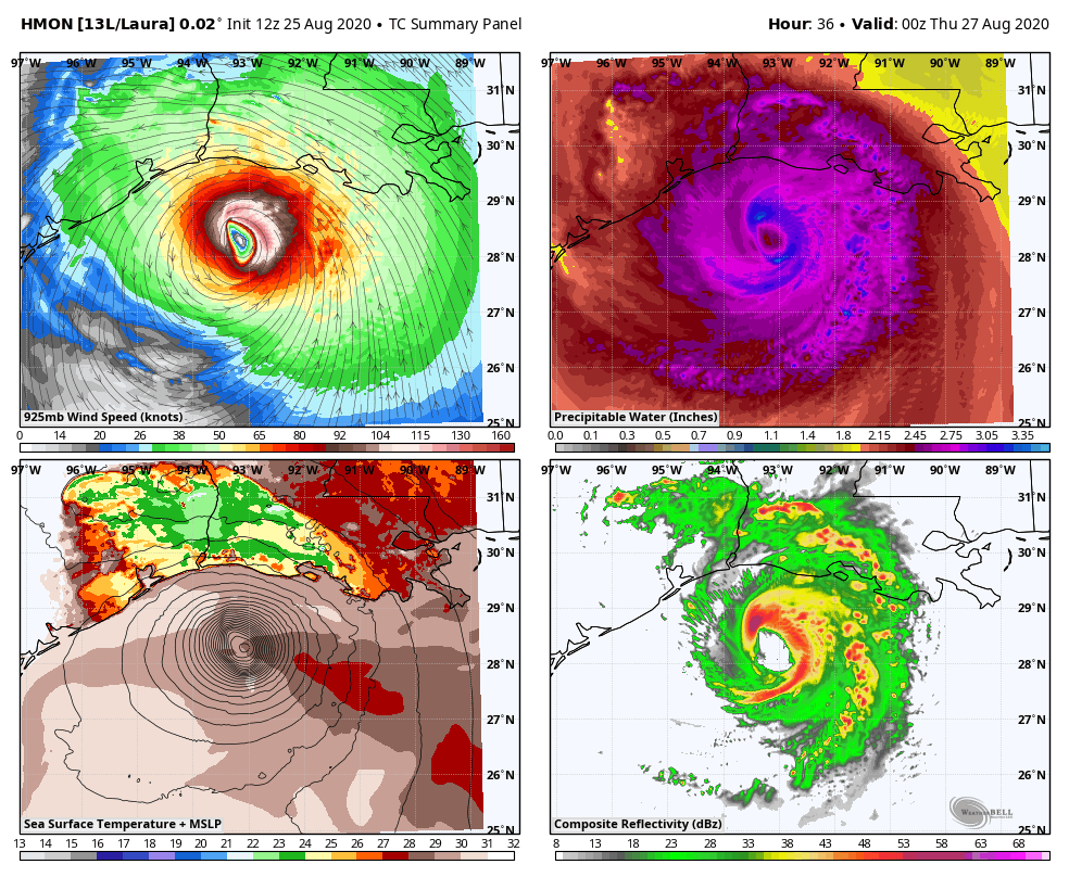
The higher resolution hurricane models are also showing this, but with some variation…
HWRF
HMON
The operational models are also locking in on Laura moving across the state…
GFS

EURO

High winds, flooding rains and the potential for strong to severe storms will be with us from Thursday night through Saturday as this storm impacts the region.
I’m back on WKYT-TV today starting at 4pm and will have the latest on Laura and the impact on Kentucky. I leave you with all the tracking tools you need…

Current watches

Possible Watch Areas

Have a good one and take care.

Thanks for the update Chris on Hurricane Laura. As I said before I have Family in southeast Texas and Louisiana and I’ve been tracking this potentially dangerous storm since it started to form a few days ago. This looks like it could be another disaster and I heard on the news that mandatory evacuation is now in effect for the coastal areas.
I notice on the GFS and the Euro weather models you posted on this Afternoon blog that both are in agreement as to the path of the tropical depression. We may be looking at a storm like Hurricane Ike that brought high winds to parts of Kentucky some years ago.
i