Good Wednesday to one and all. Hurricane Laura is heading toward the Gulf Coast and will eventually roll toward the bluegrass state. It’s looking more and more likely this will have a big impact here in Kentucky. That looks to happen from Thursday night through Saturday and may result in heavy rain, high winds and severe thunderstorms.
Before we feel the direct impact of Laura, we continue to deal with a tropical air mass well ahead of the storm. This increase in humidity will lead to a few thunderstorms going up out there today and into Thursday. The Thursday action may be a little more widespread, but today’s stuff could still cause some local issues. Here are your radars to follow along…

We will watch the Thursday action for the potential for local high water and strong storms in a few spots. Outside of the action, it’s toasty and steamy.
Hurricane Laura continues to strengthen in the Gulf of Mexico…

There isn’t much to keep this from becoming a major hurricane as it heads toward landfall tonight somewhere near the Texas, Louisiana border. Can this strengthen beyond a Cat 3? I think that’s possible. Here’s the latest forecast from the National Hurricane Center…

Here are the takeaways the NHC wants to get across about the storm…

Remember, the above maps will automatically update as soon as new information is sent out from the NHC.
The inland track of this storm continues to be aimed at Kentucky from later Friday into Saturday. This may very well still be a tropical depression as it moves from west to east across the Commonwealth. Here’s what that could mean for us…
- A general 1″-4″ of rain for many with the potential for locally higher amounts.
- Winds may be a big player and gust to greater than 40mph at times.
- The potential is also there for strong to severe thunderstorms along and ahead of the center of circulation.
- If thunderstorms do get into the mix, wind gusts may become a pretty big issue.
The latest hurricane models continue to suggest a track right across Kentucky from west to east…

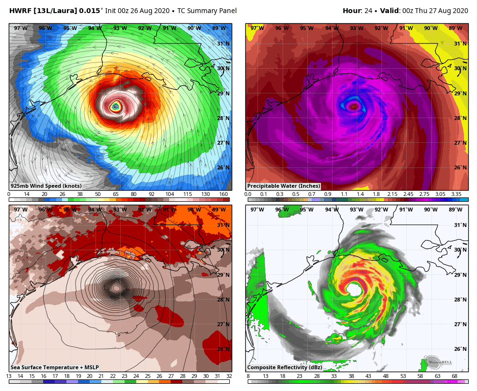
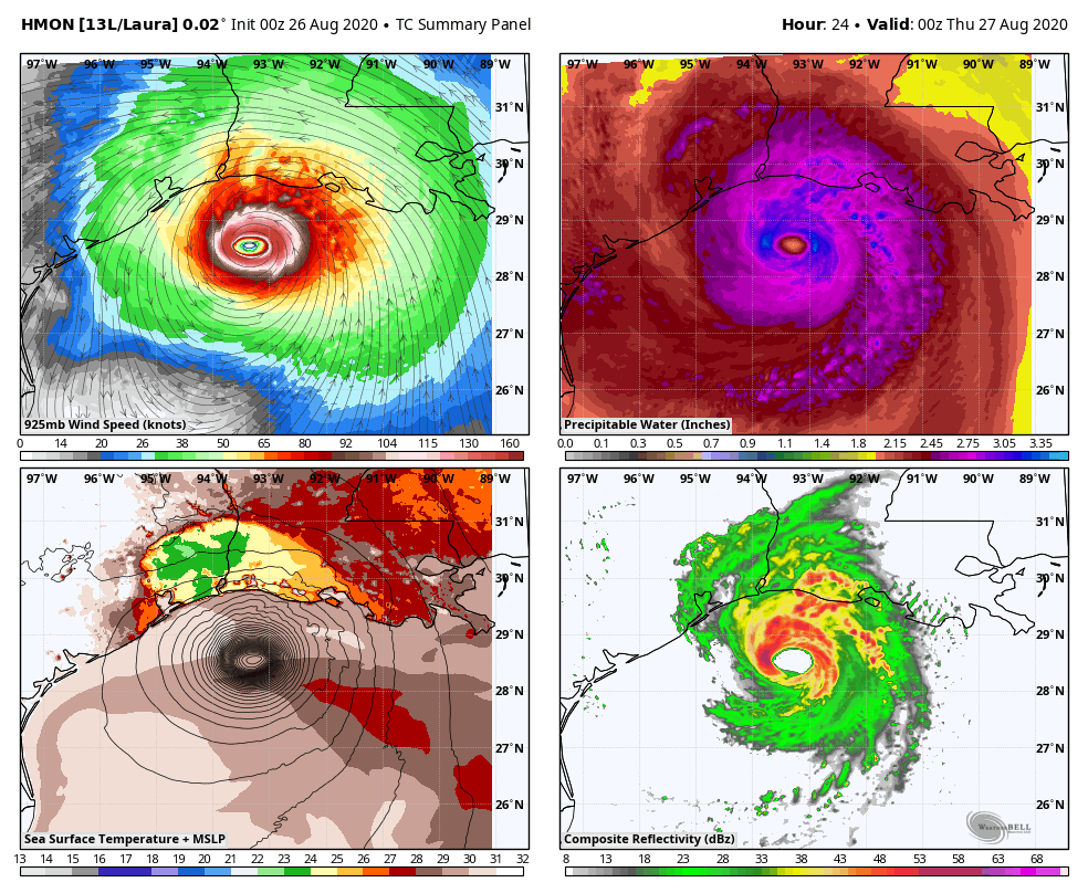
Some of the high end tropical models give us a better look at how this may play out…
HWRF
HMON
The operational Models like the GFS also show this thing turning the corner on top of the state…

Friday into Saturday could get pretty wild around here, so stay up to date on the progress of this system.
The overall pattern into early September is a very active one behind Laura. A potent system will work in here early next week, bringing the threat for more heavy rain and strong storms…

Again, this is a polar opposite pattern to the one from this time last year.
I will have another update or two later today, so check back. Until then, have a good one and take care.

Finally some action! I’ll be on Twitter I’m sure stalking the hurricane like I always do when one is coming. Finally some weather entertainment! It’ll be very interesting when it comes through ky And I pray for everyone down south to stay safe!
Thanks Chris, for a very detailed and informative discussion on Hurricane Laura.
I don’t know what to say about this storm until it is over and I have a feeling that the damage unfortunately will be widespread.
Prayers to all that will be affected.