Good afternoon, everyone. Hurricane Laura continues to strengthen as it roars toward the coast near the Louisiana/Texas state line. This major hurricane is going to be catastrophic for that region with up to a 20 foot storm surge tonight. This storm continues to track toward Kentucky Friday into Saturday and will have a big time impact on our weather.
My worries about Laura going past the Cat 3 forecast are playing out right now down in the Gulf of Mexico. The National Hurricane Center is now forecasting this to become a Cat 4 this afternoon as it barrels toward the coast. There really hasn’t been much change to the track forecast of this storm and it’s still expected to be a Tropical Depression as it rolls from west to east across Kentucky…

The first word in the Key Messages for Hurricane Laura is terrifying…

Use our exclusive interactive radar to go right into the path of the storm, using all the functions on the left side of the radar. Make sure to have the storm chasers clicked on so you can watch live video from those in the path of Laura…
Folks, that radar really is pretty awesome, so make sure you are getting the most out of its capabilities. The live streams should be wild.
After making landfall, the rest of the track appears to be in good shape. The Hurricane Models continue to show this moving north then hooking right across Kentucky…

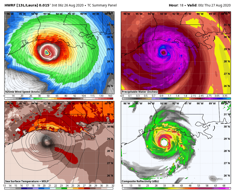
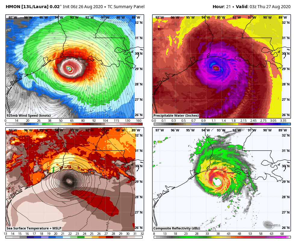
The Hi Resolution Hurricane Models continue to show a nasty setup for Kentucky…
HWRF
HMON
What does Laura mean for Kentucky? Here’s a preview of the threats:
- A general 1″-4″ of rain for many with the potential for locally higher amounts.
- Winds may be a big player and gust to greater than 40mph at times.
- The potential is also there for strong to severe thunderstorms along and ahead of the center of circulation.
- If thunderstorms do get into the mix, wind gusts may become a pretty big issue.
I will have another update on all this later today here on KWC, so check back. I’ll also be tracking this situation on WKYT-TV starting at 4pm.
As far as today’s weather is concerned, showers and thunderstorms are going up across parts of the west and south, especially. Some of these storms may put down enough rain to cause local high water issues. A greater chance for this happening takes place Thursday over a broader area.
Here’s your regional radar to track today’s storm action…

Have a good one and take care.
