Good evening, folks. All eyes continue to be on powerful Hurricane Laura that’s ready to slam ashore as the strongest hurricane on record to hit southwestern Louisiana. This thing has developed into a monster and will take lives and will devastate areas well inland. The storm will then weaken the deeper inland it gets, but still looks to have a big impact on our weather Friday and Saturday.
This will be a borderline Cat 5 upon landfall tonight. Here’s the latest info and track from the National Hurricane Center…

The message from the NHC is terrifying…

Use our exclusive interactive radar to go right into the path of the storm, using all the functions on the left side of the radar. Make sure to have the storm chasers clicked on so you can watch live video from those in the path of Laura…
Folks, that radar really is pretty awesome, so make sure you are getting the most out of its capabilities.
For Kentucky’s weather, I have no changes to my thought process…
- A general 1″-4″ of rain for many with the potential for locally higher amounts.
- Winds may be a big player and gust to greater than 40mph at times.
- The potential is also there for strong to severe thunderstorms along and ahead of the center of circulation.
- If thunderstorms do get into the mix, wind gusts may become a pretty big issue. A few tornadoes may also spin up.
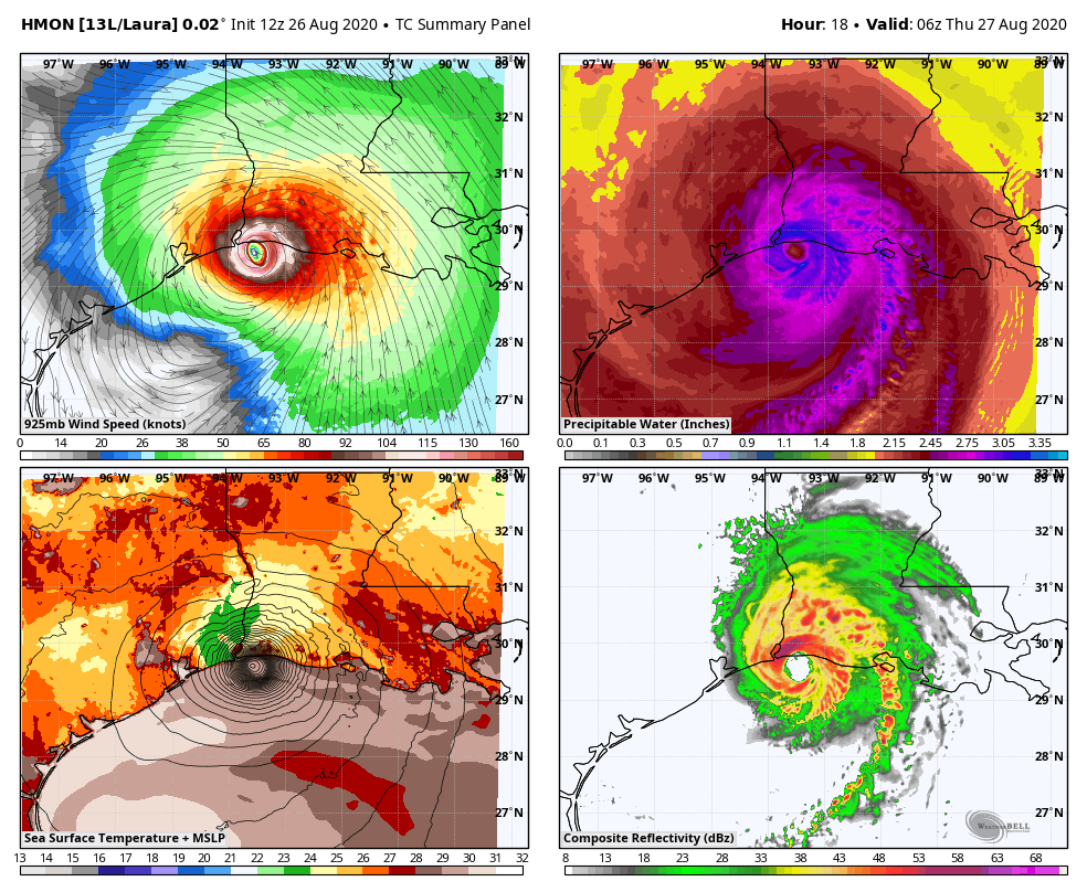
The latest suite of Hurricane Models are consistent in bringing Laura across Kentucky…

There is little change in the Hi Resolution Hurricane Models…
HWRF

HMON
I’ve got the latest on WKYT-TV tonight at 11 and on a WKYT Facebook Live around 9pm. Enjoy the evening and take care.
