Good Thursday, everyone. Hurricane Laura came ashore on the southwest coast of Louisiana as a powerful Category 4 hurricane. The devastation is going to be staggering with a storm surge expected to reach 40 miles inland. As this storm continues to work northward today, it will continue to weaken. By Friday and Saturday, what’s left of it looks to roll right on top of the bluegrass state.
First things first, let’s get the latest from the National Hurricane Center…

My overall thinking of the potential impact from this remains pretty much the same as last night…
- A general 1″-4″ of rain for many with the potential for locally higher amounts.
- Non-thunderstorm winds may be a big player and gust to greater than 40mph at times.
- The potential is also there for strong to severe thunderstorms along and ahead of the center of circulation.
- If thunderstorms do get into the mix, wind gusts may become a major issue.
- A few tornadoes may also spin up.
Speaking of severe weather, here’s the latest Friday Severe Weather Outlook from the Storm Prediction Center…

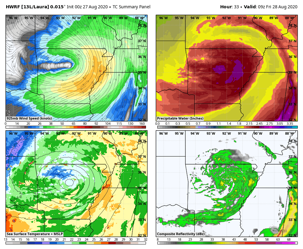
The Hi Res Hurricane Models continue to show a pretty good hit for the bluegrass state…
HWRF
HMON

Friday afternoon and evening may be especially ugly around here, so please stay up to date on how this storm plays out.
After Laura goes through here, we get a cold front to push through by Saturday night, leaving us with a nice Sunday. That doesn’t last long as another big thunderstorm and rain maker appears likely early next week with another system later in the week…
GFS

CANADIAN

Before I go, let’s talk a bit about today’s storms. With tropical moisture in place, a few storms may cause local flash flooding issues to develop. Here are your radars…

I will have additional updates later today, so check back. Have a good one and take care.

Been watching the storm half the night! All I can say is wow!! Decided to hop over back to fb to find people stating 2020 hurricane coming through Kentucky and I’ve honestly haven’t had a good laugh till I seen that acting like we have never had a tropical depression coming up through the gulf before
Have a wonderful day my weather bloggers : )