Good afternoon, everyone. It’s been a pleasant day for many, but showers and storms are kicking back up across the west. This action rolls eastward into Monday as this pattern continues to be in a very active mood to end August and begin September. With much cooler shots of air showing up in the next few weeks, we’re likely to see frequent bouts of rain and storms.
Let’s kick things off with what to expect tonight and Monday. The storms developing can put down a lot of rain in a short amount of time and that’s something we’ve already covered here on KWC. The Weather Prediction Center has a Marginal to Slight risk for flash flooding across much of the state tonight and early Monday. Here’s a look…

This doesn’t mean everyone sees enough rain to cause any issues and some may not see much at all, especially in the north. Here are your Sunday evening storm trackers…

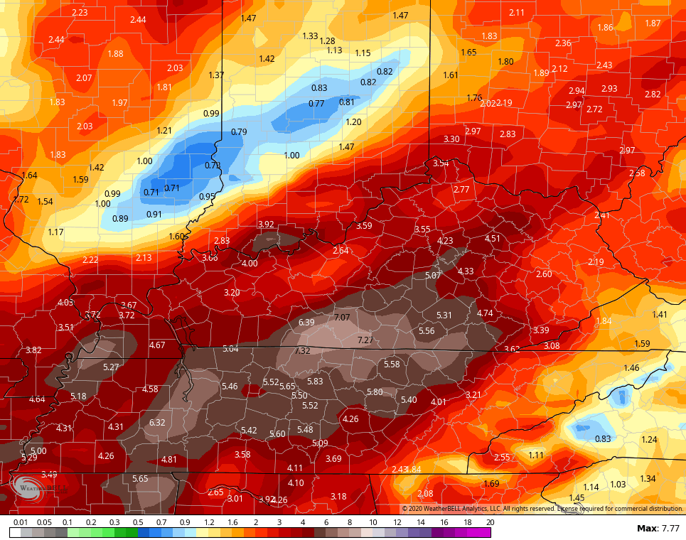
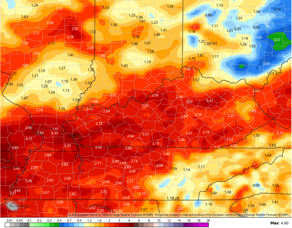
Additional rounds of thunderstorms will flare up as the week wears on as temps warm. We do have a cold front dropping in here by Thursday and that brings refreshing air behind it to start the weekend. A much bigger dip in the jet stream then takes place early the following week and the trend is for a slower evolution of this, leading to more rounds of storms. If we take a look at the rainfall forecasts from the models through day 10, one can clearly see the active pattern…
CANADIAN
EURO
Here’s the refreshing air by the start of the weekend…

Here’s a look at the stormy setup preceding the late fall type of a trough diving into the country early the following week…

That will unleash a well below normal temperature pattern for much of the country, including our region. We will touch more on that in the coming days.
Enjoy the rest of your weekend and take care.

Temperature forecast looks great.
My photo somehow has disappeared. How can it be restored?
I hope it brings a frost. It’s been a long time since I’ve seen frost in September.
Maybe this will be a pot of chili alert lol think I’ll go buy the ingredients just in case
That is exactly what I was thinking lol
Looks like we need to get ready for a pot of chili alert! Very much looking forward to that!
Very thankful that frosty weather is on the way!
Hopefully we will have brisk weather for the fall
And a very snowy winter.
God bless you all and have a great day!