Good afternoon, everyone. Rounds of heavy rain producing showers and storms are slowing down across the region, but more storms are on the way. It’s shaping up to be a stormy start to the month of September as deep fall troughs dig into the region. This means above normal rainfall and temps that go well below normal.
Let’s start with the rainfall since Sunday. I said some 2″+ amounts would show up and they did…
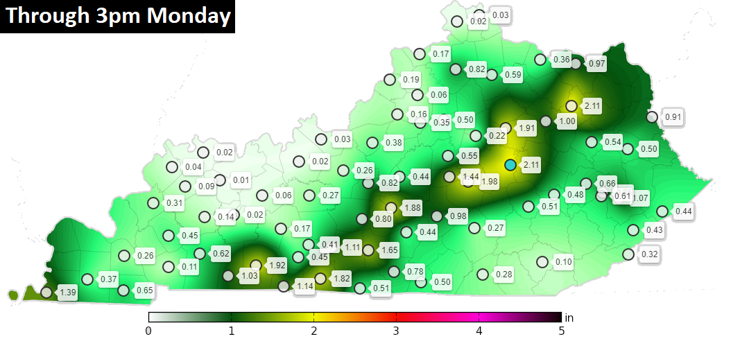
That was just a touch farther north than I thought in the east. High water issues were noted in a few spots. We’ve picked up a lot of rain since Friday with some areas of 4″ or a little more.
Scattered storms can still put down very heavy rains into the evening. Here are your tracking tools to follow along…

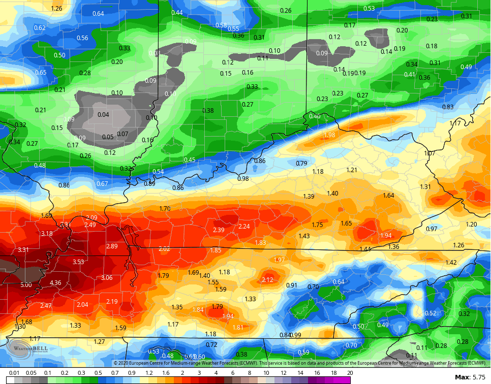
Rounds of showers and storms kick back in from Tuesday through Friday as we wait on a slow-moving cold front to arrive. Once again, locally heavy rains will be noted and more high water issues can’t be ruled out. Here’s the EURO rainfall forecast through Friday…
This is ahead of our first big push of cooler than normal air to start Labor Day/Kentucky Derby Weekend…
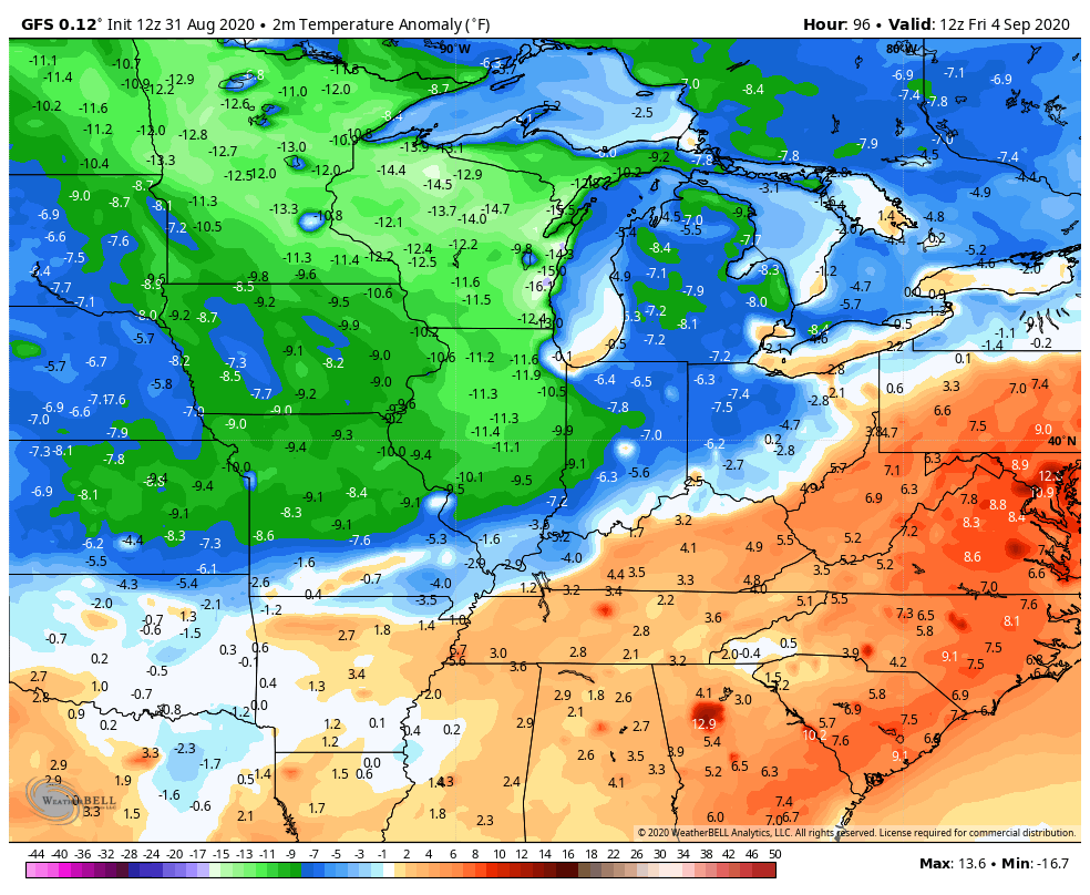
The much deeper system coming in early next week is likely to come at us in two waves. The first arrives on Monday with the second part later Wednesday. The models are still trying to figure out exactly how this evolves and that’s to be expected with such a highly anomalous air mass coming in…
GFS

EURO

CANADIAN

That’s one heck of a blast of fall air invading the country and our region!
Enjoy the rest of the day and take care.

Thanks Chris, I had a little over 0.80 in my back yard early this morning.
Hope the models are correct with those deep troughs. I just wish that the cold fronts would not “hang up” in the Ohio Valley region.
Enough rain already.
Cold nights and cool Sunny days is the best Autumn weather.
.
I’m all for this weather! But with sunny sky’s and coolness 😀
Still shaking my head at the concept of the 540 line reaching this far south, in early September!
The year 2020 just won’t quit…