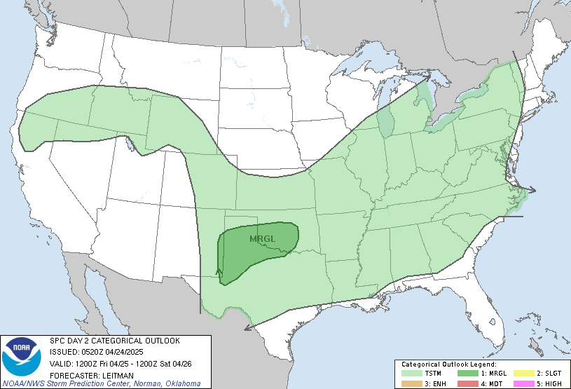
Good Saturday everyone and welcome to the weekend. Things are starting off on a very warm and windy note across the bluegrass state as a powerhouse storm cranks well to our west. The setup will eventually lead to the threat for strong and severe storms around here before the weekend is over.
Our weather out there today looks pretty darn good. Winds will gust up as warm air fights in from the southwest. High temps today will head toward the low and middle 70s for much of the state. I’m going to watch for the possibility of a stray shower or two going up across the west and north today. That’s often the case with a quick warm up like we are seeing. Just something to keep an eye on.
Something else to watch out for will be the increasing threat for showers and thunderstorms on Sunday. Low pressure is working from the plains into the Great Lakes and will drag a cold front through the state and this may set the stage for some booming thunderstorms. Here’s the latest threat map from the Storm Prediction Center for Sunday…

The prime severe weather time would be during the late afternoon and early evening hours.
Chilly air moves back in for Monday as early morning showers move away. Readings may struggle to get out of the upper 50s.
Nice weather moves back in for Tuesday and Wednesday with temps returning to the 60s. Another big storm is likely to fire up by the end of the week and this may lead to some wicked weather from Thursday through next Saturday. Check out the big cut off upper level low the European Model is forecasting…
Wind, rain and storms may give way to cold and wet weather before all is said and done with an outside shot at something extreme. Combine that with what’s going on in the tropics…

and you have some wild looking weather maps over the next week.
Make it a great Saturday and take care.
How about some extremely large wet snowflakes to go with the extreme weather that should put the comment section in overdrive for this time of the year! LOL
wish we had a “LIKE” button on here! LOL
Interesting pics (click here) at the NWS Wilmington OH radar site during dual-pol upgrade back in August.
Pics/video of the dual-pol upgrade at NWS Greenville-Spartanburg SC
http://www.facebook.com/US.NationalWeatherService.GSP.gov
Both links give an idea of the amount of new hardware and software technicians have to install. Some original components are replaced altogether, like the feeder horn.
These scenes will be common in a few days at the NWS Louisville radar.
http://www.crh.noaa.gov/dualpol/index.php?wfo=lmk
…and later at NWS radars at Jackson KY, Paducah, Ft Campbell and Evansville.