Good afternoon, everyone. Our cold front continues to push through as cooler and drier air takes control, giving us a fall feel to kick off the holiday/Derby weekend. As we look into next week, our highly anomalous system in the middle part of the country still looks like a super slow-mover and that delays the impact it will have on our weather.
We know where the weather is going for the big weekend and my thoughts on next week haven’t changed since my last update.
First off, let’s welcome the European Model back to reality. The model has spent the past several days taking this upper low to the west coast. That has finally changed…

That’s more in line of what every other model known to man has been showing for a few days now…

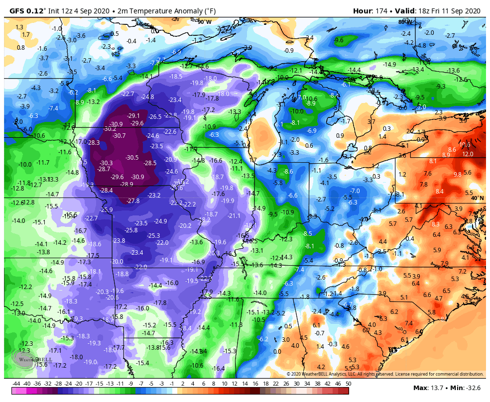
That allows for temps to warm well into the 80s until that arrives late in the week into next weekend. Once it does get closer, showers and storms will then kick in…

You can also how the temps tumble behind that front…
One thing to continue to watch is the tropics. We are closing in on the peak of the Atlantic hurricane season and we have lots of potential showing up…

Obviously, the tropics can make all the difference in the world with the setup across the United States, so let’s see what happens there in the coming days.
Enjoy the rest of your day and take care.

Thanks Chris, current temperature in my backyard is 77 degrees with a dew point of 55 degrees. Big change from this morning. Tomorrow will be prefect for outdoor work.
Glad that all models are agreeing on next weeks big weather event, and that the European model is back on your blog.
I just wish we would get in on a “real deal” cold front late next week so we can turn off the air conditioners.
An active tropical Atlantic and Gulf in my opinion is delaying Autumn weather, but maybe that is just a normal weather cycle or not.
Outside at 11 soaking it up! Feels amazing outside!