
Good Wednesday, everyone. It’s something many folks look forward to each year and it’s arriving a little earlier than normal… A Pot of Chili Watch is out for the weekend. A major blast of fall air is on the way from Friday through Sunday and this is likely to hang tough through much of next week. Fall looks to be locking in early this year! Told ya this was going to be the polar opposite of last September.
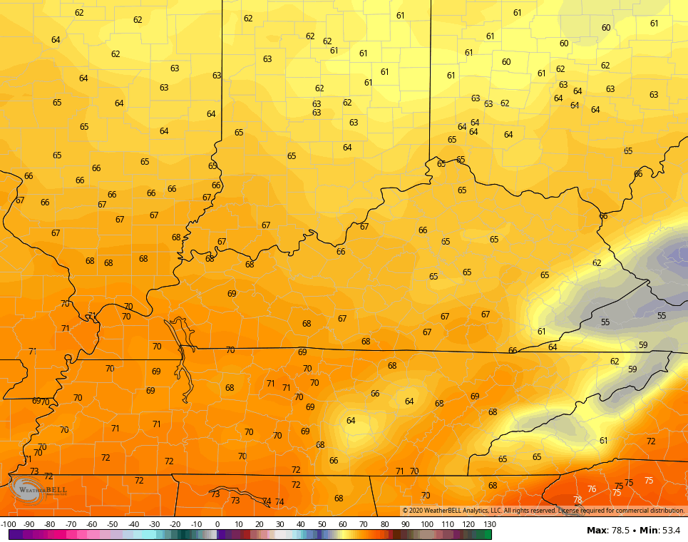
Let’s begin with how our Wednesday is shaping up. Smoky skies will once again be noted and that may have another impact on temps, keeping them under what the models think. Still, a few low 80s may show up. There’s also a small chance for a shower or storm, but most stay dry.

Our fall cold front arrives Thursday, keeping Sally well to our south and southeast. This front may only produce a scattered shower or thunderstorm. Winds will be gusty and could reach 30mph at times into Friday. This wind ushers in a true blast of fall temps from Friday through the weekend and into next week.
Highs on Friday and Saturday may not get out of the 60s for much of the region…
NAM
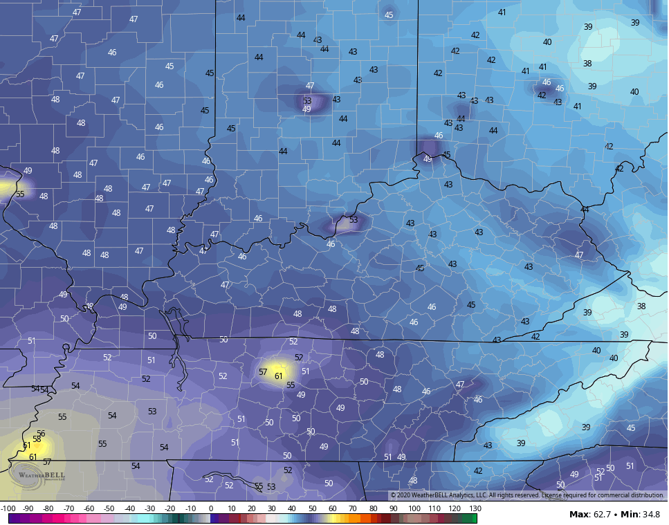
Low temps can drop way down into the low and middle 40s on numerous occasions. The NAM has even shows upper 30s trying to sneak in on Saturday morning…
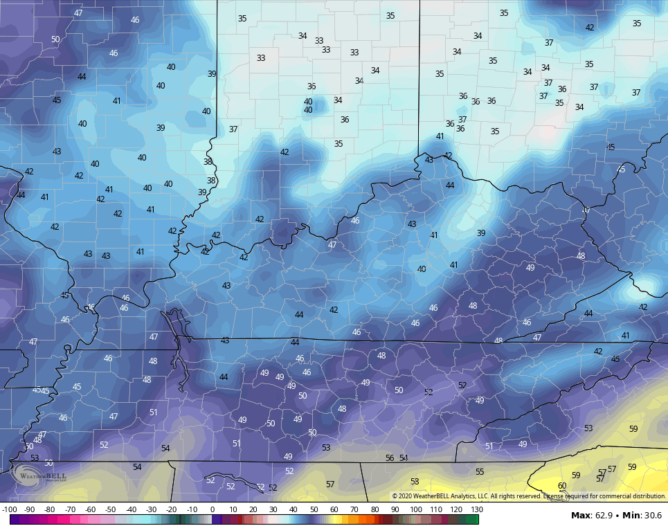
The GFS isn’t too far behind…
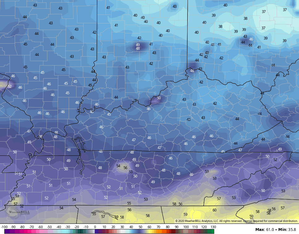
With a bit of wind still blowing, both models actually spits out a wind chill…
NAM

GFS

What the what? Am I really showing wind chill maps in the middle of September???!!! I am. Because… 2020.
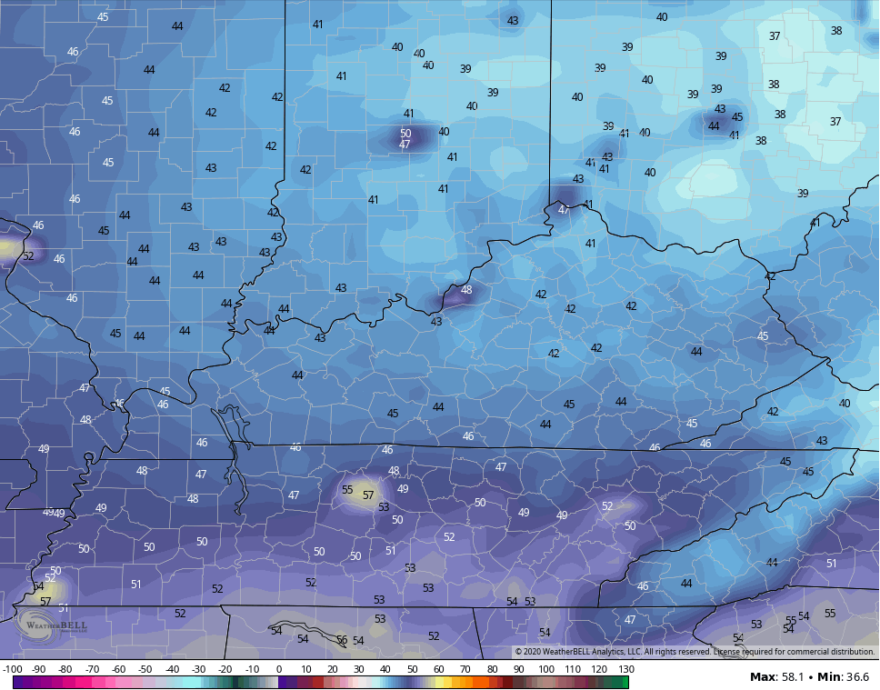
The chill of an early fall continues into early next week…
SUNDAY MORNING
MONDAY MORNING
Lows will likely stay in the 40s through the middle of next week.
Another update comes your day later today. Until then, here are your Hurricane Sally tracking tools:

![[Key Messages]](https://www.nhc.noaa.gov/storm_graphics/AT19/refresh/AL192020_key_messages+png/215807_key_messages_sm.png)
Have a great day and take care.

Happy birthday Chris!
Thanks Chris and Happy birthday. This has been an interesting year to say the least.
I don’t remember ever seeing the West burn up and the high altitude smoke over the Ohio Valley like it has been the last few days.
The air in Portland, Oregon is considered “unhealthy” Wow ! That city was known for it’s clean air a few years back and as the number one city in the US.
We are really into Fall like weather and I figure a frost might not be far off.
Hurricane Sally is currently “bashing” Alabama and the Florida panhandle. Was a Cat. 2 with 100 mph wind and now a Cat. 1 as it crawls northward. The next Hurricane to watch is Teddy which is forecast to become a major hurricane.