Good afternoon, folks. Light rain is already working across parts of western and southern Kentucky and will increase later tonight into Thursday. That’s when a plume of heavy rain should target areas of southern and southeastern Kentucky. In the longer range, things are still on pace for a major fall storm early next week. This will bring a frost and light freeze threat behind it.
Let’s get this weather party started with a look at the current setup. Lots of clouds are out there and keeping temps on the pleasant side once again. In case no one has been noticing, actual temps are putting a whoopin’ on the model forecast temps that continue to run too warm.
Showers continue across the southern parts of the state…

Heavy rain will then target areas of southern and southeastern Kentucky through Thursday night. This could be enough rain to cause some local high water issues to develop. The NAM continues to be on the high end of the model output…
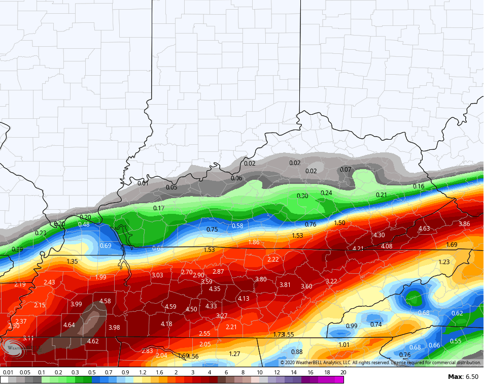
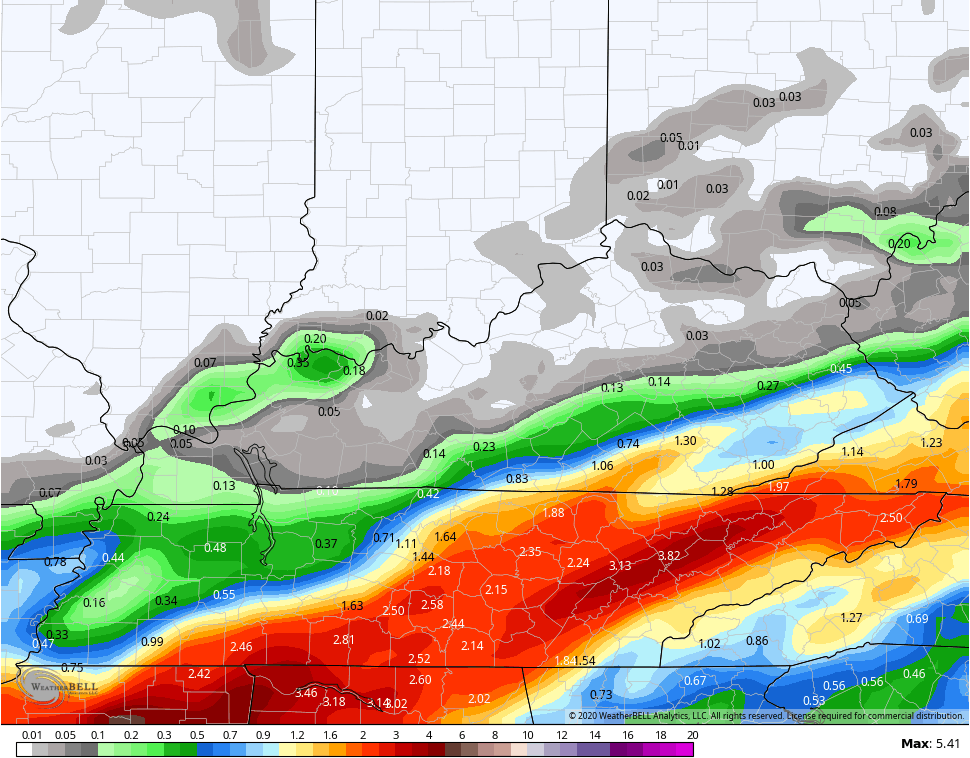
The GFS continues to come farther north and increase rain totals…
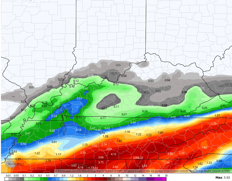
The EURO traded place with the GFS and went a little south…
Highs on Thursday won’t get out of the 60s for many and may stay in the low 60s in the south and southeast. Leftover showers linger into early Friday in the east. Low clouds then remain for much of the rest of the region with temps likely coming in on the under from model guidance.
Saturday is mainly dry and windy as temps do actually spike. Low 80s will show up in several spots.
Our next front approaches from the northwest on Sunday and will bring the potential for a few showers and storms with it. That will knock then numbers right back down into Monday as we watch a true fall storm system the dive in from the northwest. Once gain, this looks to bring rounds of showers and should be a big wind maker as cold air dives in here, setting the stage for a late week frost threat…

That’s a windy and very cold look. Winds may gust in excess of 40mph as the colder air surges in here…
EURO

GFS
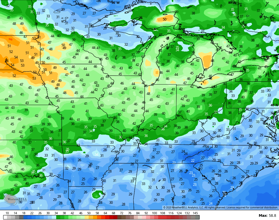
Highs in the 50s look like a good bet for several days and lows that may take us into frost and light freezing levels as temps are WAY below normal for an extended period…

Of course, that’s what happens when you get a mega trough like this…

Overall, this looks like a cold pattern into the first half of October. The GFS Ensembles show this well…

Enjoy the rest of your day and take care.
