Good afternoon, folks. We continue to see rain increasing across parts of the region and this may bring a little too much rain across areas of southern and southeastern Kentucky. This is some leftover moisture from Beta getting drawn northward into our region into the first half of Friday. From there, it’s all eyes on a massive change coming early next week. A change that essentially looks more like November than late September.
You know the drill about today’s rain. The farther north, the lower the chance of seeing anything. The farther south and southeast, you’re likely to see rain. The WPC has southeastern Kentucky in the low-end risk for Flash Flooding through tonight…

That matches up well with the map I made last night…

Here are your radars to follow the rain…

Leftover clouds will hang around for Friday as showers slowly end across the southeast. That sets the stage for a pretty nice weather weekend for the region as our temps spike from where we’ve been and compared to where we’re going. The pattern for next week continues to look very active with a HUGE dip in the jet stream taking up residence across the eastern half of the country. This will be ushered in by several systems diving into the trough from the northwest, with the first arriving Monday and Tuesday. That has our best chance for widespread rain and gusty winds…
CANADIAN

GFS

Chilly temps turn cold for this time of year as the week wears on and that continues through next weekend…
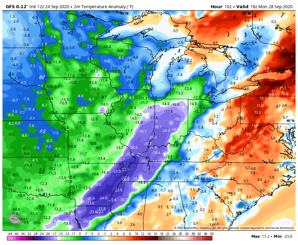
Much below normal temps will give us a few days of highs in the 50s and, on any clear night, the potential for an early season frost or light freeze. The best chance for the later to happen is by the end of next week into next weekend.
Enjoy the rest of your Thursday and take care.

The 540 line dropping THROUGH Kentucky into Tennessee, in September?? That is a real jaw dropper, and I can’t recall the last time that happened!
Could it be a portent of things to come…