Good Saturday everyone and welcome to the final weekend of September. For the most part, the weekend is looking pretty good across the entire region, but changes show up as early as Sunday evening. This is when we see start to see the first impact from a big time fall storm system set to roll in here Monday and Tuesday. This will be a good old fashioned rain and wind storm that ushers in chilly air for the final few days of the month and has even colder air behind it to start October.
Let me start this weekend party with what’s happening out there today. It’s nice. 🙂
Sunday will find and increase in clouds and the potential for a shower or thunderstorm trying to develop by the evening hours. Winds will begin to gust up from the southwest and those winds will continue to crank into Monday as we see an increase in showers and storms. This becomes fairly widespread from west to east as our storm system works in. This will be a strong fall cold front with a wave of low pressure along it…

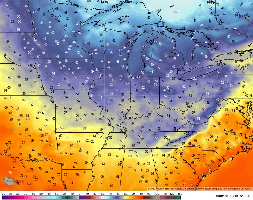
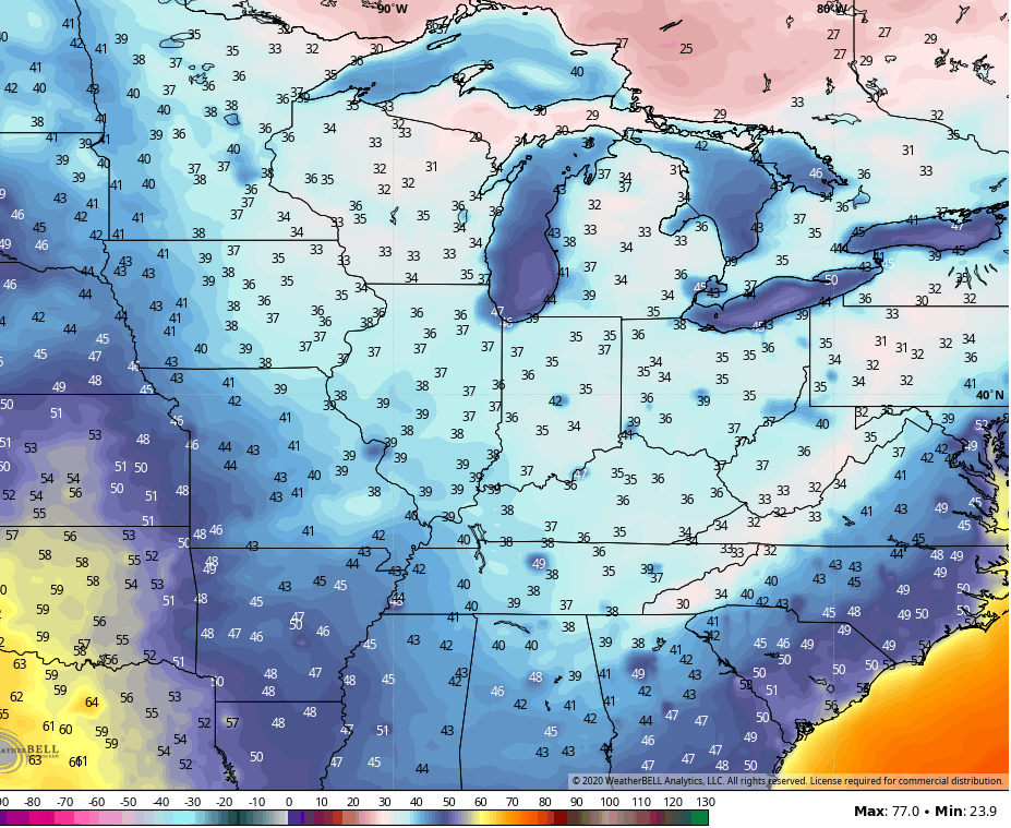
A big temp drop takes place behind the front as winds crank even higher from the west and northwest through Tuesday. Check out the drop as the front moves through…

That ushers in chilly air for the final few days of September, but the cold stuff waits to arrive once into the first few days of October as another front drops in. Highs behind this front should stay in the 50s for a few days…
Lows may drop deep into the 30s…
Another system is going to try to dig in here late next weekend or early the following week with a reinforcing blast of chill.
I will have another update later today, so check back. Until we meet again, enjoy the day and take care.

Thanks Chris, I like the Fall storms bringing us closer to Winter.
An October frost is more beautiful than a November hard freeze unless snow falls.
Thanks Chris even though I don’t live in Kentucky I enjoy reading your blog. Go team Autumn
Good to see your post sir. Are you still living in Pennsylvania ?