Good Sunday, everyone. We have a cold front crossing the state today and it’s bringing a scattering of showers with it. The air behind this may bring in another shot of frosty temps for Monday and Tuesday mornings as our colder than normal start to October rolls on. Changes are showing up later next week as the tropics flex a little fall muscle. Oh yeah… I’m also looking down the weather road to the rest of October and even showing maps that start with S. 🙂
Let’s kick it off with today and roll forward. This front won’t produce a lot of rain with it, but a few showers will disrupt some outdoor plans. Thankfully, your friendly radars are here for the tracking…

This will wrap some cold air in here behind it later tonight and Monday. Lows across areas of western and central Kentucky may drop deep into the 30s…

That could be enough to produce some frost as winds calm down. The rest of your Monday looks great with a mix of sun and clouds and temps in the 60s. This could set us up for another cold morning on Tuesday…

Temps behind all this will come up and may push into the 70s ahead of another system Wednesday. The real cold air with this is well off to our northeast, but it brings our temps back down for the rest of the week.
As mentioned, the tropics are pulsing up with Gamma and 3 other systems of interest…

The one heading into the Caribbean may be the one to watch as it tries to head into the Gulf of Mexico.
If we look ahead to the rest of October, we find the latest CFS showing a mid-month warmer spell. Here are the 10 day average anomalies from October 10-20…
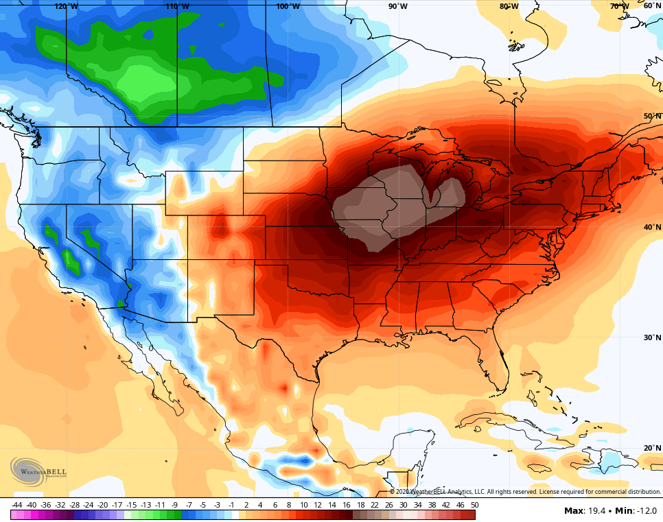
Watch how quickly the trend reverses for the final 10 days of the month…
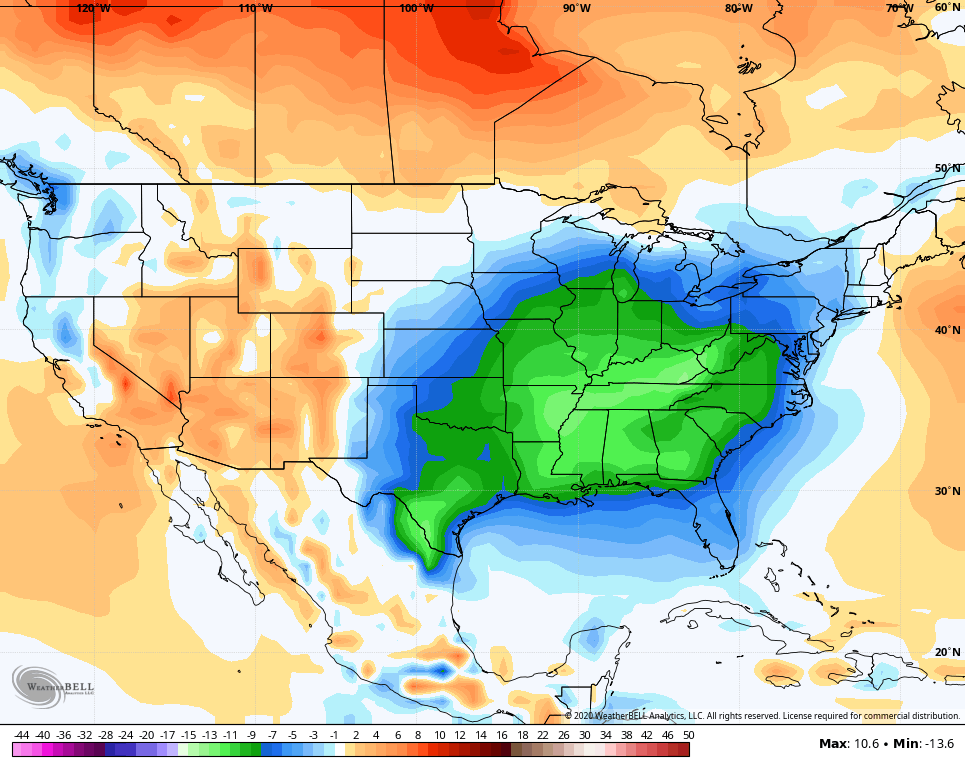
That’s an impressive switch the model is showing and it’s not alone in going cold for the end of the month into early November.
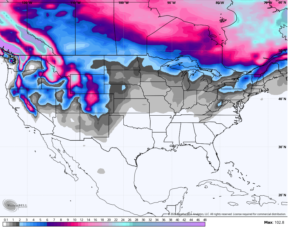
The GFS has a brand new weekly model out and it’s similar to the European weeklies I sometimes post. The GFS weeklies through the first week of November show a pattern capable of producing early season flakes…
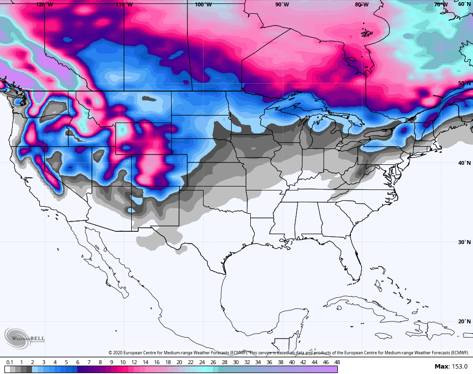
The European Weeklies don’t get as much love from me as they used to for various reasons, namely how the model just cannot see any kind of cold air anywhere. Even with its super warm bias, it is suggesting something similar through the same time period…
Given some of the analogs I’m looking at, this may be one of those front-loaded winters. I’ll be laying those years out in the coming days.
Another update comes your way later today, so check back. Until then, make it a good one and take care.

I’m ready for the SNOW talk lol