Good Thursday, everybody. Hurricane Delta is ramping up across the Gulf of Mexico and will make landfall in Louisiana on Friday. From there, what’s left of this storm will move right on top of the state this weekend. It’s going to bring a lot of rain and gusty winds to the bluegrass state.
Let’s start with a current view of Delta down in the Gulf of Mexico…

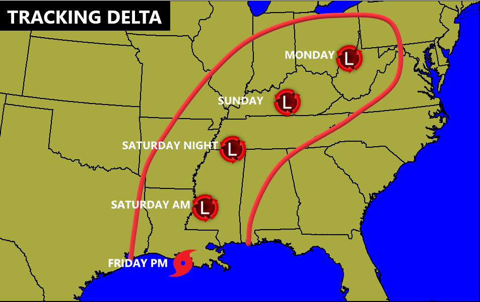
This system is primed to strengthen quickly today and will be back into major hurricane status after weakening over the Yucatan Peninsula. The latest track forecast from the National Hurricane Center continues to bring what’s left of Delta into Kentucky this weekend…

Here are the Key Messages from the NHC on this storm…

Again, this matches up well with the forecast map I’ve been posting for a few days and I don’t see much reason to make any wholesale changes at this point…
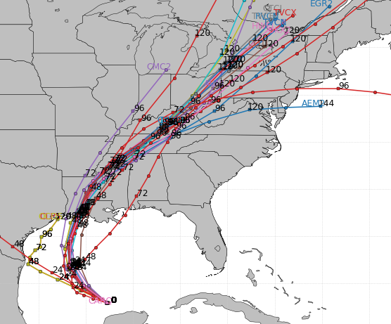
The latest from the Hurricane Models are pretty much lined up with this thought process…
Here’s an updated breakdown of how things may play out around here:
- A plume of tropical showers and thunderstorms will be well out ahead of Delta. This will arrive in Kentucky Friday night.
- Spiraling bands of tropical showers and some storms will be noted on Saturday, even as the center of circulation is still well to our southwest.
- The prime time for heavy rain and thunder comes Saturday night into Sunday. This is when we will be looking at, at least, a local flash flood threat.
- Rainfall totals with this system will generally be in the 1″-3″ range, but locally higher amounts will show up along and just west of the track of the low.
- The exact track of that low is still not set in stone, but the center of circulation looks to move into Kentucky on Sunday.
- Winds will be gusty, but I don’t see this as anything crazy high at the moment.
- There is a threat for a few strong storms along and east of the track of the low.
I will get you guys a rainfall forecast map in my next update later today.
Following all this up is a potent cold front moving in on Tuesday. This brings a line of gusty showers and storms with it and chilly air for the middle of the week.
I’ve also been talking about the look of the overall pattern later in October and early November. There’s some early season potential for a touch of winter weather to show up in this general region. Believe it or not, we’ve had October snowflakes show up in 4 of the past 8 years, so anyone dismissing even the notion of such a thing isn’t grounded in reality.
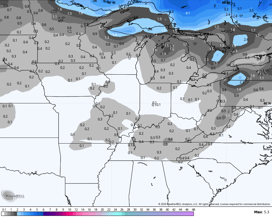
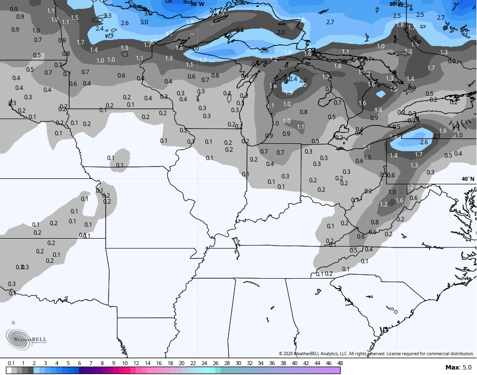
The Ensembles have been hinting at something in the second half of the month and the GFS has even been trying to catch something. Granted, this is out there in la la land for models, but it keeps picking up on something…

The last two runs of the GFS Ensembles for the next 2 weeks…
As always, we shall see. 🙂
I will have another update later today, so check back. Have a good one and take care.
