Good Wednesday, everyone. We are dealing with another absolutely fantastic fall day across Kentucky and this nice weather has several more days left in the tank. By the time we roll into early next week, big changes are coming to a weather sky near you. That’s when we see a western blast of winter slowly roll east and try to meet up with a tropical system.
Let’s talk about the weather from today through Sunday. It’s awesome. ‘Nuff said. 🙂
ETA continues to slowly weaken across Central America, but this system should emerge back over water in the next few days and should re-strengthen. Odds continue to favor this storm turning more toward the north and northeast toward Cuba by the weekend. Here’s the latest from the National Hurricane Center…

Here’s how that stacks up with the Hurricane Models…

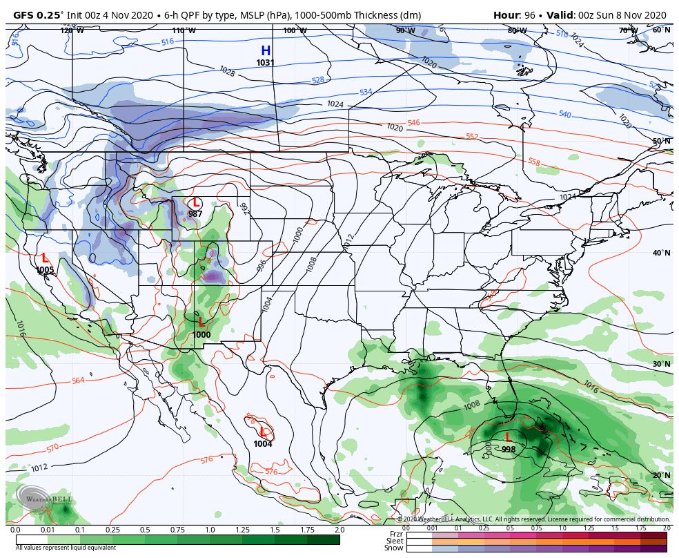
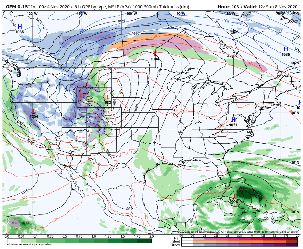
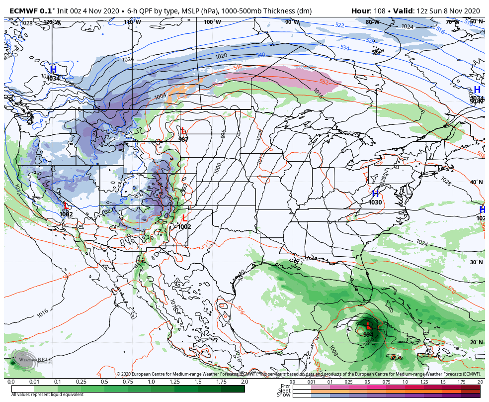
The operational models continue to feature the tale of two extremes. Not only do we have ETA, but we also have another winter trough digging into the western half of the country. That’s going to try to send systems east and one of them may pick up ETA or moisture from it. Which one does the trick remains to be seen and with so much extreme on the map, the models flip and flop on how the whole setup evolves.
The GFS brings a stout cold front in here early next week, but it leaves ETA spinning in the Gulf before the next front picks it up later in the week…
The Canadian offers a little different solution with a bigger push of the winter weather farther east…
The EURO has more of a Canadian look to it…
The whole setup with the first front sweeping in here could result in some strong storms. If the front can fully pick ETA up and bring it farther north, we would be looking at another big rain maker.
We will figure all that out in the next few days.
I will have another update later today. Have a good one and take care.
