Good afternoon, folks. It’s another beautiful day in the neighborhood as sunny skies and mild temps roll on. This mild air will continue right on through the upcoming weekend, but the pattern for next week continues to look much different. It’s round 2 of the epic battle between the tropics and winter.
Tropical Storm ETA continues to weaken over Central America, but this will emerge back over water late tomorrow or Friday. From there, this storm will then strengthen as it works toward Cuba and Florida this weekend. Here’s the latest from the National Hurricane Center…

You can see how that forecast is fairly in line with what the Hurricane Models are suggesting…

The GFS continues to show a Florida hit as it crosses west into the Gulf and hangs out for a few days. From there, it waits for the second front to pick it up…
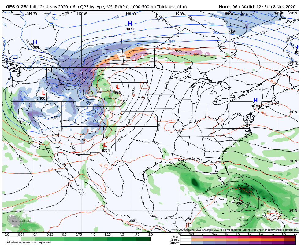
That scenario means a round of showers and storms for us with the first front early in the week as colder air crashes in. Those numbers drop even more after the second system works through here later in the week into next weekend.
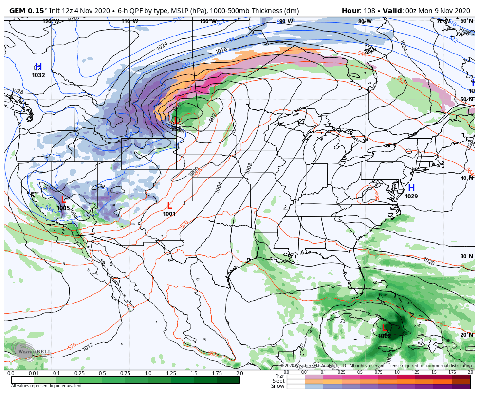
The Canadian has a little different look…
So does the EURO…
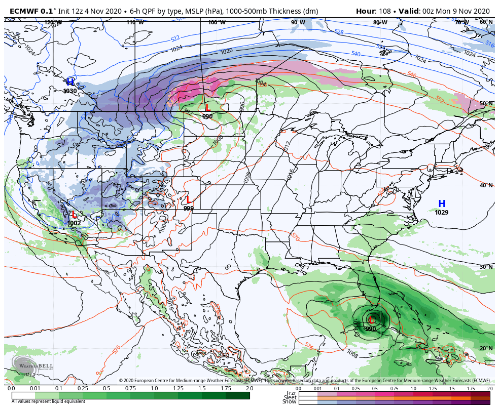
Again, such an extreme pattern means the models will change a lot over the next several days.
While the overall pattern looks much different next week, it doesn’t change my mind that November is likely skewed warmer than normal. That’s a big change from the past few years.
Enjoy the rest of the day and take care.

Weather history was made in the Chicago area on Wednesday afternoon, as the high of 74 degrees at O’Hare Airport tied the all-time record high temperature for this date set back in 1978. It got up to 75 degrees in the SW suburbs at the NWS Forecast Office in Romeoville.
This is the first time since 2016 that Chicago has seen a 70-degree day in November. Heck, last year we didn’t even have a 60-degree day during the month, let alone a 70-degree day.
More unseasonably warm weather is predicted through Monday, with a few more 70-degree days possible.
October averaged 1.0 degrees below normal for Chicago, which was the first month to average below normal since April.
The fall colors were absolutely spectacular here. Even though we’re past the peak for colors, I still noticed some colorful fall scenery on my power walk through the forest preserve this afternoon.
A cooler than normal October, followed by a warmer than normal November is a very encouraging sign that a “real” Winter is in the cards for Kentucky.
Once the tropics stops overperforming, that is.