Good Thursday, folks. Today’s weather is a little different from what we’ve seen from the past several days as clouds roll in. This is basically a one and down cloud-maker as more sunshine rolls in from Friday through the weekend. This will come with some very warm temps for early November. Next week looks like a different story as the pattern changes up in a big way.
Highs today are deep into the 60s but should be back to 70 or better by Friday through the weekend. Enjoy!
ETA continues to head back toward open waters and will then roll toward Cuba and south Florida by the weekend and early next week. Here’s the current outlook from the National Hurricane Center…

The overnight Hurricane Models show much more spread than earlier runs…

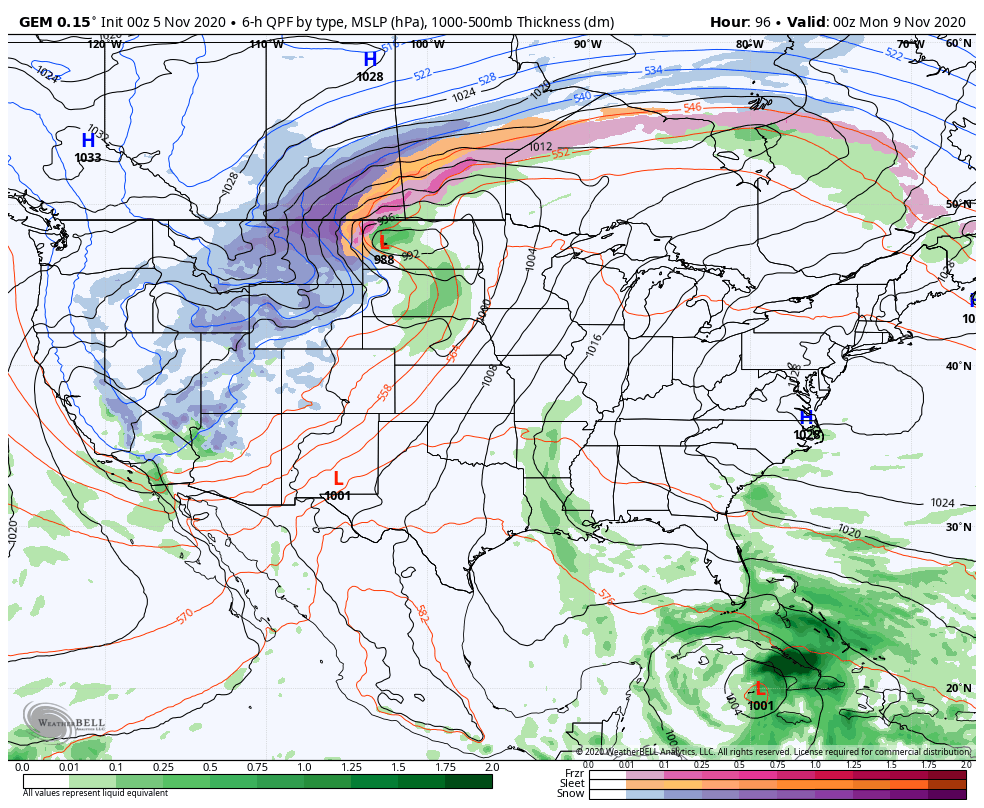
At the same time we are tracking ETA toward the southeastern part of the country, the western half of the country will be dealing with winter. A possible blizzard will slam parts of the Rockies in the coming days. Yep, it’s the tale of two extremes showing up.
How the winter setup meshes with the tropical setup remains to be seen. As I’ve said many times, the models will continue to struggle to figure out the details. We will get a nice cold front to cross our region by later Tuesday and Wednesday. That brings showers and storms in here as temps come way down. Does this trough pick up ETA from the Gulf? Does the next trough do it later in the week? Those questions don’t have answers at the moment.
The GFS waits for the second system…
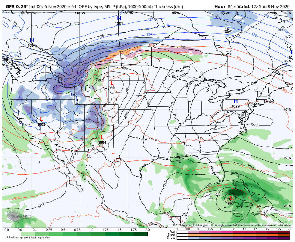
The CANADIAN has the first front push ETA back to the east across Florida with much colder air coming into our region…
Alrighty, that’s all I have for you guys right now. I will have another update later today and talk more about the upcoming winter in the days to come.
Have a good one and take care.

This is really perfect November weather, but it does not mean that the upcoming Winter is going to be snowy here in central Kentucky.
Back in 1966-67 we had a warm uneventful November in south central Indiana and was followed by a windy, balmy December and mild January. Arctic air finally flooded the area in February with one eight inch snowstorm on Groundhog’s Day.
I remember some buddies and I went camping on April first, 1967 when the high temperature was eighty degrees. We went fishing the next morning and caught many good size B*a*s*s. Great times in my life.
This upcoming Winter is one big question Mark and any predictions will be an educated guess.
With La Nina in control I would not expect much snow, but that is just my opinion.
In contrast to my post above, November 1976 was one of the coldest and driest in Evansville, Indiana.
The tropics were not that active because of a weak El Nino that develop in early August.
Cold fronts coming out of northwest Canada push south/southeast into central Florida.
The west coast was under a very strong high pressure ridge that lasted well into March 1977.
I don’t have to explain what happened in the Winter’s of 1976-77 and 1977-78.
The winter’s of 1976-77 and 1977-78 were before I was born, but I’ve read about it snowing in Miami (yes, in Florida) of all places as well as the northern areas of the Bahamas including Freeport. Even Johnny Carson could not resist joking about Miami’s snow in his monologue.
IIRC, since 1977-78 Nashville TN and Dallas TX have not had winters with more snow since (although Nashville has had some snowier winters before 1977).