Good evening, folks. Some clouds are rolling across the region and that’s the most exciting weather thing of the entire week around here. Remember, when I’m bored it means the weather is awfully nice for you guys. 🙂 Once into next week, we continue to see a much more active setup take hold. It’s one featuring a wetter and cooler look around here as winter and the tropics go back at it.
Highs from Friday through Monday will likely be in the 70s, so enjoy it. As I’ve mentioned, this is a far cry from the past two Novembers that led us into nearly non-winters. For that matter, the entire late summer and fall have been totally different.
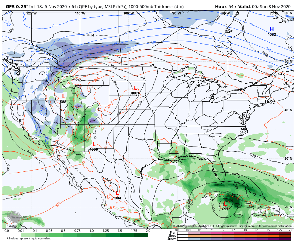
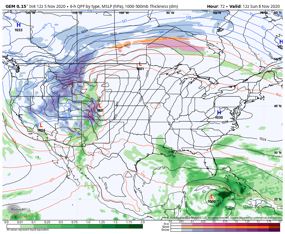
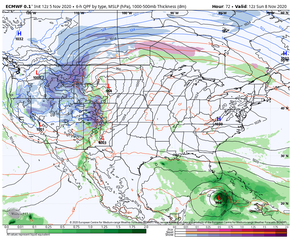
The winter verses tropics pattern is another heavyweight fight. A blizzard will develop in the Rockies in the coming days at the same time a Tropical Storm works toward Florida and into the Gulf of Mexico. ETA has one of the strongest late season hurricanes on record as it hit Central America a few days ago. This is emerging back over water and will fire back up as it heads toward Cuba and Florida this weekend.
Here’s the latest from the National Hurricane Center…

The Hurricane Models are now back into similar fashion with that track…

The models continue to waffle a bit on the evolution of ETA and whether or not it meets up with front number one or front number two later in the week.
GFS
CANADIAN
EURO
How that works itself out remains to be seen, but that’s a pretty active looking setup as we start to crank up the storm track near us. This storm track may be pretty common as we head into the winter months. Are we in for a lot of fence-riders? Me thinks so.
Enjoy the rest of your day and take care.
