Good Saturday, folks. It’s a flat out awesome first full weekend of November as temps flirt with record highs over the next couple of days. As all this is happening, the overall pattern across the country is going back toward the extreme as a tropical system hits Florida and a blizzard hits the northern Rockies.
Let’s kick this post off by talking about the warm temps. Highs are in the 70s through Monday and we will flirt with records at a few locations. Soak. It. Up.
Tropical Depression/Storm ETA is churning toward Cuba and will work into south Florida by late Sunday or early Monday. From there, this storm likely gets into the far eastern Gulf of Mexico and slows down. Here’s the latest from the National Hurricane Center…

The updated Hurricane Models…

The operational models continue to show up differently with how they handle ETA and the overall pattern. The EURO is much wetter for us with the first front moving in here for Tuesday and Wednesday, with a bigger system behind it finally picking up ETA…
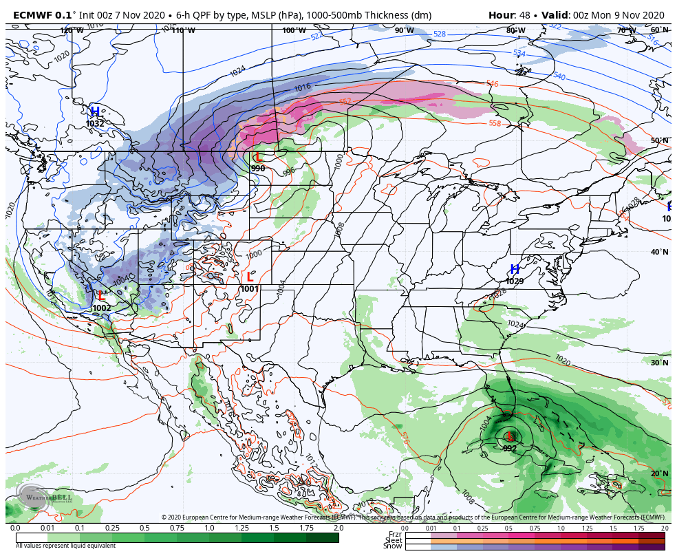
That’s a pretty wet look around here and that’s a nice shot of cold at the end of the run.
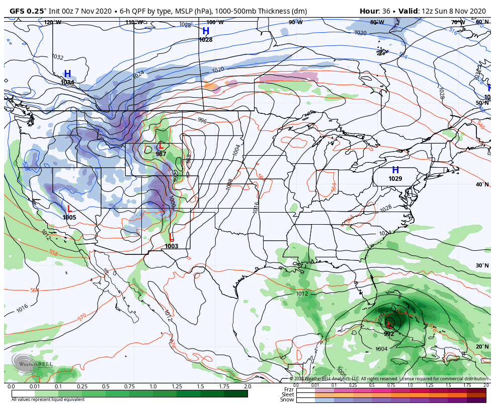
The GFS has a similar look initially before diverging with how it handles ETA and the system behind it…
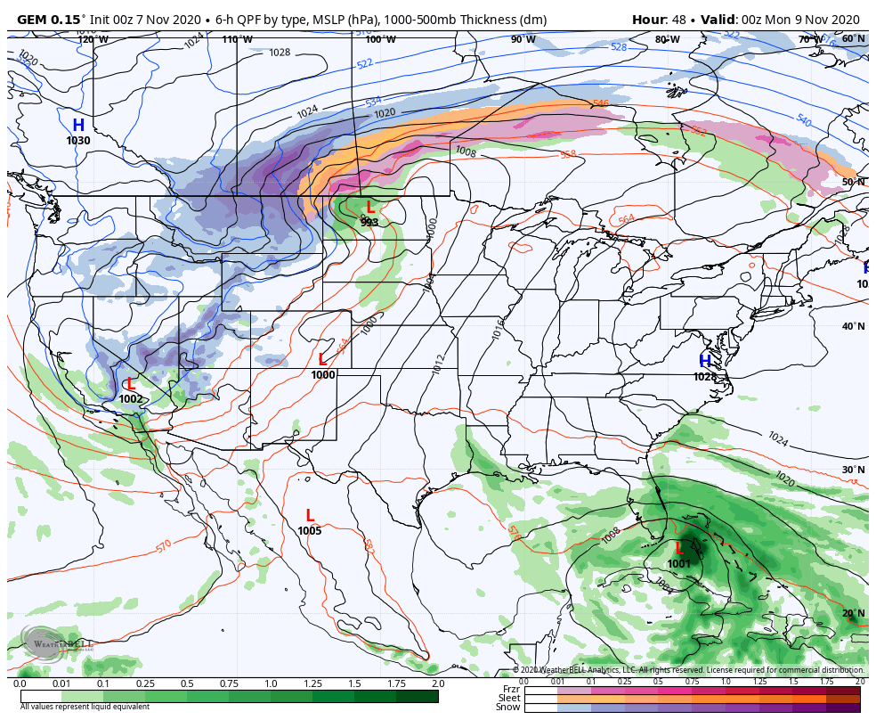
The Canadian Model has more of a EURO look to it…
Moral of the story is for us to enjoy this calm and quiet period because we are going to have a lot to talk about in the upcoming week and change.
I will throw you another update later today. Have a good one and take care.

The snowstorm/ blizzard in the northern Rockies is something to watch indeed as we bask in Indian Summer warmth here in the east.
The “southeast ridge” continues to block weather from moving into the Ohio Valley.
I don’t like to hear of record high temperatures just before Thanksgiving, but it has happened before. November 1966.
We will have to wait and see how this pattern plays out as we enter the month of December.
Calm and quiet we all need these days.