Good Wednesday, folks. The calm weather pattern we’re in for the next few days isn’t an indication of what’s coming for Thanksgiving week. It continues to look like a very busy pattern taking shape as several storm systems look to impact our weather. It’s also a pattern trending colder as we get closer to it and that’s something we’ve talked about for several days now. We will look that that and go farther down the weather road into December.
As always, we kick things off with what’s happening in the precious present. Highs today range from the mid and upper 40s for the eastern half of the state, to the mid and high 50s in the west. Everybody has a sunny sky.
Temps for Thursday and Friday continue to look really nice as highs reach the low 60s.
The setup goes from calm to super-active pretty quickly as we wrap up the weekend and kick off Thanksgiving week. It’s a setup you’re now seeing the models skewing colder on and I think we get three different systems to impact our weather. Can one of them bring a touch of winter to the region? That remains to be seen, but the models are getting closer.
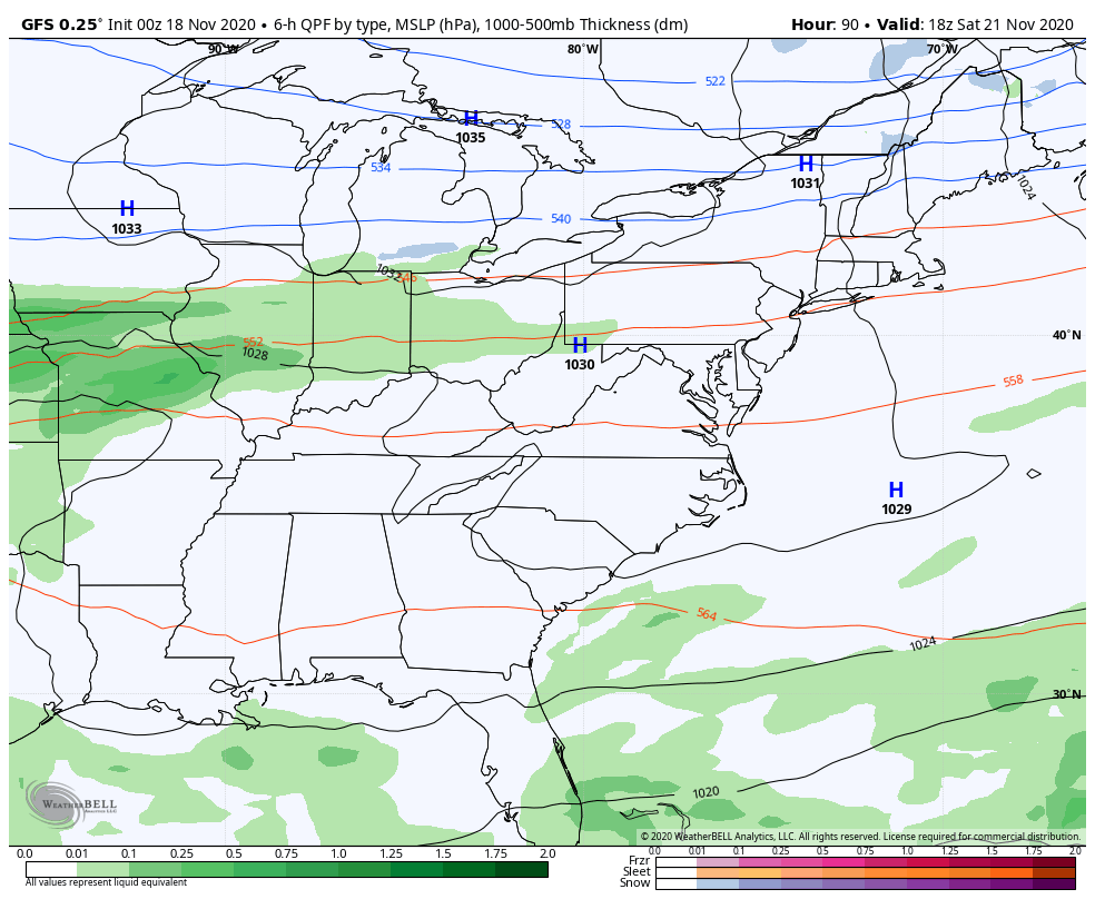
Before we focus on the main setup, we need to be on guard for a few sneaky showers getting in here Friday night and Saturday. That’s something to keep a close eye on. Our first two systems roll in here from Sunday night through Tuesday. The GFS has some cold rain and gets some flake action close…
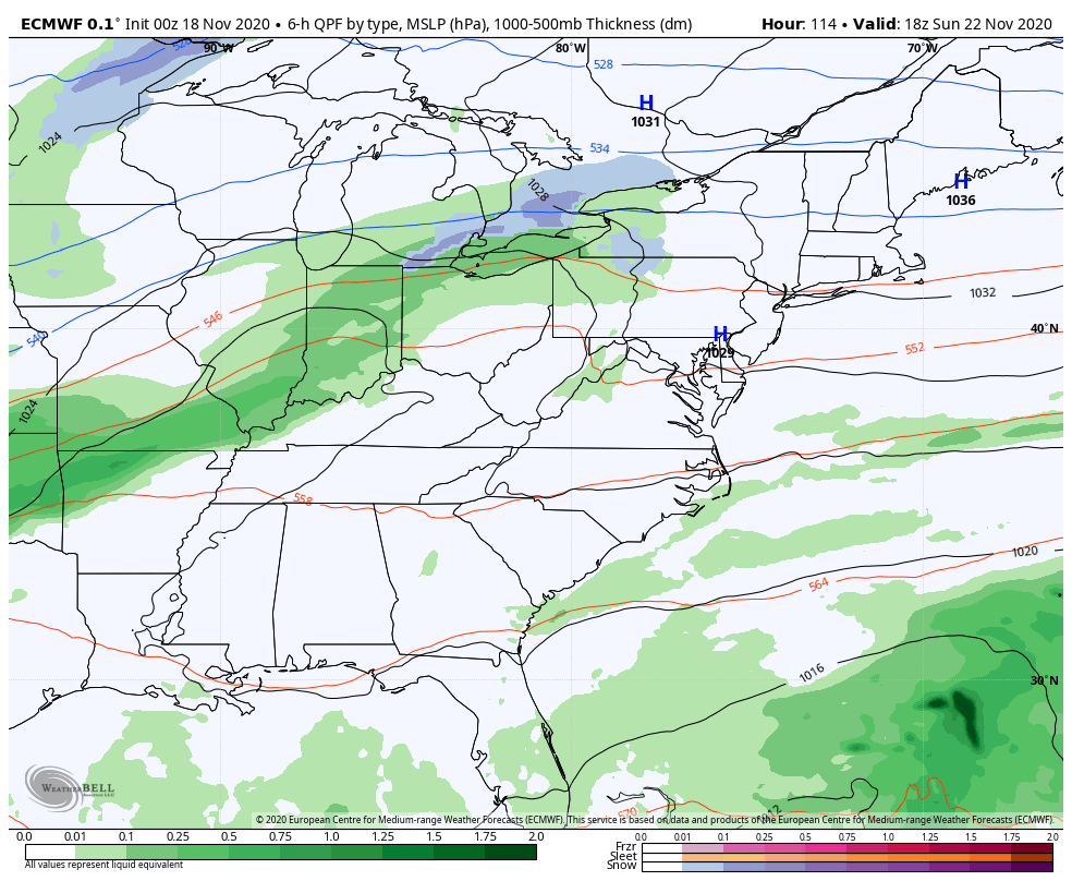
The EURO is slower and stronger with this second system and waits to bring it in on Wednesday…
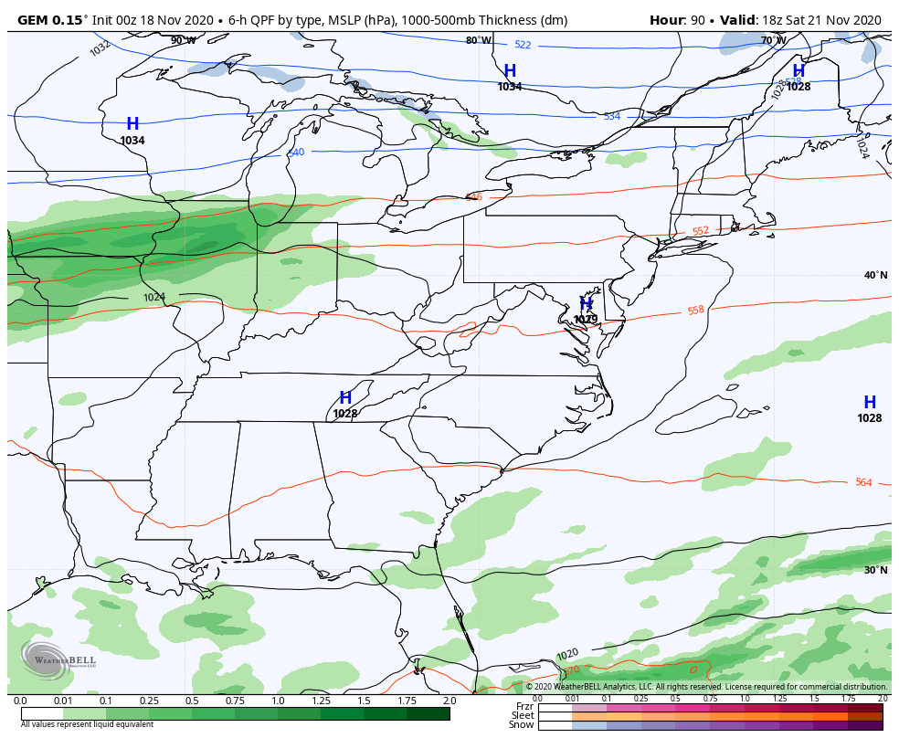
The Canadian is actually a little colder and flakier for some of the region…
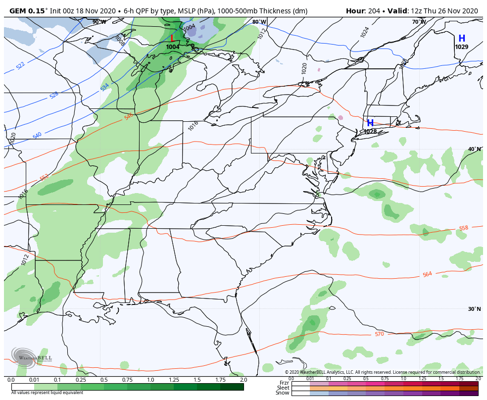
The Canadian is much colder with the late week system coming in Thanksgiving night into Black Friday…
Again, the models continue to vary greatly from run to run on how they handle each system, so there’s that to consider. 🙂
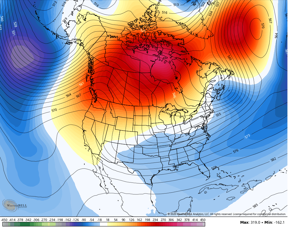
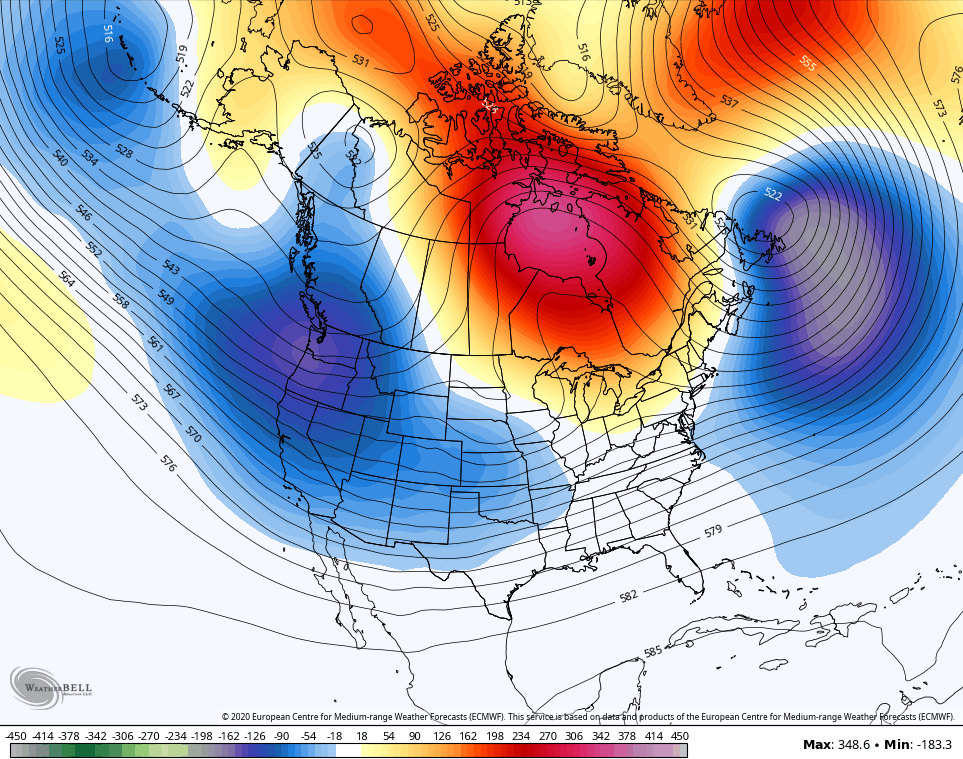
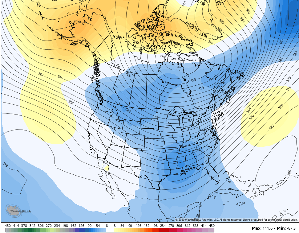
Let’s go ahead and look deeper into December for a little entertainment value and to see if we can find any trends on the seasonal models. The following maps are all 7 day averages at 500mb and illustrate where ridges and troughs show up on the models.
December 6-13 on the control run of the GFS Extended…
December 13-20 on the same run…
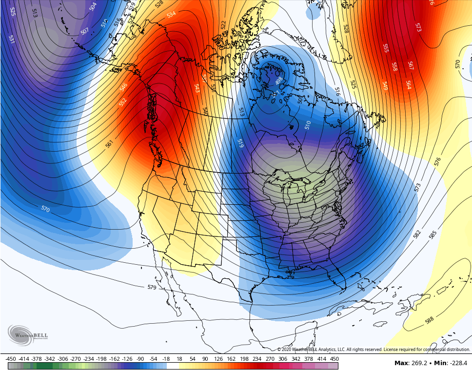
That would argue for some major cold in the east.
The Control run of the Euro Weeklies for December 13-21…
The same model run for Christmas week…
So we have agreement (for now) from the control runs of the GFS and EURO weeklies for mid and late December. What does the CFS think for the same time as above? Let’s check in…
Again, much of this is for entertainment purposes but I want to make a couple of points about the above maps and December…
- MOST of my analogs are cold in December. Even the analog years that had warmer overall winters had below normal numbers for December.
- A couple of the analogs had a blockbuster December.
- I know lots of folks are looking at the non control run of the EURO Weeklies and freaking out because it shows a scorching December. Guess what, folks? Every run of the EURO weeklies this year also showed well above normal temps. No joke… The Euro Weeklies cannot see any kind of cold anywhere in the country. They haven’t all year. One just can’t say “Oh it’s November, let me look at this model to see what’s ahead”. You need to watch all models all the time to understand their biases.
- Sure as I say all this, it will be the one time the EURO Weeklies are correct. 🙂 There was also one really warm December on my analog list, too. 🙁
I will have another update later today, so check back. Have a good one and take care.

As far as I am concerned we can continue the present weather pattern through the entire Winter with some good rains from time to time.
Looking forward to your long range Winter forecast tomorrow Chris.
I don’t know which warm December that would have been. But I remember well the Christmas of 77 or 78. We were opening gifts on Christmas Eve with the family in short sleeves, with the door open. It was pouring the rain.
Hope we don’t have another like that!
Have you a great day everyone!!!
Warmest December I can remember was in 1965. And the coldest was in 1989.