
Good Wednesday, everyone. Today is a busy weather day, but it’s also a day that’s a fun one here on KWC. As is tradition here on the blog… the Wednesday before Thanksgiving pays respect to a classic movie wrapped around this holiday… Planes, Trains and Automobiles. This is actually one of my favorite movies and that should give you some insight into the warped mind of your friendly weather dude.
We have a lot to talk about in terms of the weather, so this isn’t the typical PTA post. We have a windy and stormy day out there today and the potential for a major winter storm system to impact our region Sunday night through Tuesday.
A big time storm system is pushing through the Ohio Valley today, bringing gusty winds, heavy rain and thunderstorms with it. Winds today may reach 40mph or greater at times and there’s still a low-end risk for a few strong or severe storms for parts of the state. Here’s the current Severe Weather Outlook from the Storm Prediction Center…

Here are your rain and storm tracking tools…

Current watches

Possible Watch Areas

Clouds will linger into Thanksgiving and through Friday. There’s a small chance for a lingering shower both days, but a lot of dry should be the rule. Temps are pretty normal for this time of year.
Another weak front arrives late Friday and knocks the numbers down a bit by Saturday.
This brings us to the increasing threat for a major winter storm system Sunday night-Tuesday. The specifics of how this storm evolves won’t be known for a few days, but this has the potential to be a headline making winter storm for parts of the Ohio Valley, Great Lakes and Appalachian Mountains.
Let me start this out by reminding you I’m showing computer forecast models that change from run to run. Sometimes these changes are minor, sometimes they can be significant. We are discussing the possibility of a storm that’s still 4 days away from developing, so don’t get overly excited or dejected by any of the changes. The closer we get to this system, the clearer things will become. All I can tell you from this point is that the potential is there. If I grow more confident of this storm, then you will be the first to hear about it and I’ll start putting out specific forecasts on it. Until then, we are just discussing the potential.
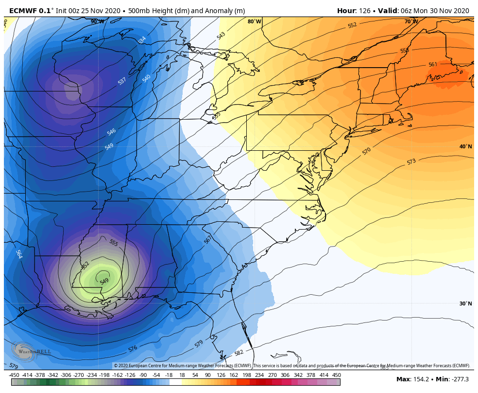
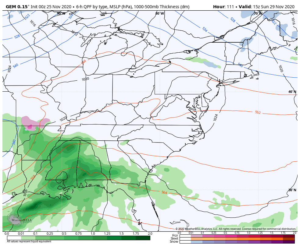
Recent model trends have been for a fully phased storm system that will wake the weather world up today. Some of the new model runs are eye-opening. The latest run of the European Model is crazy with the wind and snow…
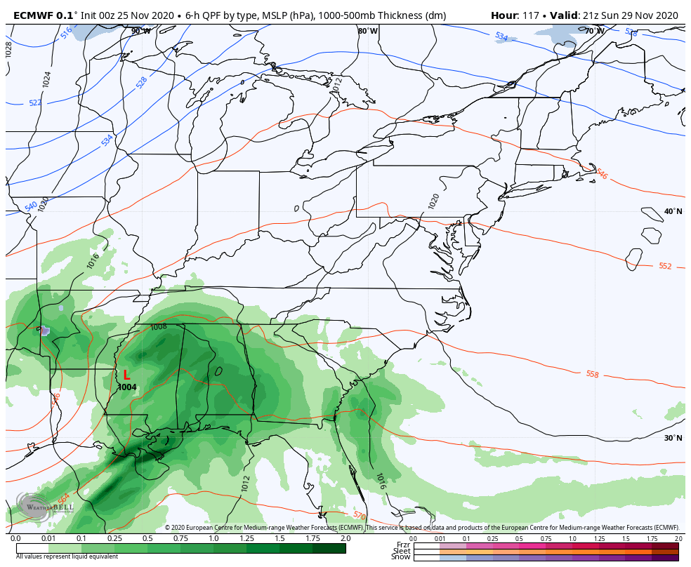
That’s what happens with a fully phased storm system, folks. Here’s what that looks like in the upper levels and it’s a thing of beauty…
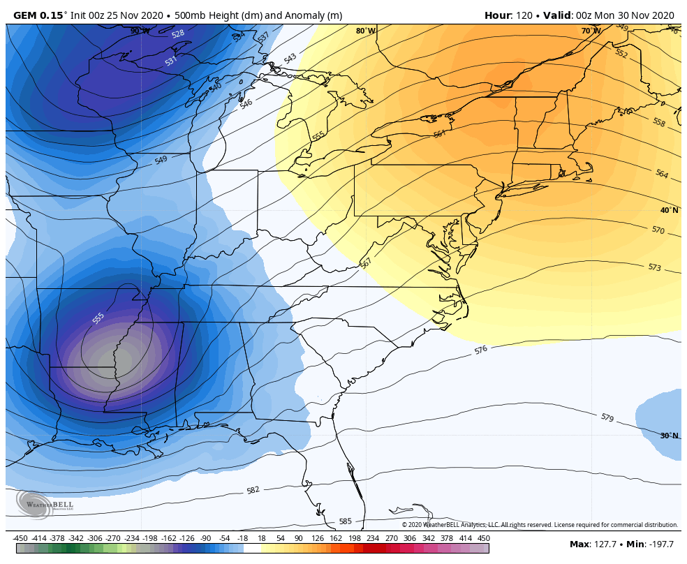
The Canadian Model is similar before dropping another system in behind it…
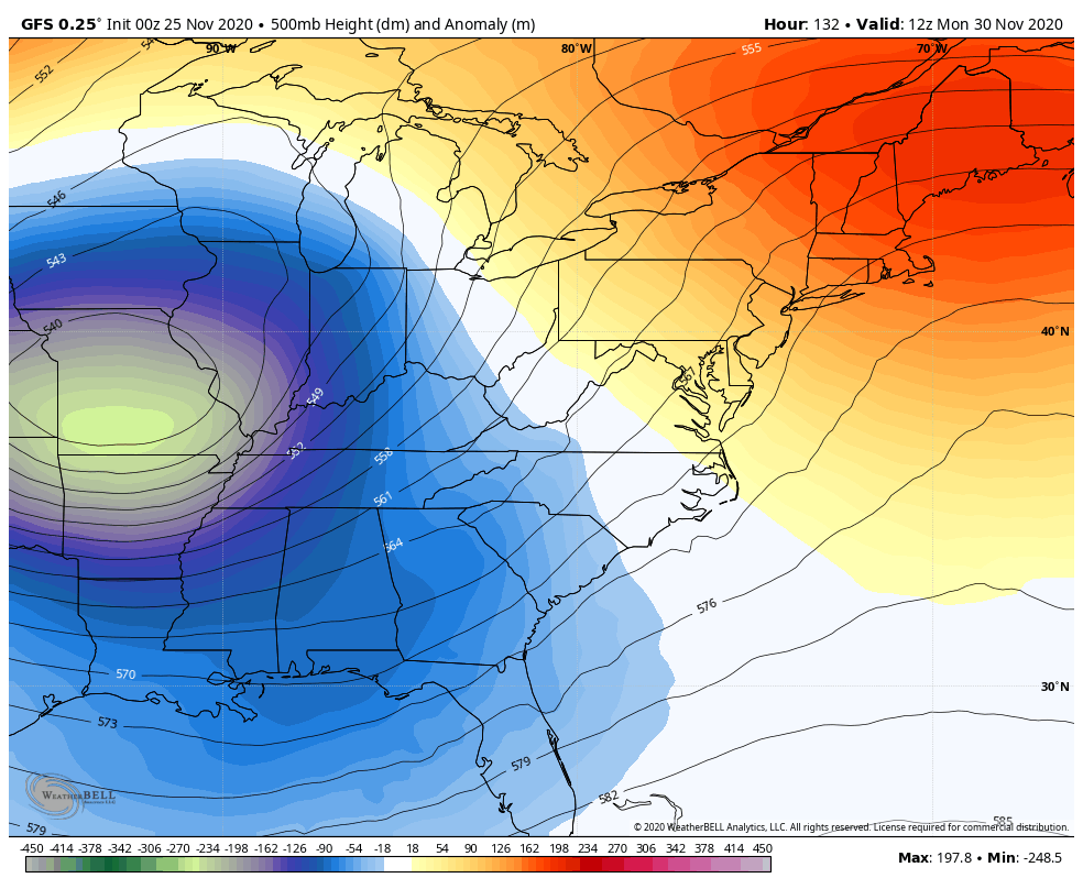
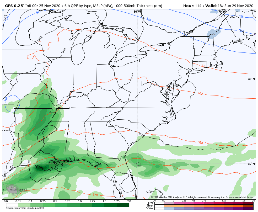
The GFS is also in the same ballpark…
The Canadian Model at the surface is very similar to the EURO, but just a bit farther east and has the second system skimming us from the south by the end of next week…
The 18z Tuesday run of the GFS was almost spot on to the EURO from above, but the 0z run got all confused with multiple lows. This run can’t figure out which low to key on…
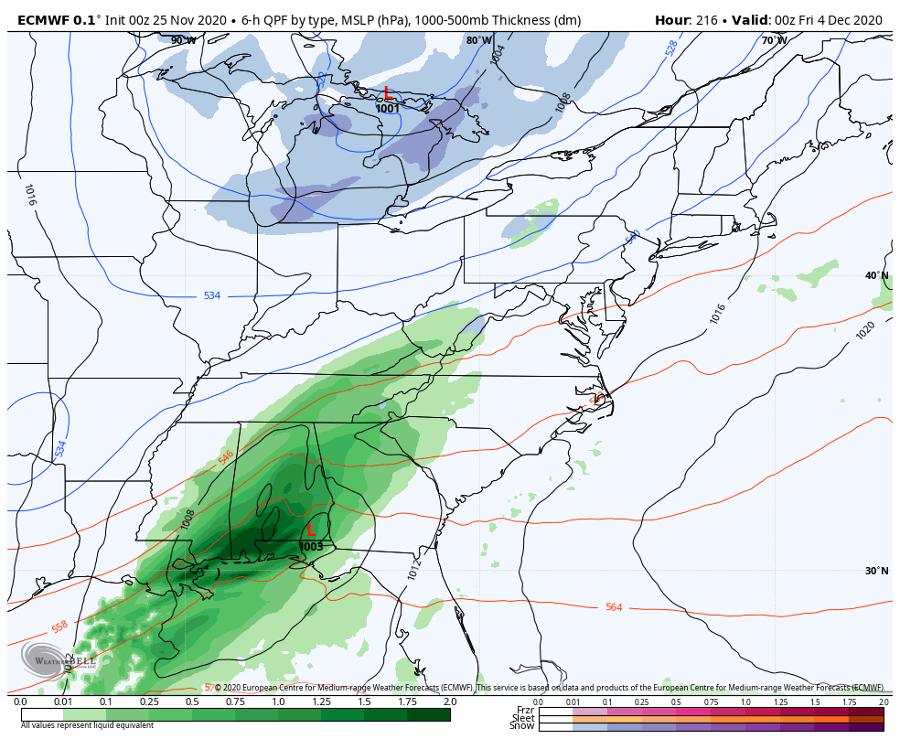
In terms of the late week system, the EURO is seeing this better…
This is one heck of a pattern ahead, folks. Buckle up for a wild ride of model swings and mood swings, depending on whether or not you want snow. 🙂
I will have multiple updates later today, so check back. I leave you with this famous scene from Planes, Trains and Automobiles…
Make it a great day and take care.

Our first measurable snowfall of the season in the Chicago area Tuesday morning was pretty impressive here in the SW suburbs, as the snow came down at a pretty good rate for three hours or so in the early morning before changing to rain. At the NWS office in Romeoville, 35 miles SW of Chicago, 1.5 inches of snow was measured (only a few tenths of an inch was predicted), compared to just 0.7 inches at Chicago’s O’Hare Airport.
Of course, the one day a week I have to go in to work early was Tuesday morning, with the roads being snow-covered and slick. Even though temps were a degree or two above freezing, the snow was falling so hard it was sticking to the pavement, and no salt trucks were out.
Nothing is left of the snow now, as temps rose to the 40s throughout yesterday and stayed there all night. It remains to be seen if the big storm that’s predicted for early next week will affect the Chicago area. It’ll be interesting to follow in the coming days for sure.
Safe travels to anyone who’s traveling for Thanksgiving!
Models are still close to agreeing on a good snow maker for Kentucky.
Those upper level models are pretty impressive reminds me of the blizzard of 1978, but there was a lot more Arctic air involved back then.
At this time I’m more concerned about the severe weather that is forecast in my area later this afternoon. This is one day I do not want Sunshine and rising temperatures.
This will be interesting to watch and see how it plays out. I live far western ky so as of now it looks like it’s more central or eastern part of the state getting the brunt of it . Have a good day and God Blessed.
Kind of unusual flirting with a snow this early in December with a moderate-strong La-Niña.+PNA with signs of -NAO and EPO getting involved also.Strange.Anyway here’s a clown map.
https://www.pivotalweather.com/model.php?m=ecmwf_full&p=sn10_acc&rh=2020112500&fh=240&r=us_ov&dpdt=&mc=
Cool! (I know, way to early to get this snow lover’s hopes up!) Thanks for sharing!
Found this interesting looking for analogs.
https://www.weather.gov/iwx/2006_winter_summary
But this is 2020 who knows what mother nature got in store for us. Time will tell just hope this virus go away so we can live a normal life.
So I guess the talk about possible snow for Friday and Saturday is not going to happen, I guess the models right now squash that and waits for Sunday-Tuesday?
KY weather 50/50
Holy sheets
https://www.pivotalweather.com/model.php?rh=2020112512&fh=240&dpdt=&mc=&r=us_ov&p=sn10_acc&m=ecmwf_full
I like eye candy!