Good Sunday to one and all. It’s full steam ahead toward our first blast of winter weather moving in for the next couple of days. This one has been on our radar for a week or so and has a lot of moving parts, complicating the overall forecast, let alone the snowfall forecast. Nonetheless, we have you covered with not one, but two versions of the First Call For Snowfall.
Since we are looking at two different waves of snow makers, I wanted to try to keep them separate. The first call is for the action right along and behind the surface low as it tracks just to our south and east Sunday night and Monday morning…
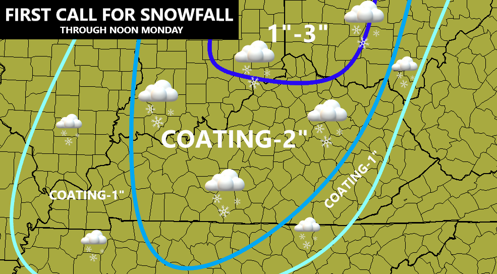
Here are thoughts on this first round of snow…
- Rain changes to snow quickly from west to east late Sunday night and Sunday morning. The trend on the models is for this change to be a little quicker.
- This happens as the models now see the track and intensity of the low much clearer.
- Temps are likely just above the freezing mark for much of the morning hours Monday. That, combined with a very wet ground, try to keep accumulations down. Still, if rates are high enough, that won’t matter, especially on grass and elevated surfaces.
- The timing of this may actually have a big impact on the Monday morning commute in central Kentucky.
- I will play this conservatively with the first call, but there’s a chance I may edge some spots up a bit.
The second First Call For Snowfall comes with the upper low and northwest flow from late Monday through Tuesday. This one focuses more on the eastern half of the state…
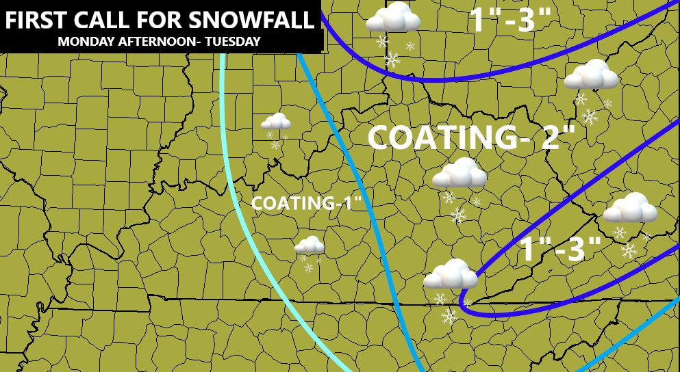
Some thoughts on this part of the system…
- Fairly widespread light snow will be noted Monday afternoon through the wee hours of the morning. Snow showers then take over late night into the first half of Tuesday.
- Temps drop quickly below the freezing mark by early Monday evening. This is really when the additional accumulations start to kick in.
- Unlike the earlier snow, we won’t have as much melting to worry about once the sun goes down. This is when slick travel may develop, especially on bridges and overpasses.
- This isn’t a lot of snow with many picking up a coating up to a few inches. With Lake Michigan sending snow plumes at us, a few spots may do it a little better.
- Snow showers taper from southwest to northeast on Tuesday as cold winds continue to blow.
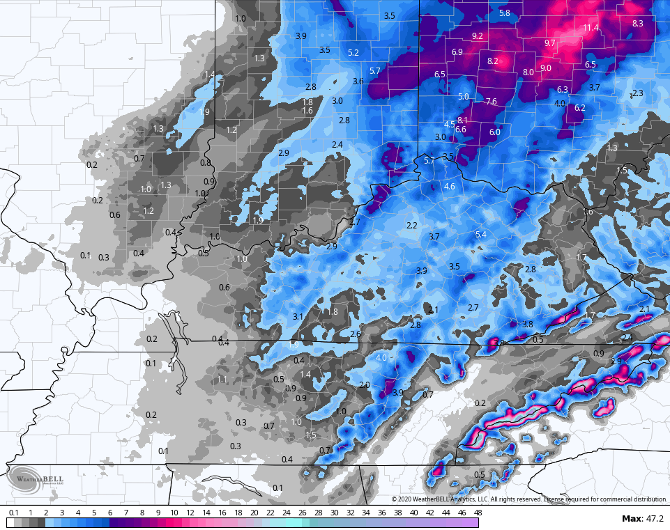
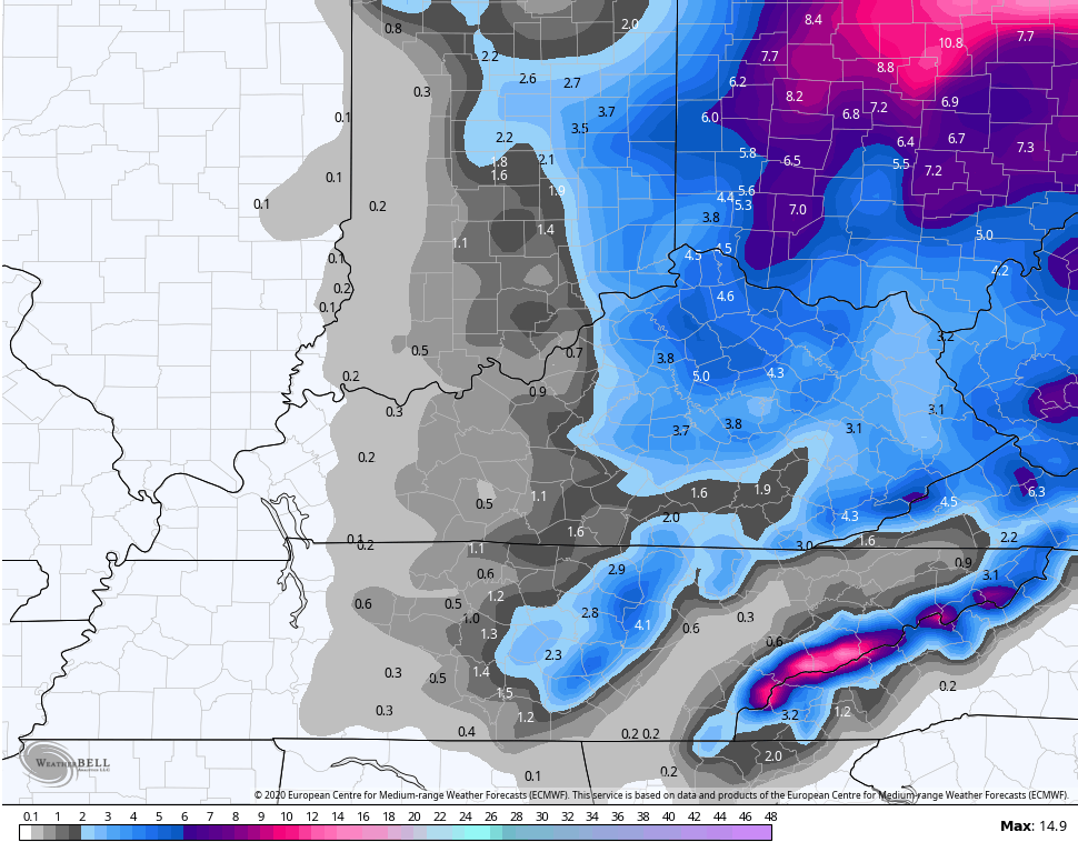
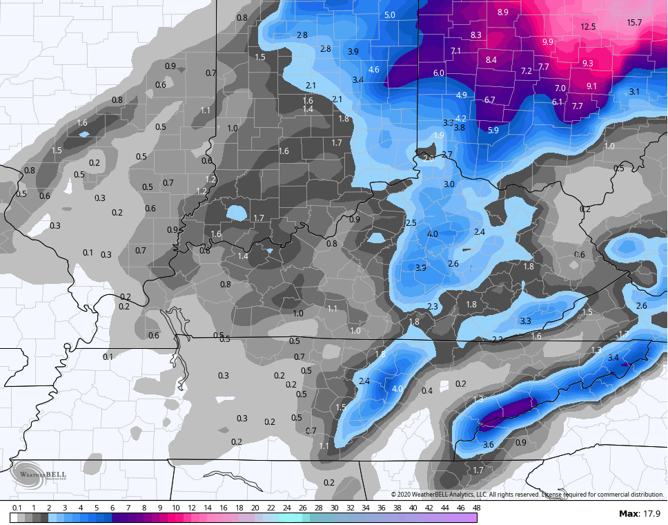
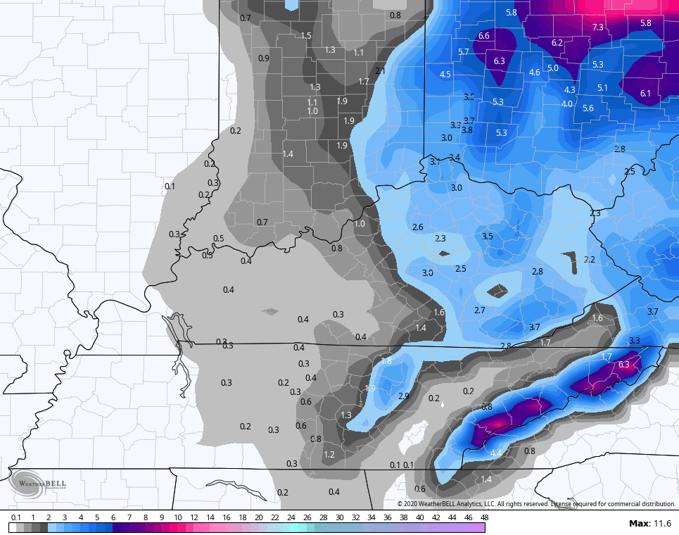
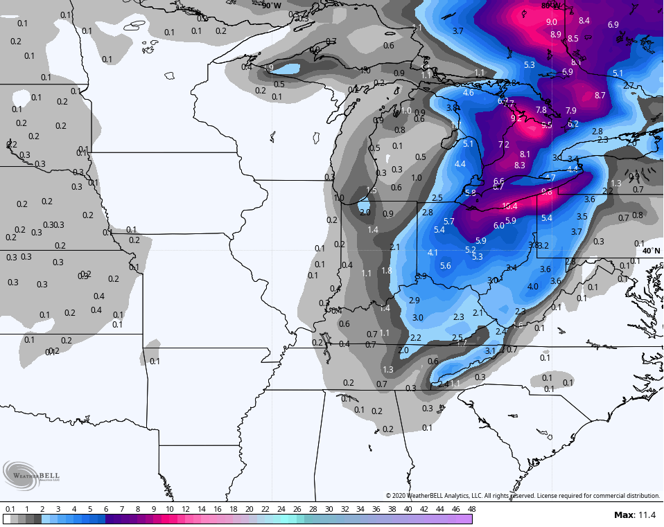
Here’s a check of the snowfall forecasts from the models. Keep in mind, these are snowfall forecasts and not snow depth forecasts…
HI RES NAM through 7am Tuesday
EURO
NAM
CANADIAN
GFS
The average of the 21 member GFS Ensembles…
Another system will roll in here by the end of the week and that’s one to watch. The overall setup for December continues to look pretty darn wintry across our region.
I will have additional updates later today and will put out a New Call For Snowfall(s).
Have a great Sunday and take care.

I was hoping that this system would be bigger.
WKY hopes to get more…..
It looks like everyone is on the same page on this one.
Thanks Chris, very well detailed blog as to what might happen with the snow accumulations across the state.
Whatever amount of snow that falls we can still enjoy it even if it’s minor and a short lived event.
If I haven’t said it before Chris your new blog site is great, especially the bold typed letters. Good for this old commentator’s eyes.
Everyone make it a great Sunday, and all the snow lovers out there that big time snow event is getting closer, maybe this one coming will overachieve. Again, thanks Chris for all your hard work.
Like! Like! Like! We need a like button
Looks like Monday evening into Tuesday will be the day for our area, but it looks sweet for us