Good afternoon, everyone. Our winter weather maker continues to roll toward the region and arrives this evening as rain presses in from the south. From there, we get two rounds of snow from late tonight through Tuesday. This means our first snowfall of the season is still on track to hit the region.
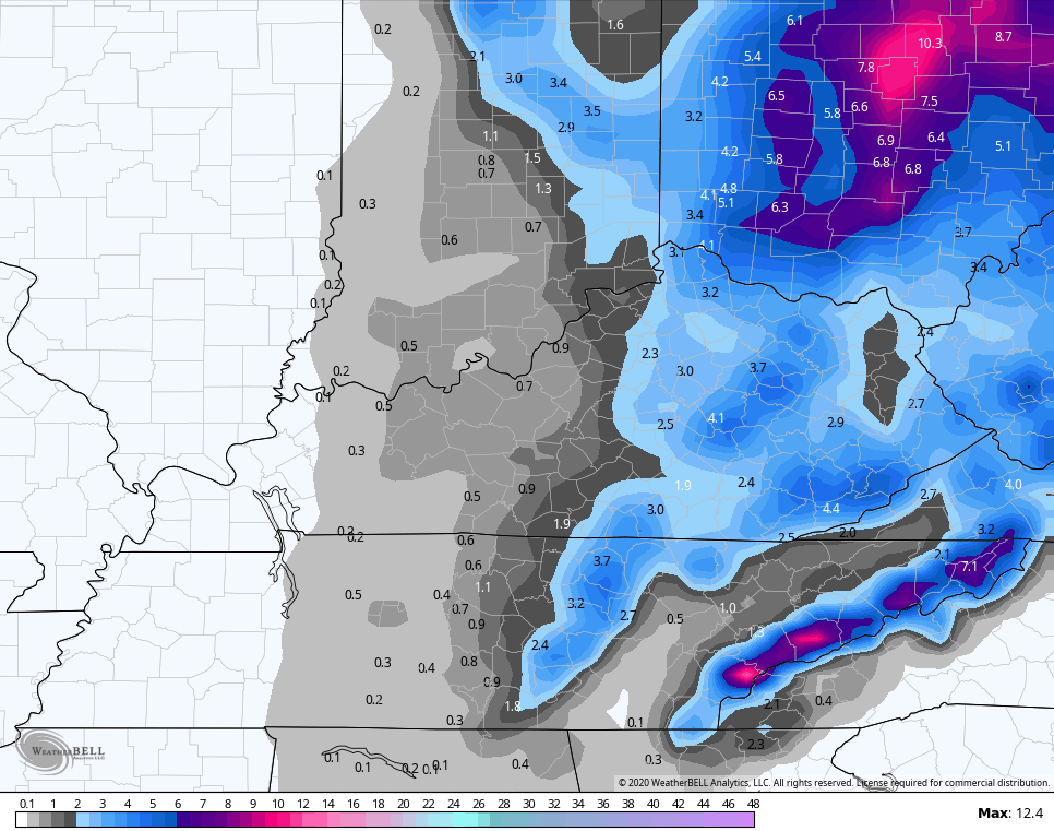
Overall, I’m pretty good with where I have things right now with two different maps. The first continues to be for the system coming in tonight and early Monday and I did make a few changes to this…
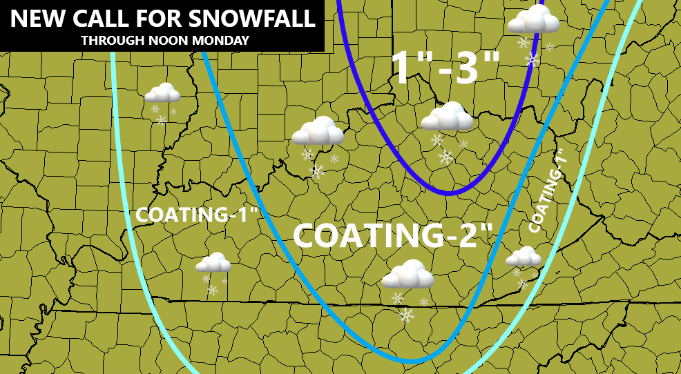
I brought the 1″-3″ line a little farther south into north-central Kentucky. Several models try to amp this up a bit early in the morning. I also adjusted the rest of the map a bit east to account for current trends.
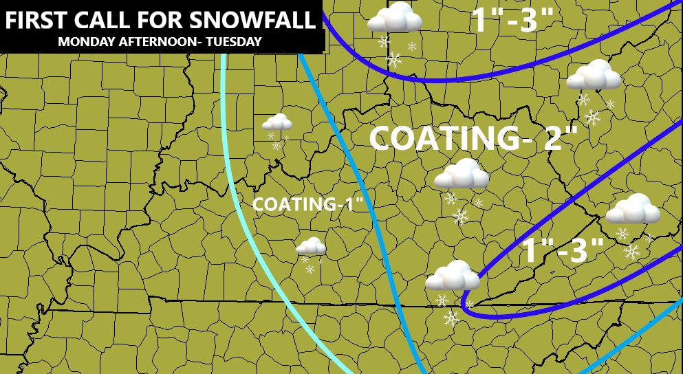
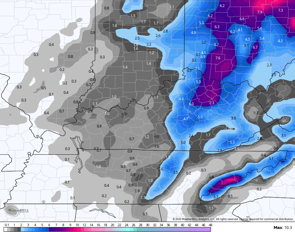
The second First Call For Snowfall is for the light snow coming from the upper low and the northwest flow. You dig, yo? 🙂 Here ya go…
A few reminders of how this plays out…
- Rain rolls in this evening and takes us into tonight before changing to snow by morning in the west and central parts of the state.
- I’m watching for a possible band of overachieving snow from the Bluegrass Region into northern Kentucky to start the day.
- Temps are marginal for sticking snow and we have a wet ground, so a lot of flakes will bite the dust. Still, snowfall rates will overcome all this for a time.
- Much of whatever sticks will be on grassy and elevated surfaces.
- The farther east you live, rain is a playa until later in the day. There’s even the chance for a little rain/snow mix at times in the very light stuff farther west in the morning.
- As temps continue to drop during the afternoon and evening, light snow really fills back in as our upper low swings in. Combine that with a northwest flow and you get the best chance for accumulating snow across much of central and eastern Kentucky through Tuesday morning.
- Some locations may only reach the low end each time period. Some may hit the high end each time.
- With temps dropping into the low and mid 20s wet roads will ice up and then we may put down a little snow on them. That will lead to some slick travel.
- Overall, I would expect Winter Weather Advisories to be issued soon for much of central and eastern Kentucky from late tonight through early Tuesday. It’s the first accumulating snow of the year and will impact travel at times.
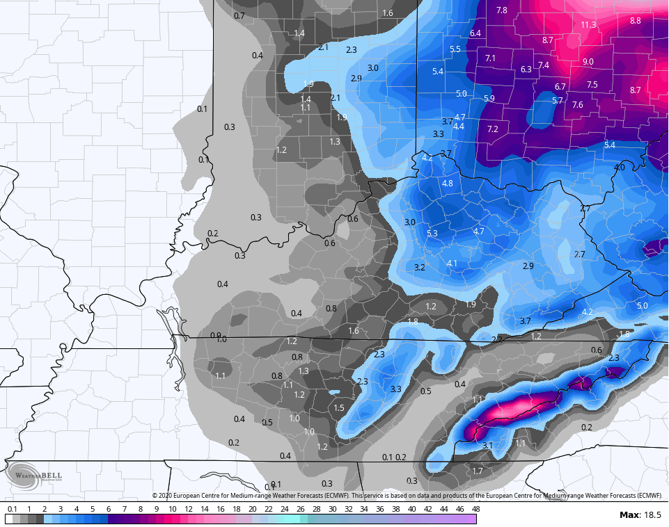
Let’s do a quick check of what the latest models are thinking…
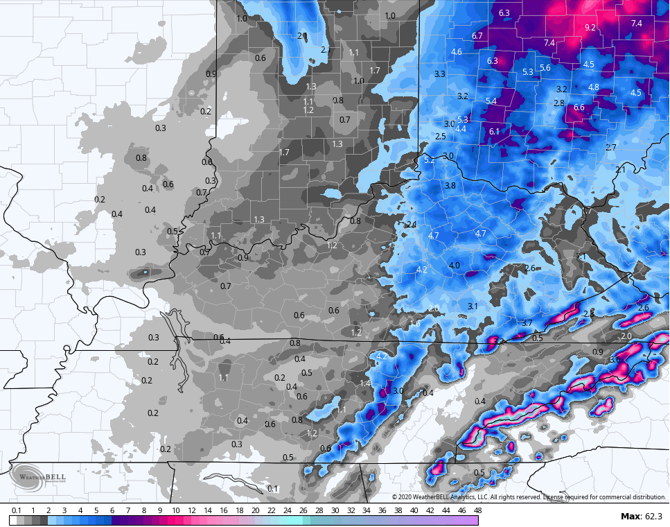
The EURO sees the north central Kentucky action…
GFS
CANADIAN
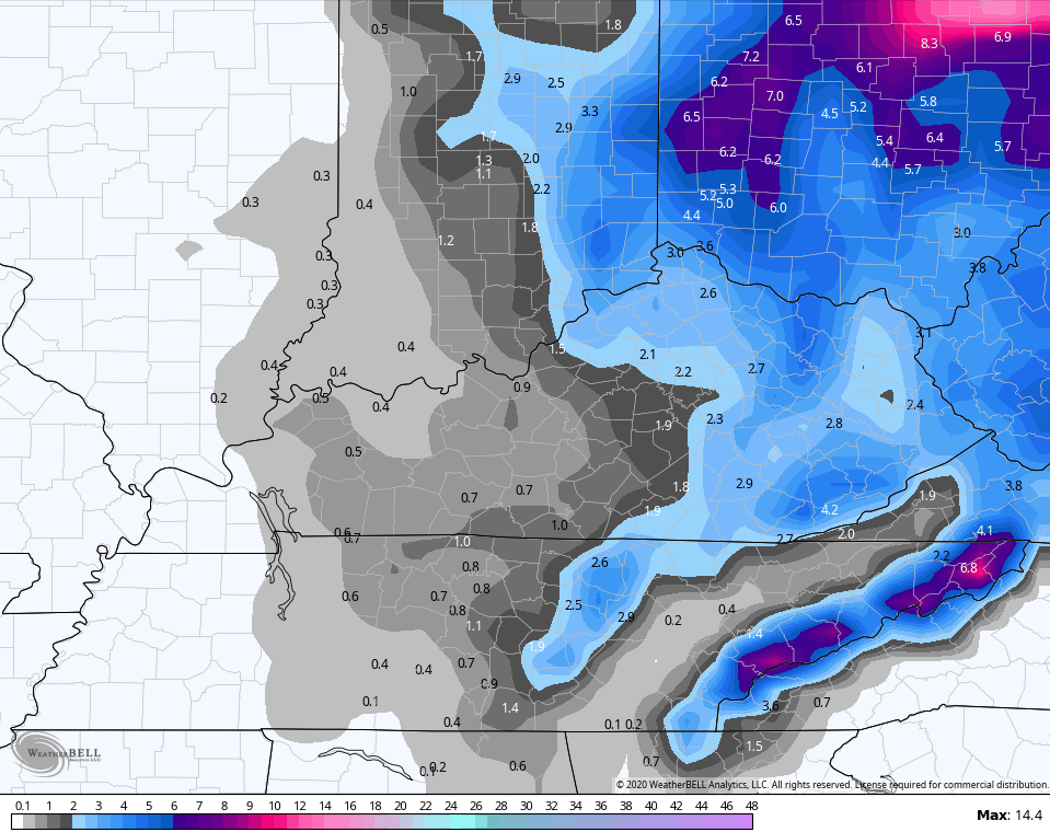
The NAM has this thumper snow we have to watch for early Monday morning in north central Kentucky…
The HI RES NAM it as well, but is just a little east…
I will have additional updates later today so check back. Until then, here are your radars to track the rain in from the southwest…

Make it a great day and take care.

Any snow in late November and early December is a bonus. Haven said that I’d be willing to bet my area only gets the usual nuisance dusting
BOOO! WKY barely in the first call and not even in the 2nd. We miss out again!! RIP first snow chance of the season
I hope the north central and the mountain areas of the state get a big time snowstorm out of this system.
In my county of Taylor I hope we just get a good soaking rain, which we need.
The estimates for South Central Kentucky have been declining steadily. We’ll be lucky to come away with only a trace of snow, which would be a trace more than what we ended up with all Winter last year.
BOOO! WKY barely in the first call and not even in the 2nd. We miss out again!! RIP first snow chance of the season
Here in NW PENNSYLVANIA we are expecting up to a Foot of Snow guess I’ll have to break out the new snow shovel I bought last Year.