Good evening, folks. Let me once again start out by apologizing for the site issues. As you know, I upgraded KWC back in the summer, but the new design is failing the first test of the winter. I will get this resolved one way or the other this week. I share your frustrations, too as it’s even difficult for me to get in and update. Oh and I don’t like the ad page that comes up, either. Thanks for your patience.
As expected, a Winter Weather Advisory is out for central and eastern Kentucky Monday into Tuesday morning. This is largely for the second round of snow coming in during the afternoon and evening hours. That’s when the primary time is for the best sticking snow as temps crash.
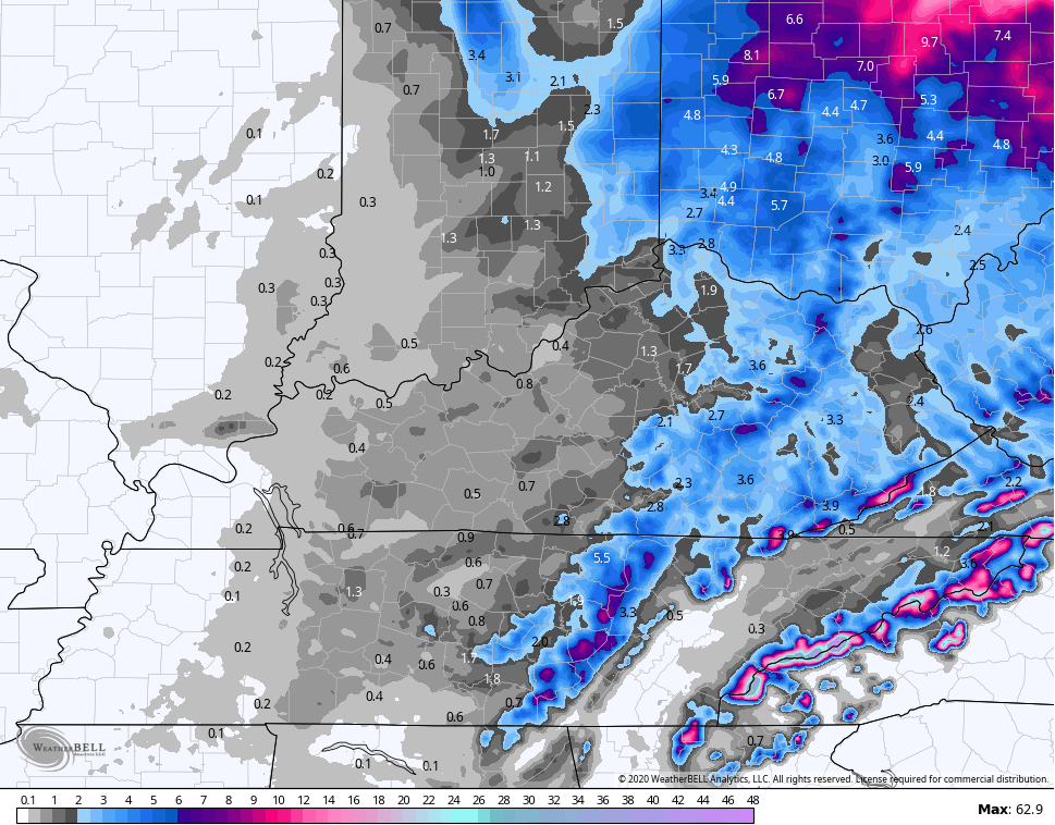
Here’s a look at the Winter Weather Advisory…
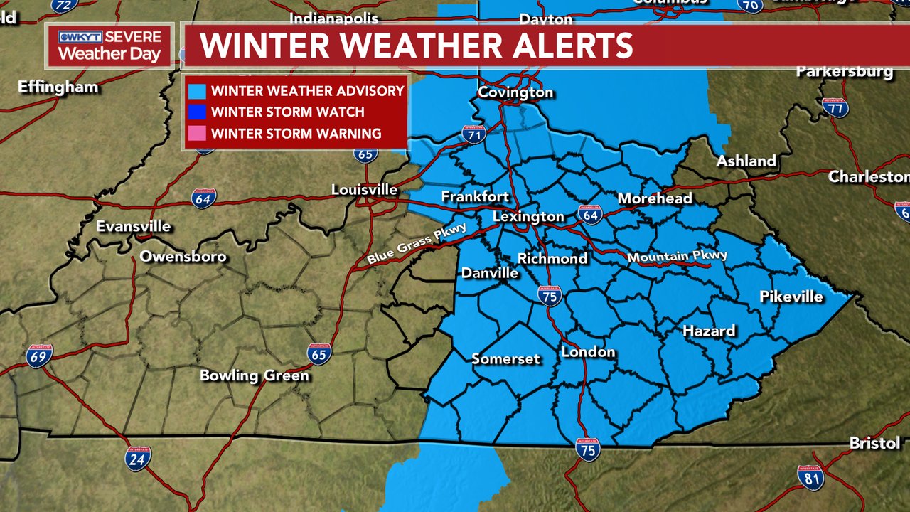
The northeastern counties into WV will likely be added soon.
I’m once again changing my thoughts on the early Monday morning setup to account for the latest trends. The afternoon look on the models suggests the change from rain to snow is a little slower later tonight and Monday morning. To account for this, I went back to something similar to what I had on the First Call…
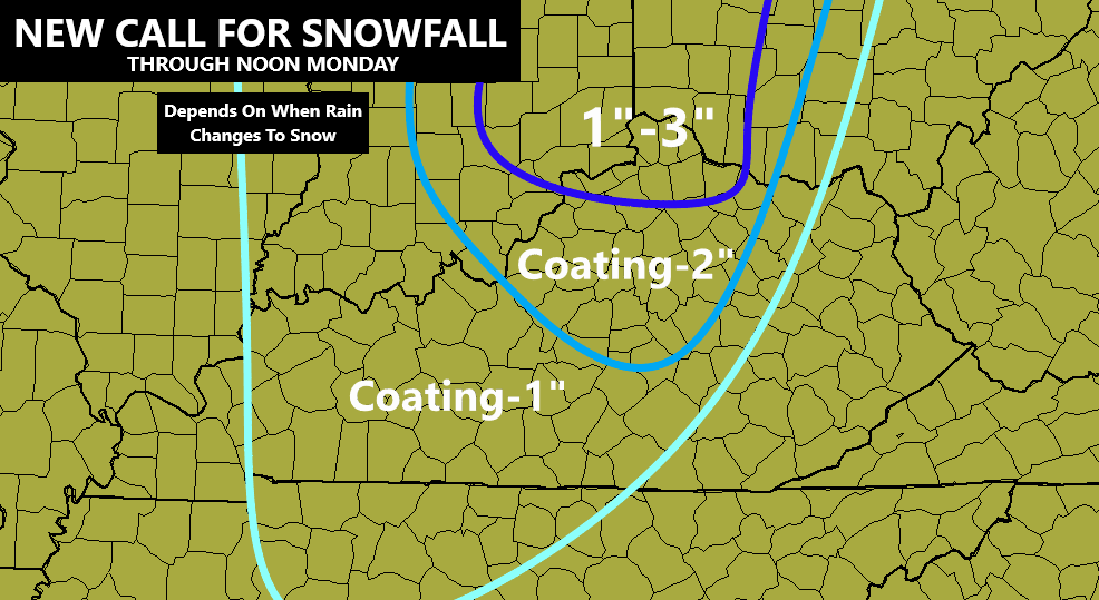
From the beginning, I’ve been much more adamant on the second wave being our primary snow maker across central and eastern Kentucky. The initial wave is a rain to snow situation with marginal temps for anything sticking. Plus, the change times for any one location are really tough to determine. It’s one of those setups in the morning that the heavier the precipitation, the better the chance for it to snow. Lighter stuff is likely mixed rain and snow until the cold air takes over later in the morning from west to east. I’m really torn on this morning stuff, especially in the Lexington metro and north.
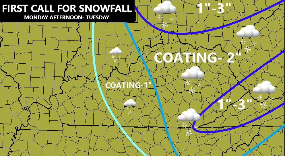
My thoughts on the main snow maker remain unchanged and that’s always a good thing. Monday afternoon through Tuesday morning is our prime time to put snow on the ground for much of central and eastern Kentucky. Widespread coating – 2″ will be a good bet, with some local 3″ amounts possible. With temps dropping through the 20s, slick roads will be possible during this time…
The late afternoon model runs have bounced around a bit. The EURO continues to hit the snow a little harder in the morning…

The GFS continues to hit the late second system harder and that’s essentially what it shows for most of the accumulation on this run…
The GFS Ensembles are in very good agreement…

The Short Range Canadian looks VERY similar…

The NAM Fam took on a much different look from their morning runs and went a bit east and got a little choppy…
Hi Res NAM
Winds are going to be very gusty during this time and may reach 30mph at times. That means some plaster snow will show up on the sides of trees and various objects. These winds will also make it feel absolutely frigid. Check out the wind chills from Monday morning through Tuesday afternoon…

A full update comes your way later tonight. Until then, track the heavy rain into the region with our radars…

Enjoy the rest of the evening and take care.

Looking at the 2 AM radar, much of Kentucky is getting a soaking rain.