Good afternoon, everyone. Snow continues to take control across central and eastern Kentucky as our upper low and northwest flow kick in. This is when things start to get tricky on the roads as temps crash through the 20s into tonight. Throw in a gusty wind from the northwest and you get one heck of a winter day to end November.
The overachieving band of snow did in fact show up this morning across areas of central Kentucky. An inch or two feel in a short amount of time and this is what I always tell you guys… Snowfall rates can overcome ground temps very easily. I once saw it snow 2 feet in early April in eastern Kentucky. 🙂
Round two of the snow continues to kick in as the upper low dives in with a northwest flow coming at us from Lake Michigan. This will put down more light snow on a much broader scale, so those folks who haven’t had any yet, will get in on the act through tonight. That’s especially true across central and eastern Kentucky and this has always been the main system I’ve been keying on.
My Last Call For Snowfall looks to be in ok shape and has already verified in several areas. It won’t be perfect by any means, but that’s the nature of the snow forecasting beast. Keep in mind, this does include what feel earlier in the day. Snowfall… Not snow depth. 😉
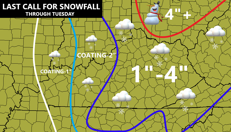
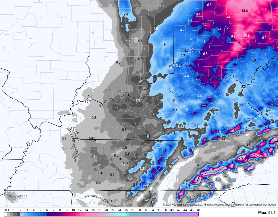
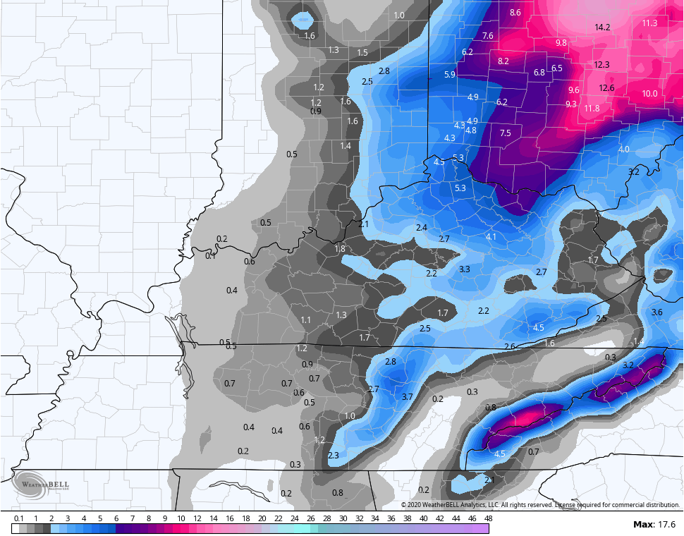
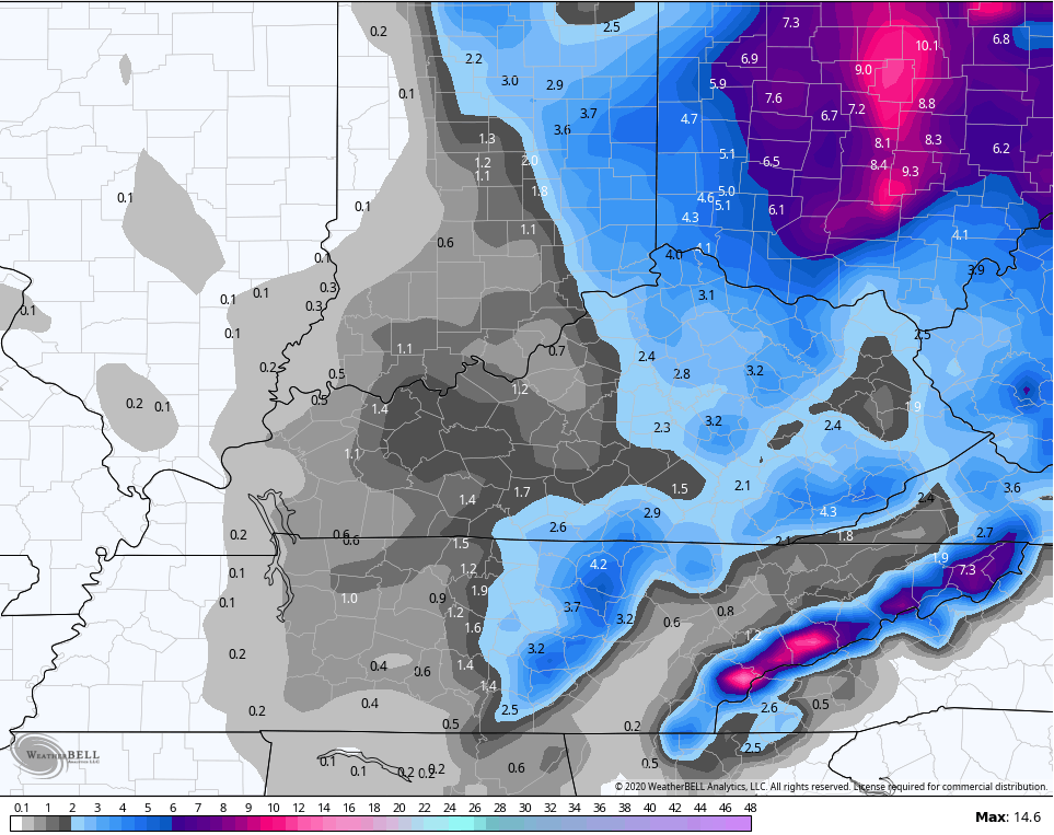
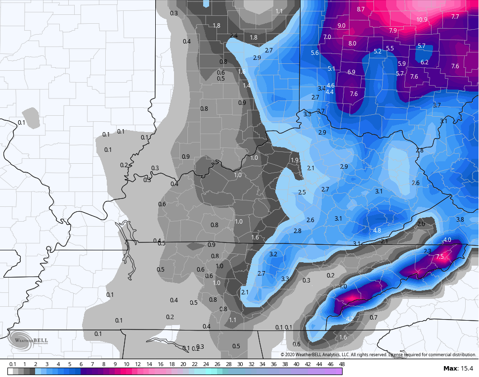
Additional snowfall from the forecast models looks like this…
Hi Res NAM
NAM
CANADIAN
GFS
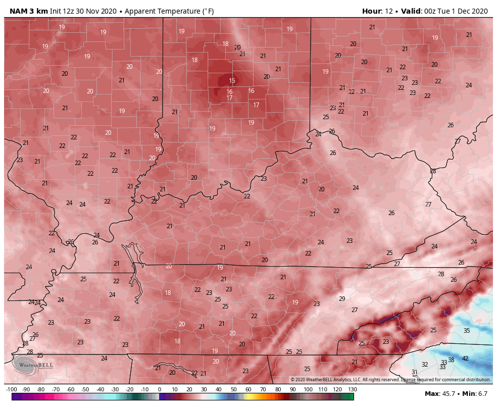
Travel conditions go downhill after dark as temps drop into the 20s. There’s a lot of water out there just waiting to freeze up.
Winds will continue to crank and may reach 30mph at times. Wind chills are still way down…
EURO

Snow showers and flurries taper off from southwest to northeast Tuesday morning.
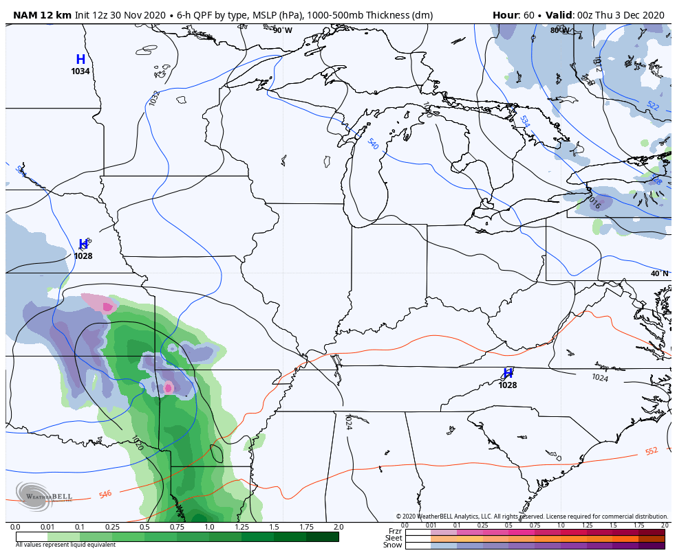
The next system to watch rolls our way late this week into the weekend. This is all over the place on the models. This may be a big slow-moving bowling ball of a winter storm system that rolls right on top of us. The NAM is picking up on the beginning of this at the tail end of the run…
The Canadian is seeing the potential even better…
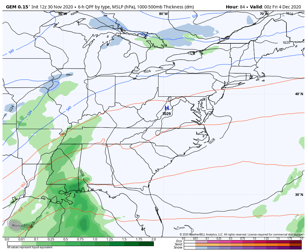
The EURO and GFS had this system a few days ago, but keep that energy spinning well to our southwest. We shall see.
Your radars have you covered to track the snows and to follow the connection to Lake Michigan…

I will have another update later today, so check back. Make it a good one and take care.

Thanks Chris, It’s been snowing all day long, but not accumulating until now. Two inches would be fine for tomorrow morning. Just enough to make it pretty on the tree branches.
I recall the two feet of snow in April 1986. I lived in Boyd County and was in elementary school, and the big snow occurred during our Spring Break week! We just don’t get them like that anymore.