Good Tuesday, everyone. Our first taste of winter weather is pulling away early today as snow showers wind down on this first day of December. The cold air remains, though, as we turn our attention toward another system trying to bring a mixed bag of precipitation later in the week. I say trying because we have some disagreement among the models. Shocking, right? I will also take a deeper look down the December weather road.
First off, for such a complicated scenario with a surface low and upper low, the forecast played out pretty darn well. I’ll take it! 🙂
Snow winds down through the morning hours, but not before leaving behind a nice accumulation to start the season. As a matter of fact, this is the first time Lexington has started December with snow on the ground since 1976. This isn’t the first connection of the year to 1976. Until this year, 1976 was the previous record holder for for fewest days between the final spring 32 degree temp and the first of the fall at 167 days. This year broke that with 161.
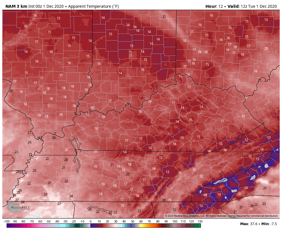
Slick spots are a good bet on roads across central and eastern Kentucky this morning, so keep that in mind if your travelling. Here are your radars to track the decrease in flake action across the east…

Temps today range from the upper 20s and low 30s east to mid and upper 30s in the far west. Gusty winds will make it feel much colder. Here are the wind chill numbers from 7am this morning through 11pm…
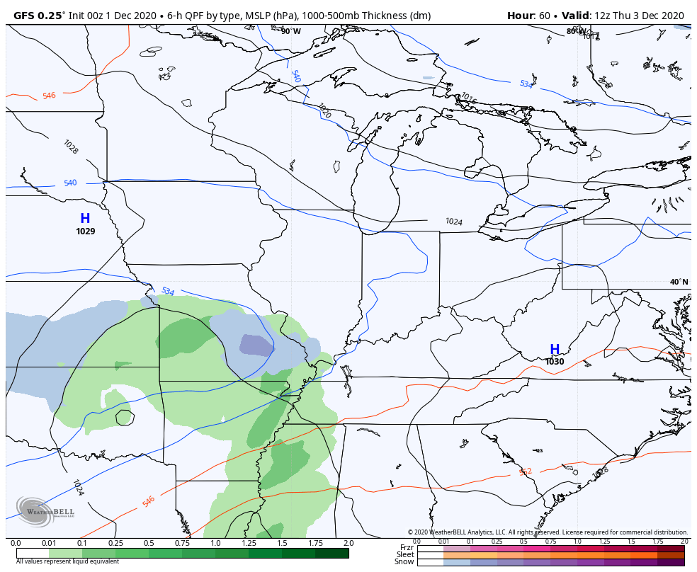
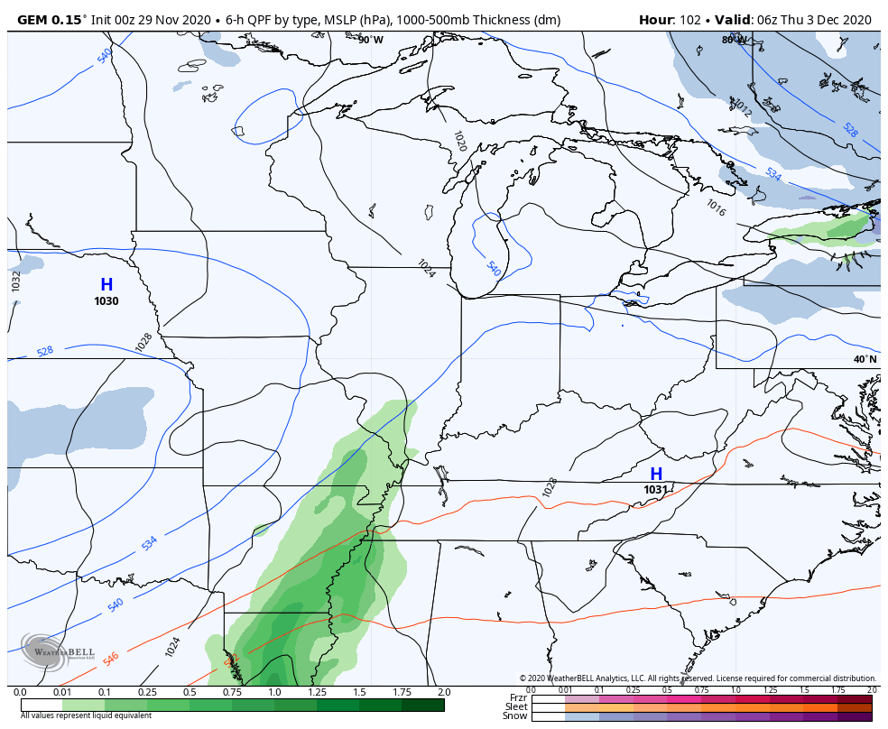
The next system coming our way later this week into the weekend still has some issues to be resolved. It’s essentially another big upper level low spinning across the southern plains. Does this just keep rolling east as one main entity or does it split off with a piece coming our way and one retrograding back toward the southwestern part of the country? None of the models appear to have a full grasp on it and they all go back and forth on how to handle it.
The GFS is trying to bring more of this system east with rain and some snow…
The Canadian has been more consistent with this system…
The model I’m probably trusting the least in this setup is the EURO. Why the EURO after it did such a good job with this last system? Because energy coming from the southwest is something this model can rarely figure out. If everything else goes toward it, then I will trust it, but not until then. 🙂
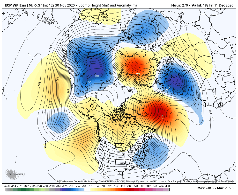
Looking down the road through the middle of December, recent runs of the various ensembles are pointing toward a deep trough that gets more of a cold air connection…
EURO ENSEMBLES
GFS ENSEMBLES
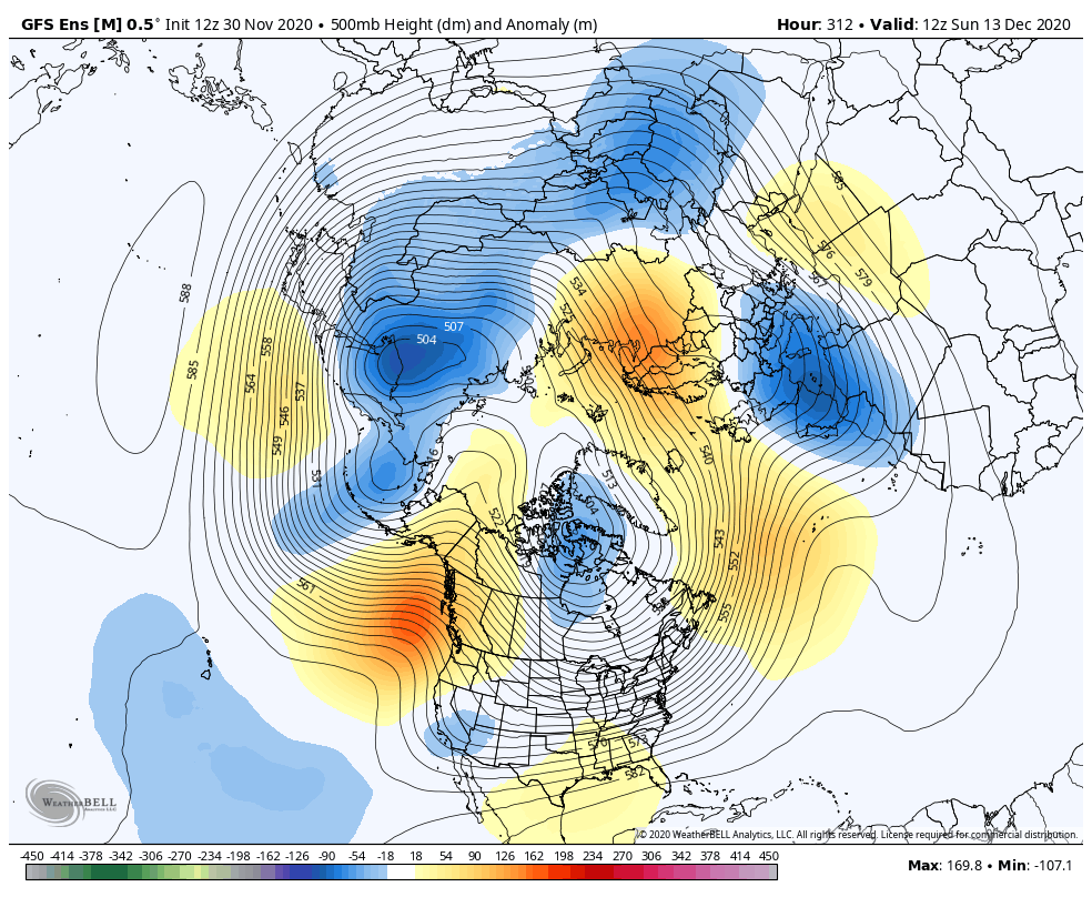
This December continues to look it may be the coldest and snowiest since 2010. Of course, the majority of the Decembers since then haven’t seen much cold and snow.
I will have updates later today, so check back. Have a good one and take care.

1/4 inch at my house.
I hope the next system has more cold air to work with.
Right at 1″ here in Eastwood, KY about 2 miles west of Shelby Co/Jeff Co line.
Right at 1″ here in Eastwood, KY about 2 miles west of Shelby Co/Jeff Co line.
Snow accumulation in my backyard ranges between 0-2 inches. Hard to tell really.
This could have been a major snow event if the phasing took place earlier as forecast last Wednesday.
The path that was forecast was exactly as the blizzard of 1978.
Back then it is interesting to note all of the teleconnections were negative except the( PNA +) and the phase of ENSO was a weak El nino.
The snow this morning will be beautiful when the sun comes up and early this morning it was beautiful with the full Moon.
Already got 6 inches of snow and it snowing heavily right now here in NW PENNSYLVANIA with more lake effect snow snow coming tonight.
About an inch here, which is more than the last two winters combined….that’s a plus
WOW, that is more snow than I’ve seen in seven years. It is so interesting how lake effect snows form.
You need to go out and build a snowman.
You may get more before Christmas. My last White Christmas was in 2004, when 22 inches fell in Evansville, Indiana.
A couple tenths of an inch here in south-central Indiana.
Chris, you are getting us excited about the words on Twitter “thump”. That word is usually used for whoever plays the Bengals!