Good afternoon, everyone. It’s a heart of winter looking and feeling day out there to start the month of December. That northwest flow continues to spit out areas of light snow and flurries for central and eastern Kentucky and snow-lovers are in heaven with this first snowfall. Now we turn our attention toward the late week and weekend system. Like I suspected, the models are now trending back toward a bigger system impacting our weather.
Let me kick this off with the precious present. Light snow and flurries will slowly diminish this afternoon and evening, but some light coatings are still possible across the eastern half of the state. Road conditions are better, but we will likely see refreezing taking place this evening, so keep that in mind.
The radar won’t pick up on a lot of the flakes, but here it is nonetheless…

Our next system then rolls our way as early as Thursday and Friday. This comes as a slow-moving upper low develops across the southern plains. We are now seeing the models bringing more and more of this eastward through the coming weekend. Here are some thoughts:
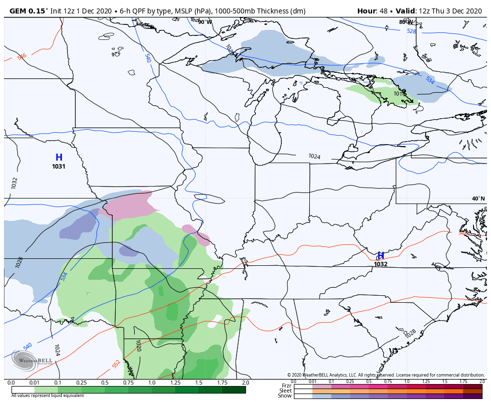
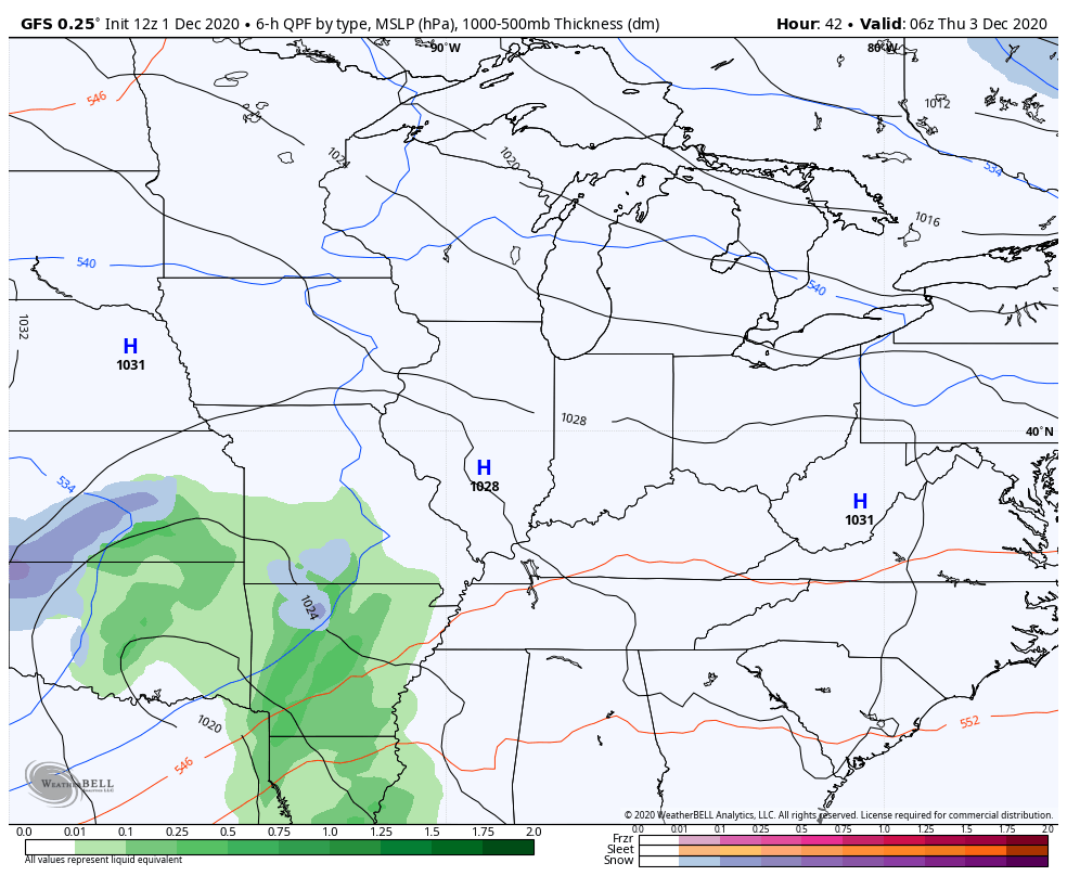
- Rain and snow should move into western Kentucky on Thursday. Light accumulations will be possible there.
- This massive upper low will then slowly work to the east. Ahead of this, temps should spike enough for rain to develop across the state on Friday.
- Under the upper level low, and just to the north of it, cold air will produce snow.
- Exactly where does this upper level low track? If it comes right across Kentucky, then we are gonna have a thumper snowfall set up.
- Does a northern stream piece of energy drop into this upper low and cause a much bigger system to develop? Right now, there’s an outside chance of this happening.
- I expect all models to trend more wintry around here in the next few days. Essentially, we will see the models go back to what they were showing up until a few days ago.
The Canadian Model has been the most steady with this system. Watch the core of the upper low produce a thumping snow…
The GFS is getting closer to this same scenario…
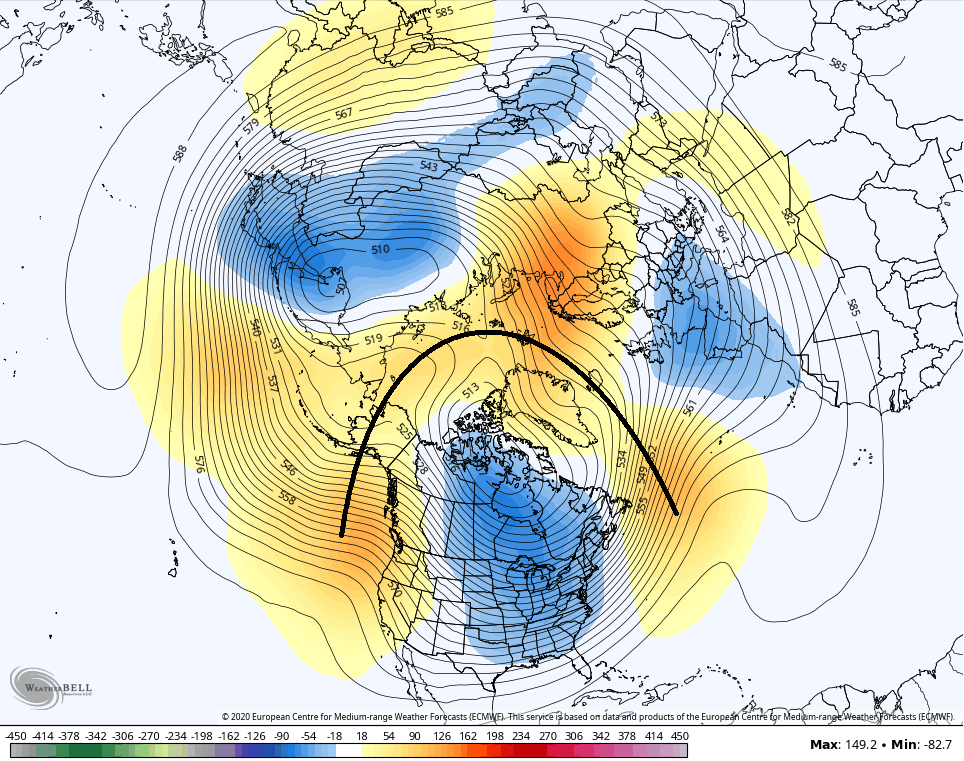
I warned you guys not to trust the EURO and how it was handling this system. Now, it has a completely different solution compared to the last run. I still don’t think this is right, but it’s getting closer…

As we look farther down the road, the middle of December is getting my attention in a big way. This isn’t just because of the increased chances for snow, but this would seem to be a pattern that can produce a full-blown arctic outbreak into the country. This is some big time blocking, kiddos…
The computer models show some big heavy hitters in the analog packages. From last night’s GFS Ensembles…
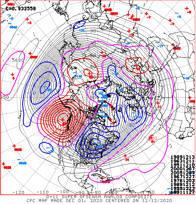
1989, 1963, 2000 are in the top 4 analogs. Guess what? Those are the top 3 coldest December’s on record around here. You will also see 1976 lurking in there, too.
Here are the top 10 analogs to this morning’s operational GFS centered on December 12th…
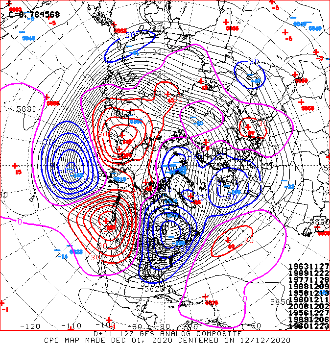
1989 is in there twice, 1963 continues to show up and we add in 1977.
Interesting times, folks!
I will try to throw you another update later today, but I’m also trying to enjoy a snowy day off work. 🙂
Enjoy the rest of the day and take care.

1976,1977,1978 were bad winters we had a lot of snow and cold temperatures in Eastern KY some of the snows were 20 inches and stayed on the ground most of the winters
Yeah, I was in my Fresh/Soph years of HS then and remember one of those winters(can’t remember which..lol..I’m old)where it snowed our first day back after Christmas break, we got off early because of it, and we only had school about 5-6 days total from Jan 3-first week of March. And the 78 blizzard, too! We had good snows back in the 70’s. Wish we could get some of those back! I was happy to see our 1″ in Bardstown this morning!
Thanks Chris, I’m old enough to remember December 1963. When I got home from school around 3:30 pm the temperature was just above zero and there was eight inches of snow on the ground. Snow was on the ground the entire month. Yes a White Christmas.
The years 1976-77 started out mild and dry until New Years Day when a clipper system came through and deposited four inches of snow with a load of Arctic air minus ten degrees. January was very frigid with lots of snow and there were days the high temperature never got above zero. Good Winter to be a plumber. LOL
December 1989 featured waves of frigid Arctic air almost the entire month with not a flake of snow. After New Years Spring weather prevail with a late freeze.
Already a foot of snow in my Yard we might get close to two feet of snow by tomorrow.
I’ve been studying the radar in northwest Pennsylvania this afternoon and that storm system is not going anywhere as it appears now it could continue the next couple of days with heavy lake effect snows.
You could end up with three feet of snow before it moves out.
I love the snow belt areas.
Looking forward to watching and waiting! Oh ! The website is MUCH better now! Thanks!