Good Wednesday, folks. The record setting snow has finally ended, but the focus is already on the next storm system rolling in here later this week into the weekend. This comes from a bowling ball upper level low that can bring rain and snow across much of the region. If we can get under or just north of the upper low, we could be in some good snow business.
Before we look ahead, let me take a quick look back at the record setting snow to end November and begin December.
This was the snowiest end to November and start to December on record in Lexington. We officially recorded 2.3″ of snow Monday, breaking the daily record for November 30th. Tuesday’s 1.5″ of snow breaks the record for December 1st. That brought the event total to 3.8″. This was also the snowiest November since 1976 (there’s that year again) and it all fell in one day. The 2.3″ yesterday was the snowiest November day since 1966. Tuesday’s 1.5″ of snow makes this the snowiest December since 2012 and that fell at the end of the month. Tuesday’s snowfall is also more than the past 7 Decembers combined (1″) and we did it in one day.
This brings us to the next system that may throw rain and snow into western Kentucky as early as Thursday. What happens from here is still rather murky as a bowling ball upper low comes east. How this thing comes out determines how much of an impact this system has on us. Rain and snow will both be possible Friday into the weekend, but I really can’t say anything more than that.
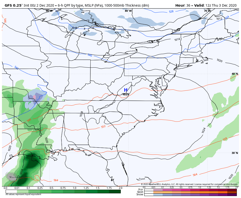
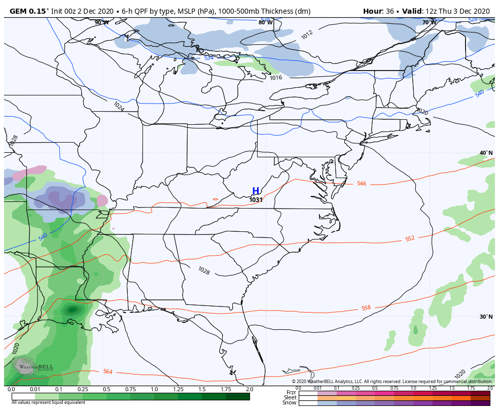
The models aren’t really a big help as there really isn’t much in the way of agreement…
GFS
CANADIAN
EURO
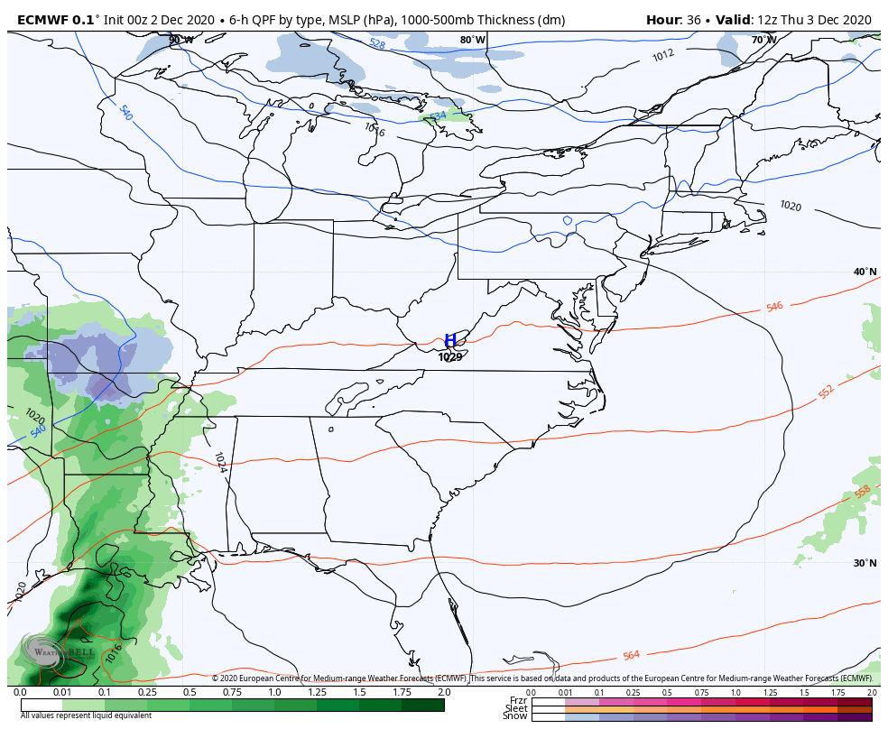
This could be one of those systems that goes from 0-60 in a single run with every model getting on board at the last second. On the flipside, it could also be a situation with the models going from 60-0 in a single run with every model getting off board at the last second. Cutoff lows are a bear to forecast.
I’ve been pointing toward the middle of December for the potential to get some arctic air diving into the country. The various ensembles continue to carve out a DEEP trough into the country during this time..
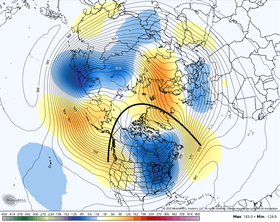
That’s a nice little hookup of the various blocks over the top.
Now we’re seeing the operational models picking up on the potential for this deep trough…
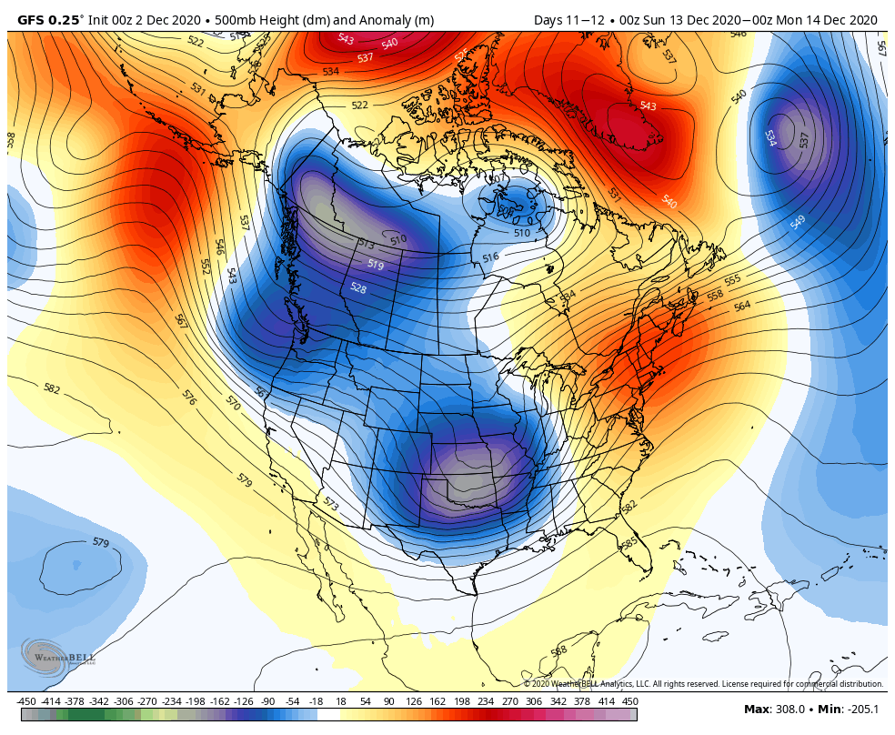
Yes. this is out there in week two, but it matches the pattern and matches what the different indices are screaming at us. The GFS is seeing the arctic potential for the middle of the month…
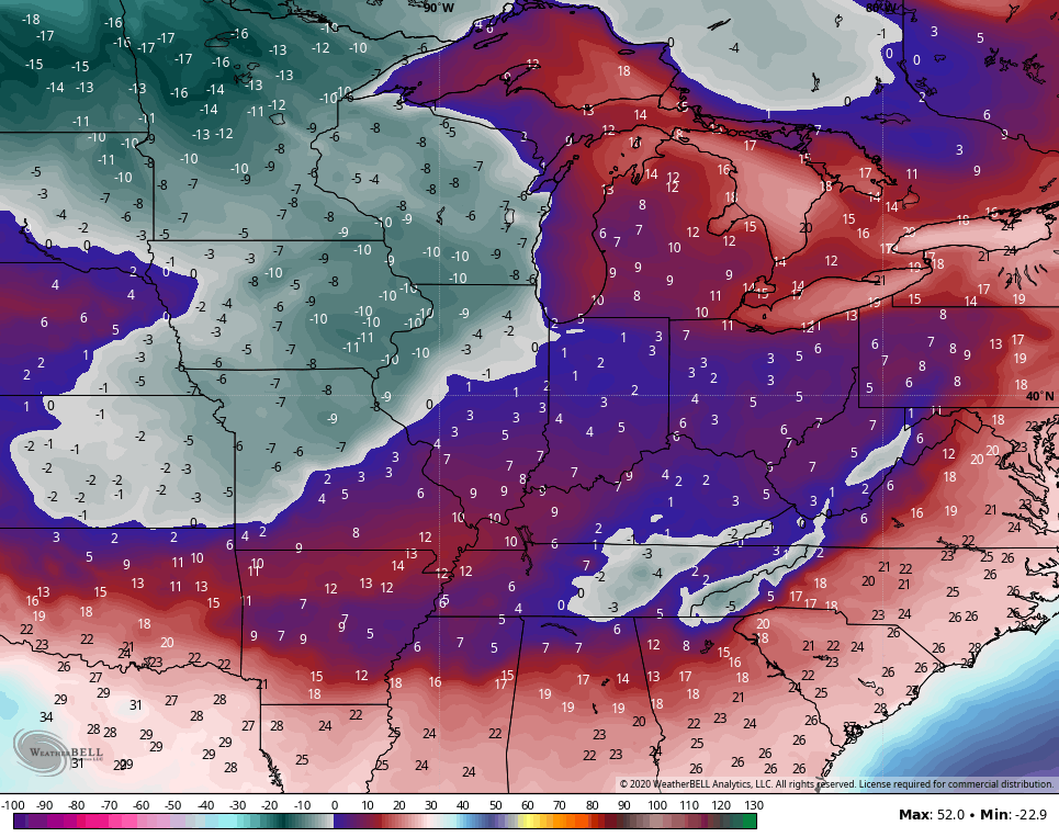
Wind chills

This ain’t last December, folks. As a matter of fact, this is likely to be the coldest and snowiest since 2010 before all is said and done.
I will have updates later today, so check back. Have a good one and take care.

This November turned out to be the fourth warmest November in Chicago history, with an average temperature of 47.4 degrees at O’Hare Airport, which is 7.1 degrees above the normal of 40.3 degrees. There was just a measly 0.7 inches of snow recorded at O’Hare during the month, which fell in a few hours the morning of the 24th (1.5 inches here in the SW suburbs). Heck, a lot of you in Kentucky had more snow in just one or two days than we did the entire month!
Compare that to last November here, which had an average temp of just 34.8 degrees and 3.7 inches of snow. We were nearly 13 degrees per day warmer this November… wow!
No rain or snow is predicted for the Chicago Metro area for the next 7-10 days, with high temps in the upper 30s to low 40s. It certainly doesn’t look to be a cold and snowy month here.
Interesting that some of the computer models are predicting a major Arctic outbreak for the middle of this month, while the Climate Prediction Center is predicting above normal temps for a large part of the country for December.
Of course, things can change quickly, so we’ll see what happens.
A cold rain is a good bet for the latter end of the week.
That’s exactly what I’m betting on.
Thanks Chris, Here in Taylor county we received about an inch of snow from the previous event.
This morning the low was 17 degrees in my backyard.
Looks like today the Sun will shine with a high in the low 40’s.