Good afternoon, everyone. The sun in shining, but our temps continue to run well below normal. This colder than normal pattern continues through the rest of the week and through the coming weekend. This is when the next system takes aim at the region, bringing the potential for rain and some snow.
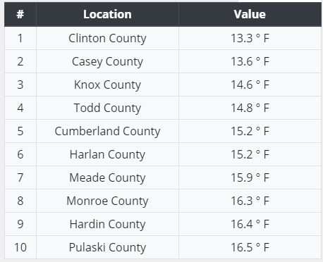
Before we start, let’s look back at the coldest morning of the season, so far. Here are the top 10 cold spots from the Kentucky Mesonet…
With the clear skies today, we can get a great view from space of the snow on the ground. Look at the blanket of white across central and eastern Kentucky and the connection back to Lake Michigan…
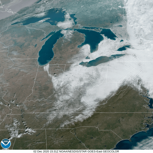
How cool is that?!
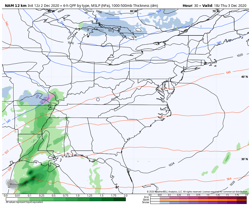
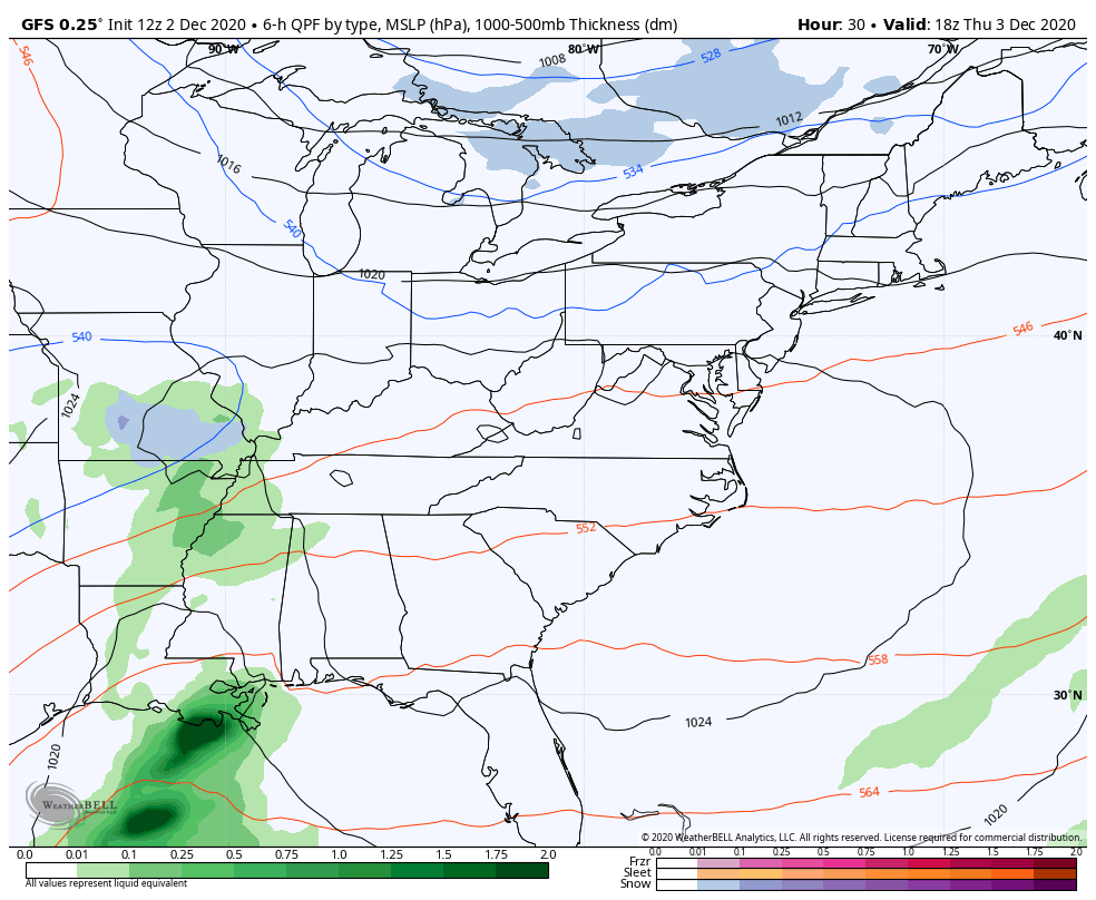
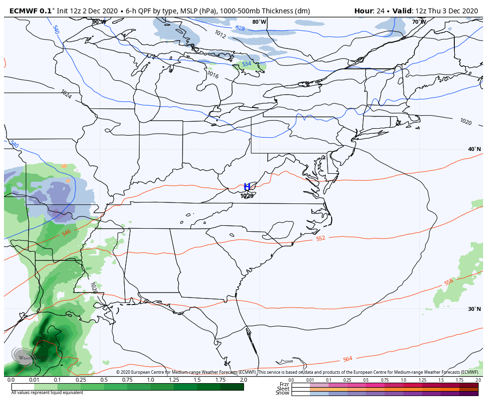
Clouds will increase on Thursday as temps bounce back up into the 40-45 degree range for many. A touch of rain and snow moves into western Kentucky as our upper level storm system moves east. We continue to see the models handle this very differently.
The NAM brings this out much quicker with chilly showers ending as some flakes by Saturday morning…
The GFS has a much slower system, thus kicking off a much stronger surface low on top of us. It has rain ending as some snow under the upper low…
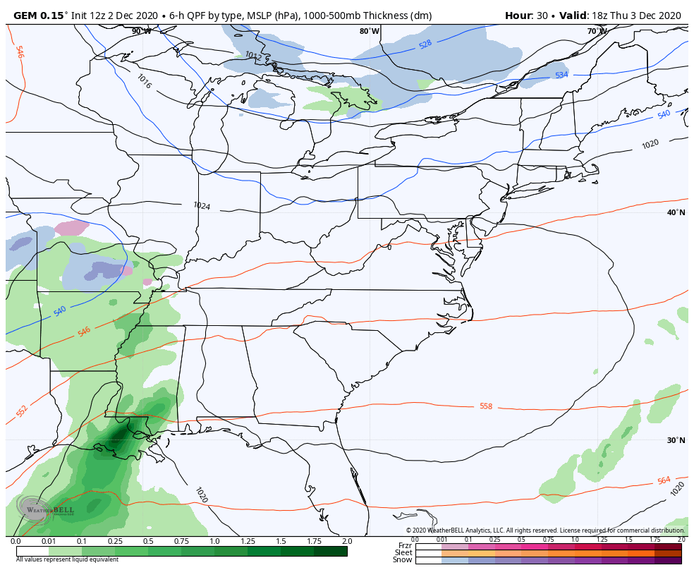
You can also see how it follows that up with a light snow maker dropping in from the north Sunday night and Monday. This system also shows up on the EURO…
The Canadian doesn’t look as good with it…
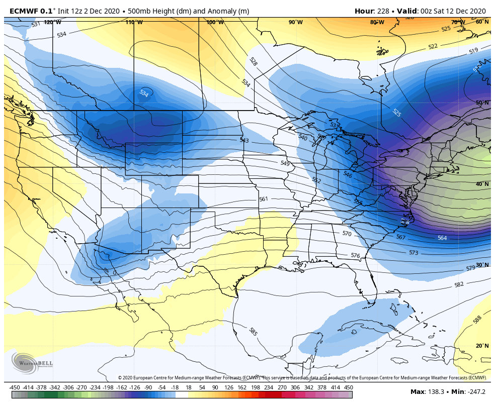
All models not named the GFS then drop another system in behind that by the middle of next week…

The Day 10 EURO has a threatening look to it two systems try to come together for a big storm developing to our southwest…
I will have another update this evening, so check back. Make it a good one and take care.

So, It looks like really nothing this weekend, some cold rain, that’s ok though! As long as we are talking about some chances. I don’t mind some hits , then misses. Last two years it has been talking about something then miss and misses!
Thanks Chris, The snow we had on the ground is now in the weather history books.
The weather at the present is beautiful like we had a week ago.
I wish we could get into a pattern of training snowstorms like we had in December 1969.