Good evening, folks. We continue to watch the setup for the end of the week into the coming weekend. It’s a bowling ball of a storm system that’s really giving the models some trouble in settling on an exact solution.
Moisture moves in on Thursday with a touch of rain and snow in the west. A shower does try to develop across the entire region tomorrow afternoon and with dry air in place, there’s a small chance for touch of sleet.
Rain rolls in here on Friday, but can it end as some snow Friday night or early Saturday? It can and the late afternoon models show a little better chance of this happening…
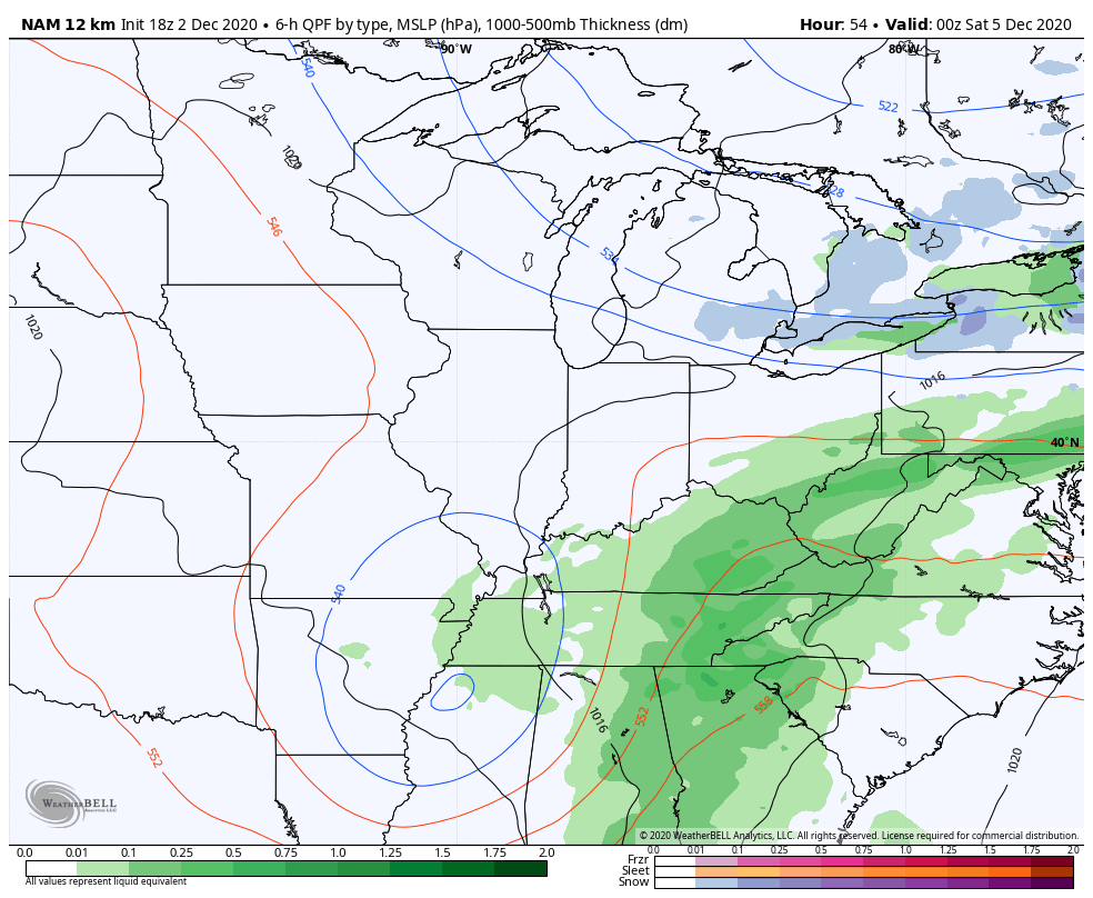
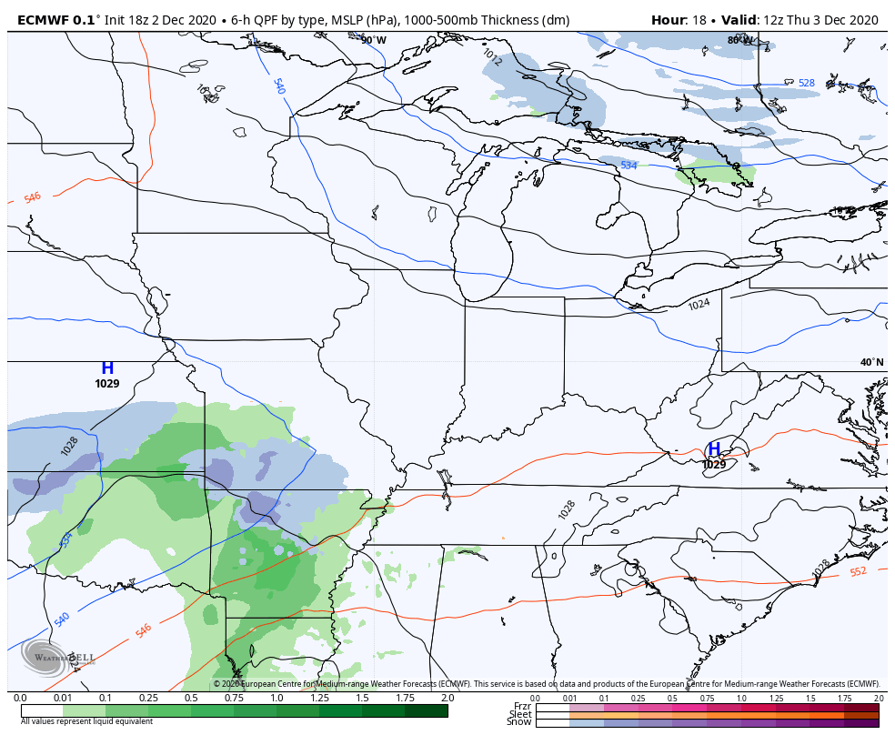
The NAM and Euro changed around a bit and now show some snow by Saturday Morning…
NAM
EURO
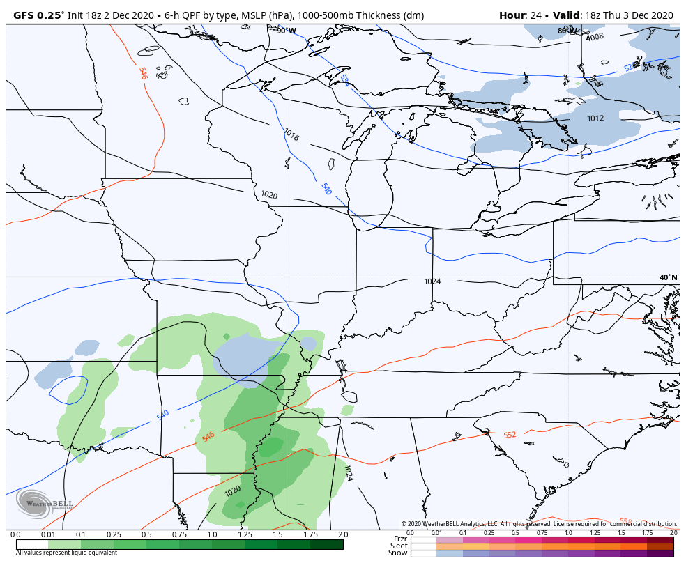
The GFS is close…
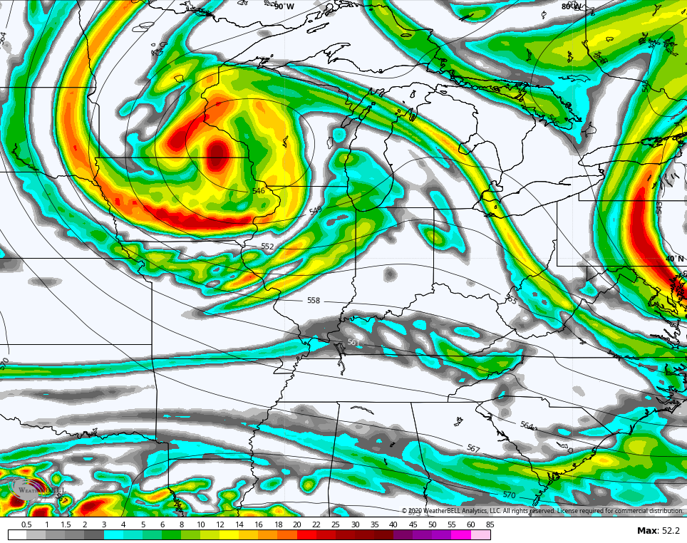
From there, we watch another upper level system dropping in from the northwest. This has a nice look on the models. This is the NAM early Sunday…
That’s all I got for the moment. I’ll make it up with the post later tonight. Have a good one and take care.
