Good Friday, folks. A cold rain is pushing across much of Kentucky today as a fast-moving system impacts our weather. The reason this is moving so quickly is because the system coming in behind it is showing up much stronger for late Sunday and Monday. This is starting to take on an interesting look and could very well become a light snow maker in our region.
Today’s rain is heaviest across the east and southeast where local half to one inch amounts may show up. Farther north and west, rain will be much lighter and won’t hang around as long. Here are your radars to follow along…

Lots of low clouds will linger through tonight and into Saturday. This may be able to fire off a few snowflakes across central and eastern Kentucky as a seasonal brand of cold air continues.
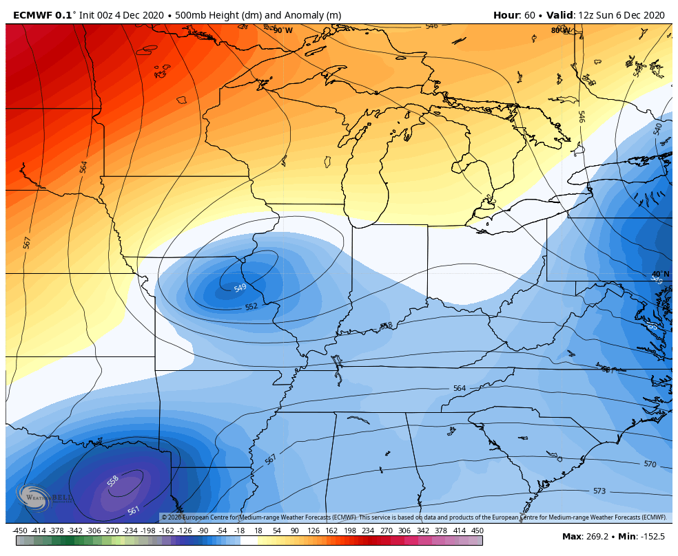
This brings us to the system dropping in from the northwest that tries to phase with another system working in. If we can get these two (and even a third dropping in) to fully hook up, then we are in business for another round of winter weather. This has some legs as the models get more enthusiastic about the phasing…
GFS
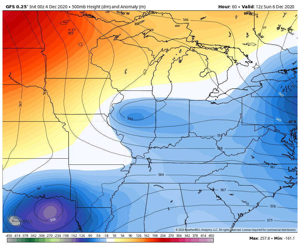
The GFS is known to be too progressive, so I’m wondering if that corrects west and slower. As is, it still produces light snow around here…
The EURO has a similar look, but is a little bit southeast…

The Canadian has the best look for snow lovers around here…
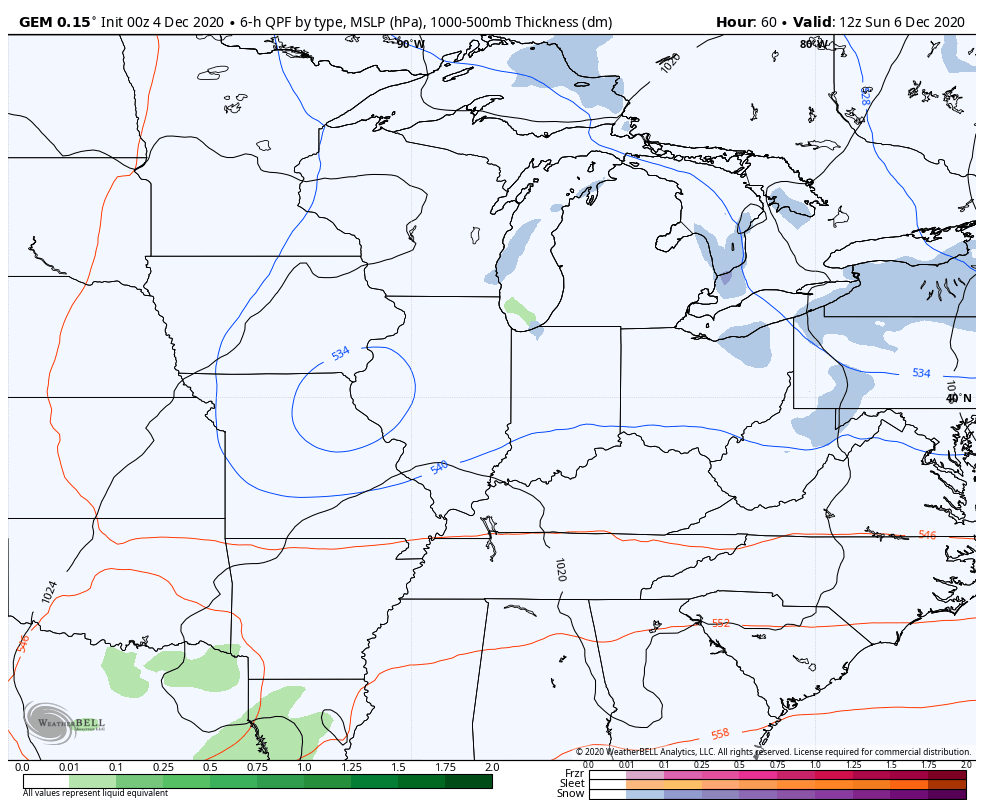
So the trend from the past day or so has been for this upper low to show up stronger with much more of a surface low developing. If you’re a fan of snow, you want this upper level phase to happen a little earlier and farther west and that is certainly on the table. If we can get today’s system to bomb out in New England, it would slow the flow behind it and allow for this thing to deepen farther west.
After that goes through, we have a little break for the rest of the week as temps moderate. The pattern then turns back toward winter beginning next weekend into the following week.
I will have your normal updates later today, so check back. Have a good one and take care.

Thanks Chris, I just learned that the predicted Nor’Easter is mostly going to effect areas from Boston to Maine with the northern interior areas receiving the brunt of the storm. These areas including southeastern Canada which have been inundated with snow over the past couple of weeks.
I also notice that in the Texas panhandle phasing is going on as heavy amounts of snow are expected to fall in that region the next couple of days.
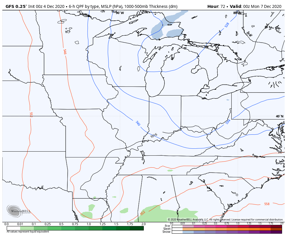
Maybe Sunday’s system will overachieve for the Ohio Valley with more than a light snow maker ?
All the early season snow action has been east of I-65.
Cold rain this morning, but it’s early December – this to be expected. Now, let’s just drop the temp some and get some snow!