Good evening, everyone. Rain (and a touch of sleet) is increasing across the region as low pressure works in from the southwest. This brings an increase in a cold rain overnight and Friday, especially across the eastern and southeastern parts of the state. While there still can be some flakes behind this early Saturday, the system continues to move through quicker because of a system that continues to look stronger digging in behind it.
Scattered showers increase across the state this evening through tonight. Your regional radar has you covered…

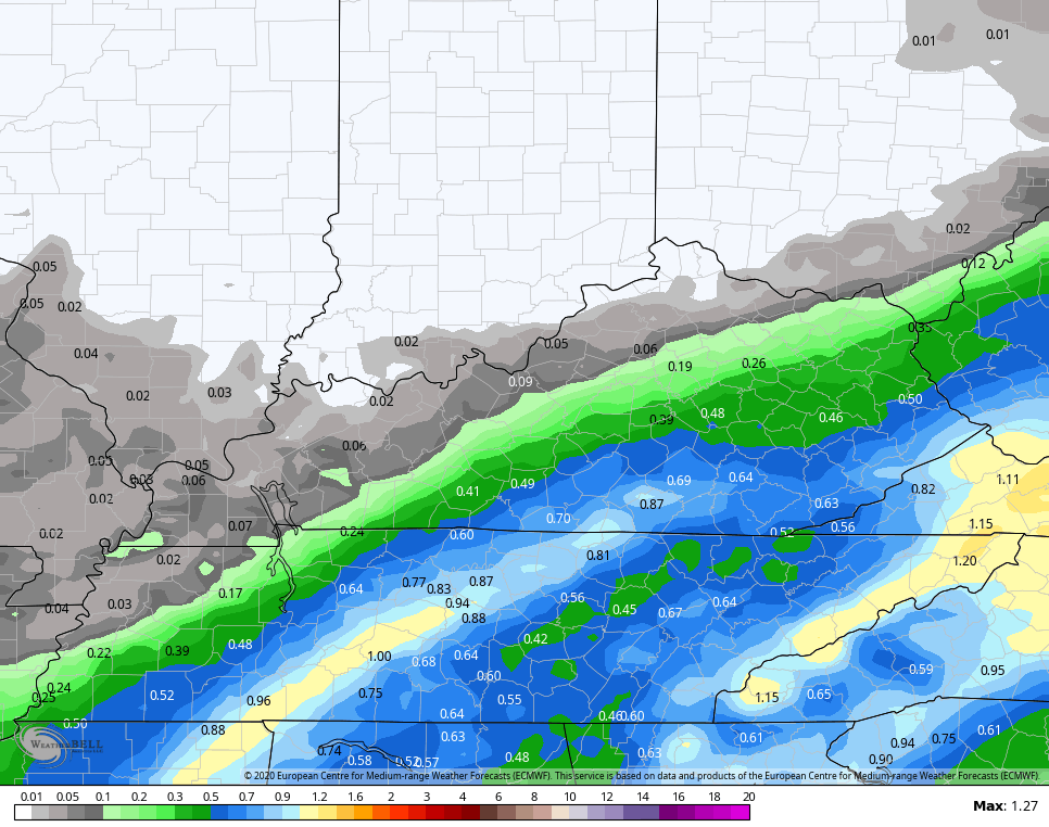
The rain will be heaviest across the southeastern part of the state, with a sharp drop in rain numbers in the north and west…
NAM

EURO
A few flakes will likely show up early Saturday, especially across the east and southeast.
One of the reasons this system is showing up weaker is faster is because the system dropping in behind it continues to show up slower and stronger. The surface maps will be the last to adjust, but this is a potent upper low dropping in…
If we can continue to get that to show up even stronger and close off earlier, then things could get a little fun Sunday night and Monday. That’s a trend worth, at least, following the next few days.
Enjoy the evening and take care.
