Good evening, folks. My time is limited, so let’s go ahead and get straight into the highlights, or lowlights, depending on your perspective. 🙂
Rain is clearing out of eastern Kentucky after putting down some local 1″ amounts. A touch of mist and drizzle continue behind this as chilly winds continue to blow.
Here are the radars to follow the heaviest rain out of eastern Kentucky…

Low clouds will be stubborn across central and eastern Kentucky on a weak northwest flow into Saturday. There’s still the chance for a flake or two, especially across the high elevations of southeastern Kentucky. Here’s where the Hi Res NAM thinks some flakes will fall through Saturday evening…

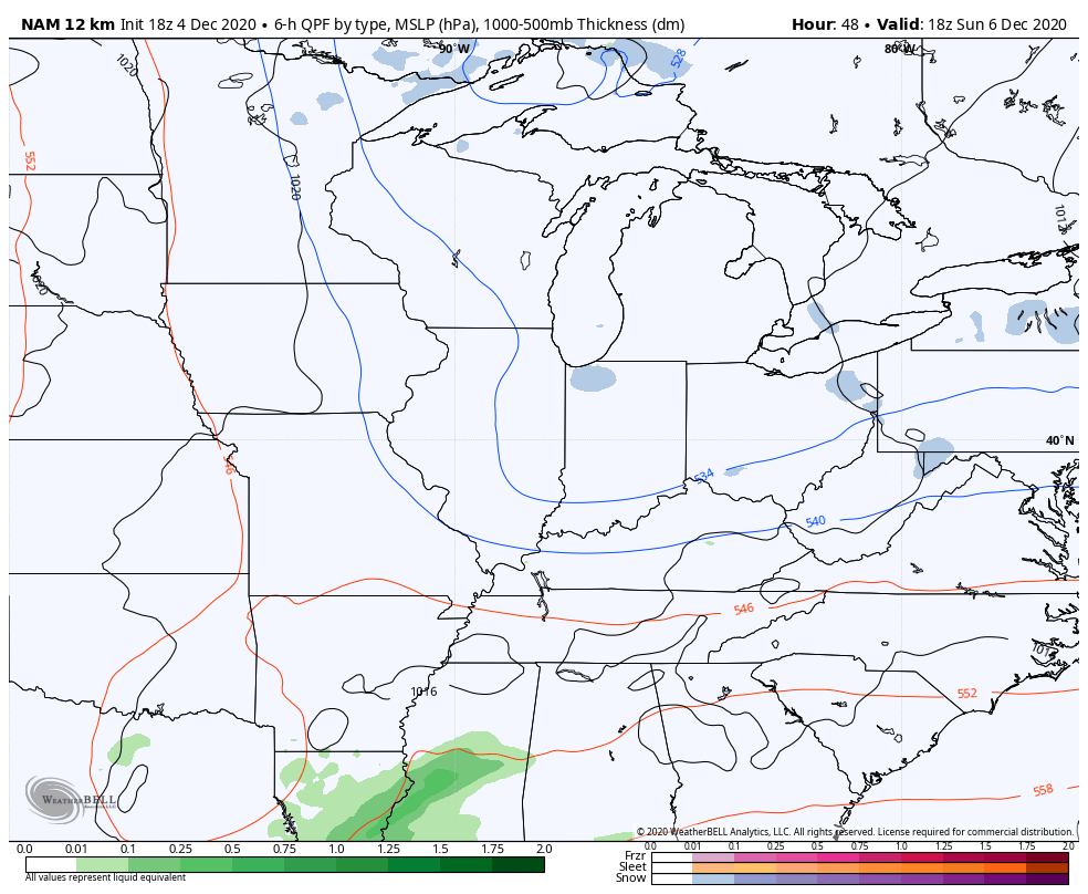
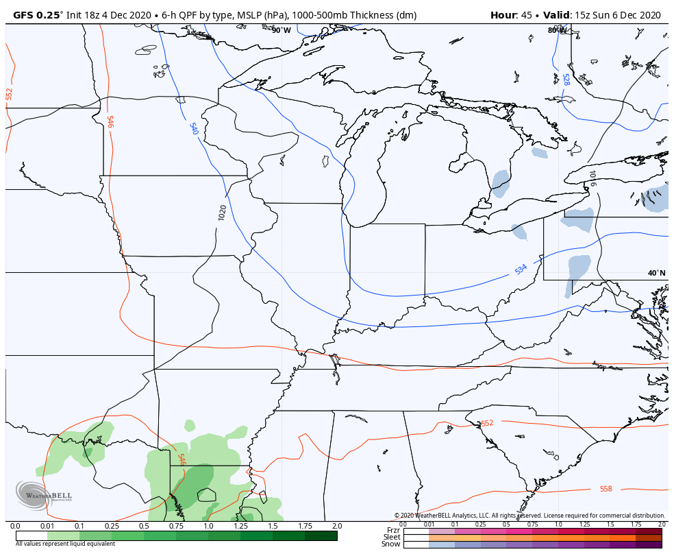
The system coming in behind this continues to look like a light snow and flurries maker across parts of the state. The phase on this doesn’t look like it will happen quickly enough for anything more than that at the moment.
NAM
GFS
EURO
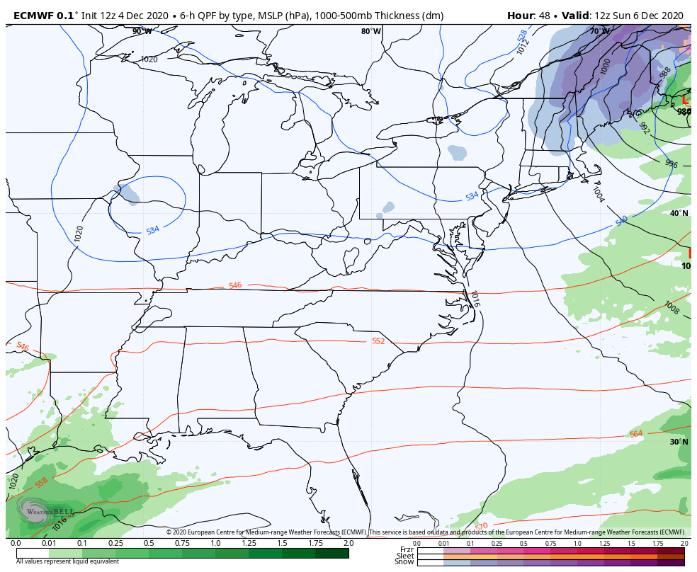
That may bring flakes all the way to the beaches of North and South Carolina.
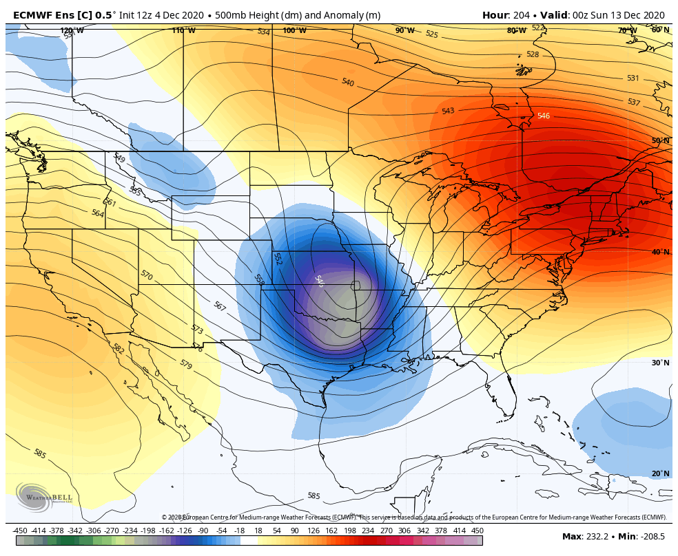
The pattern relaxes for the middle and end of next week as temps go a little above normal. The overall pattern beyond that continues to look much colder and we could watch several winter storm systems crossing the country…
Enjoy the rest of your evening and take care.

Thumbs down